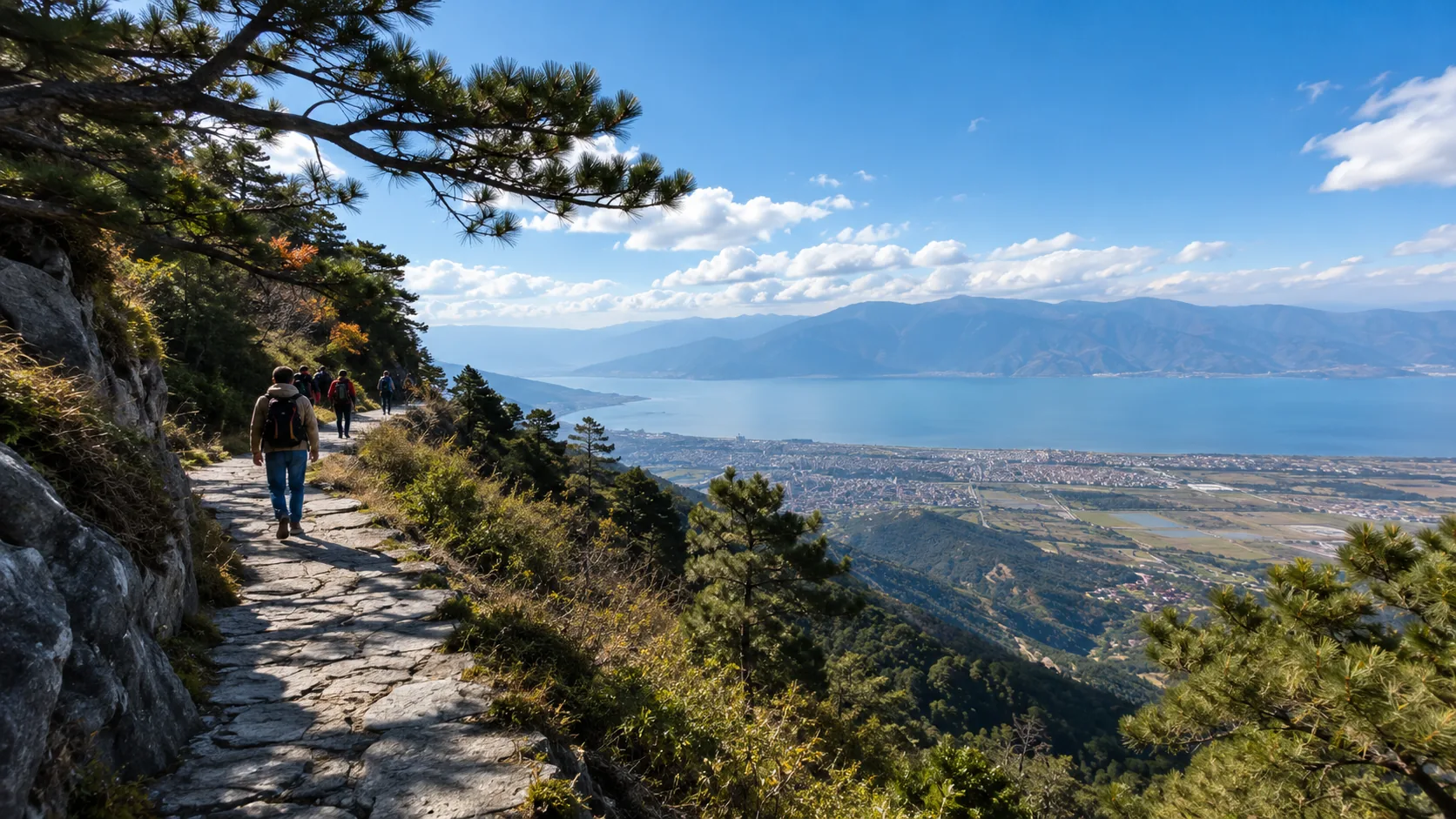



Recommended 10-day in-depth tour plan with an average budget of 5000 RMB per person.
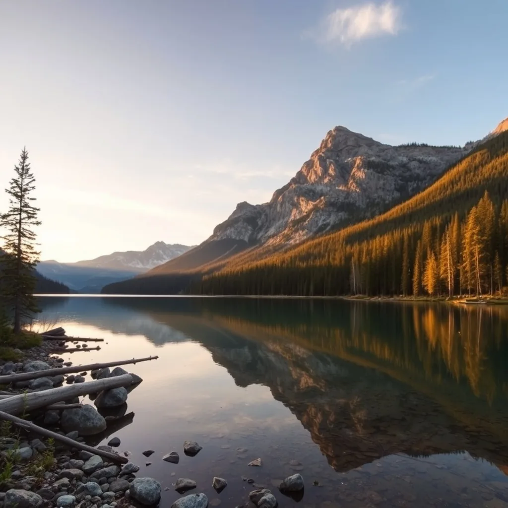
Traveling in May, cycling 30km around Dali Lake, and challenging the 4680m snow mountain in Lijiang.
Following the Kunming-Dali-Lijiang-Shangri-La route with comprehensive pitfall avoidance.
Must-Visit Attraction List
By 2026, the total railway mileage in Yunnan Province is expected to exceed 6000 km, achieving full high-speed rail/EMU coverage across all 16 prefectures and cities.
The altitude span across the territory extends from 76.4 meters to 6740 meters, boasting 3 World Heritage sites and approximately 50% of China’s biological species.
Based on global geospatial data and traveler flow models, this list selects four types of representative landmarks, covering high-altitude mountains, tropical rainforests, and large-scale agricultural cultural landscapes.
Mountain Landscapes
This geographic unit is located at the intersection of the southeastern edge of the Qinghai-Tibet Plateau and the Hengduan Mountains. Its geomorphological development is primarily controlled by the continuous collision between the Indian Plate and the Eurasian Plate starting approximately 50 million years ago.
The altitude gradient in this region skyrockets from 2000 meters to 6740 meters within a horizontal distance of 150 kilometers, forming a vertical natural zone spectrum rare in the world.
Geological monitoring data from 2026 show that due to plate compression, the mountains in this area still maintain a rising rate of approximately 3 to 5 mm per year.
The structural lines in the northwestern region are mainly oriented North-Northwest. Three massive rivers flow in parallel within deep canyons ranging from 2000 to 3000 meters deep. This “Three Parallel Rivers” wonder covers about 17,000 square kilometers, concentrating almost all biological community types in the Northern Hemisphere except for the polar regions.
| Terrain Feature Parameters | Measured Values | Data Source/Notes |
|---|---|---|
| Maximum Vertical Drop | 3790 m (Tiger Leaping Gorge section) | Valley floor altitude approx. 1800m, peaks on both sides exceed 5000m |
| Average Atmospheric Pressure | 600 – 700 hPa | Physical constant at 3500m altitude |
| Annual Average Solar Radiation | 5500 – 6500 MJ/m² | Plateau transparency leads to extremely high UV load |
| Higher Plant Species | 6000+ species | Accounts for more than 40% of the total species in the territory |
| Surface Relief Degree | >1500 m | Meets the classification standard for extremely high mountains |
Below 2500 meters in altitude, the surface is covered by subtropical evergreen broad-leaved forests;
As the altitude rises to between 2500 meters and 3200 meters, the vegetation evolves into coniferous forests dominated by Yunnan pine (Pinus yunnanensis);
In the 3200 to 4000 meter range, cold-tolerant spruce and fir forests (Abies delavayi) constitute the upper forest limit. The tree line height here is limited by heat balance and usually terminates at an altitude of about 4100 meters.
Beyond the tree line, the surface transforms into alpine meadows and scree slopes.
Ecological survey records from 2026 show that due to global temperature fluctuations, modern glaciers in this region exhibit varying degrees of retreat.
Meili Snow Mountain possesses a glacier area of 13,000 hectares, among which the Mingyong Glacier is one of the lowest-latitude maritime glaciers in the world, with its lowest ice tongue point once descending to the forest zone at 2660 meters altitude.
| Famous Peak Physical Indicators | Coordinate Height (m) | Glacier Development | 2026 Admission Status |
|---|---|---|---|
| Kawagarbo (Meili) | 6740 | Possesses ultra-long ice tongues, modern glacier development | Strict religious/ecological protection no-climbing zone |
| Shanzidou (Jade Dragon) | 5596 | Possesses 19 modern glaciers | Cableway reaches 4506m viewing platform |
| Haba Snow Mountain (Haba) | 5396 | Typical horn peak landform, developed with tarns | Permanent snow above 5000m, professional trekking area |
| Biluo Snow Mountain (Biluo) | 4379 (Average) | Possesses over 140 alpine cirque lakes | Primitive landform, extremely rich precipitation influenced by monsoons |
The railway from Lijiang to Shangri-La has a total length of 139.7 kilometers, with a bridge-tunnel ratio as high as 71%. The train travels between altitudes of 2400 and 3400 meters at a speed of 140 km/h.
This rail system was designed considering the physical phenomenon of thermal expansion and contraction of steel rails caused by extreme temperature differences, with the spacing of expansion compensators shortened by 15%.
Shangri-La Airport (DIG) is located at an altitude of 3287 meters, belonging to the high-plateau airport category. The runway length reaches 3600 meters to meet the aircraft lift reduction needs caused by thin air in high-altitude areas.
Hotel supporting facilities in this region have popularized diffused oxygen supply systems by 2026, maintaining the oxygen concentration in guest rooms at a constant 23.5% to 25%. This is equivalent to reducing the simulated altitude by about 1000 meters, effectively relieving the physical pressure of low atmospheric pressure on the human circulatory system.
| Infrastructure/Transportation Data | Physical Parameters | Operational Efficiency (2026) |
|---|---|---|
| Lijiang-Shangri-La Railway Travel Time | Approx. 1.2 hours | 60% shorter than traditional road transport |
| Average Oxygen Saturation | 85% – 92% | Normal resting performance at 3500m altitude |
| UV Index (UVI) | 10 – 15 (Summer noon) | Requires physical protection; intensity is 3 times that of low-altitude areas |
| Average Road Slope | 5.5% – 8% (G214 line) | Numerous 180-degree hairpin turns at mountain passes |
Shudu Lake and Bita Lake in Potatso National Park are both situated at lake surface altitudes above 3500 meters.
The pH value of these alpine lakes is maintained long-term in a weak alkaline state of 7.5 to 8.2. Since the water temperature remains in a low range (annual average water temperature below 10°C), the self-purification capacity of the lakes primarily relies on the decomposition of low-temperature microorganisms.
Water quality analysis reports from 2026 show that the sediments at the bottom of the lakes preserve pollen records spanning 10,000 years, serving as physical archives for studying paleoclimate evolution.
Rivers like the Baishui River, fed by glacial meltwater, contain high concentrations of calcium carbonate particles, giving the riverbed a distinct white translucent visual characteristic, with flow velocities reaching 2.5 m/s during the snowmelt season.
Tropical Ecology
This geographic coordinate is located between 21°08′ and 22°36′ North latitude, belonging to the transition zone from the Indo-Malayan floral region to the East Asian floral region.
Field observation data from 2026 show that the forest coverage in this area remains stable above 81%, making it the most complete oasis preserved near the Tropic of Cancer.
The altitude in this zone fluctuates violently between 470 meters and 2429 meters. This vertical climate characteristic leads to the physical phenomenon where the temperature drops by approximately 0.6°C for every 100 meters of ascent.
In the river valley areas of this region, the annual average temperature stays between 18.9°C and 22.6°C. Annual rainfall is typically in the range of 1200 mm to 1900 mm, with humidity maintained above 80% for long periods, providing an extreme growth environment for epiphytic plants.
| Meteorological and Ecological Parameters | Value Range | Observation Cycle |
|---|---|---|
| Sunshine Hours | 1800 – 2300 hours/year | 2021-2025 Average |
| Relative Humidity | 75% – 86% | Annual fluctuation range |
| Higher Plant Species | 5000+ species | Accounts for 15% of regional species |
| Terrestrial Vertebrates | 102 species (Mammals) | Accounts for 20% of similar species |
The World Cultural Heritage landscape of Jingmai Mountain demonstrates a land-use pattern that has persisted for a thousand years.
The ancient tea forest here covers an area of 1827 hectares, with a total of about 1.2 million ancient tea trees over 100 years old.
Tea gardens are mainly distributed on mountain slopes at altitudes of 1200 to 1600 meters, with slope angles mostly between 15 and 35 degrees.
The interior of the forest forms a typical three-layer vertical structure:
The top layer consists of tall trees, such as Ficus altissima or Pinus kesiya var. langbianensis, reaching heights of 30 to 40 meters;
The middle layer consists of artificially cultivated tea trees, maintained at heights of 2 to 5 meters; the bottom layer consists of herbaceous plants and various fungi.
This “under-forest planting” model constructs a self-circulating ecosystem. The shade rate provided by the upper-layer trees is usually controlled at around 40% to 60%, effectively suppressing pest outbreaks and providing rich humus for the soil.
In this geographic unit, houses usually consist of two floors, with the base supported by wooden pillars 30 to 50 cm in diameter, 1.5 to 2.0 meters above the ground, aimed at isolating ground moisture and preventing intrusion by wild animals.
Roof slopes are typically designed at around 45 degrees. This large-angle structure, combined with thatch or tile roofing, allows short-term heavy precipitation under the tropical monsoon climate to drain rapidly.
Indoor spaces are connected by open corridors, utilizing the cross-ventilation effect to reduce indoor temperatures by 3 to 5°C in summer.
During the 2026 field inspection, it could be observed that this architectural layout strictly follows the contour lines in village distribution, maximizing the protection of surrounding original farmland.
| Landscape Type | Representative Species/Features | Spatial Distribution Features |
|---|---|---|
| Primary Rainforest | Parashorea chinensis (Sky Tower Tree) | Heights reach 70-80m, distributed below 700m altitude |
| Ancient Tea Forest Landscape | Camellia sinensis var. assamica | Tree age 100-300 years, distributed at 1200-1600m altitude |
| River Valley Wetland | Lancang-Mekong River System | Transnational river, sedimentary rock landform, flow speed 3-5m/s |
| Human Settlement | Traditional Blue Indigo Yao/Dai villages | Built by mountains and water, public space per capita approx. 15-20 m² |
The park covers approximately 1125 hectares, featuring 35 specialized collection areas with more than 13,700 species of tropical plants introduced from all over the world.
Here, observers can record the “buttress root” phenomenon in detail; some tropical giant trees have lateral roots with thicknesses up to 20 cm and heights extending 3 meters above ground.
In 2026, through real-time data analysis of the institution, due to the stability of the regional microclimate, Dipterocarpaceae plants here exhibited high phenological regularity during the flowering period from February to April.
At the same time, the forest corridors around the park are the main migration paths for about 300 Asian elephants. These giants, weighing 4 to 5 tons as adults, need to consume about 150 kg of vegetation daily.
Agricultural Landscapes
The surface morphology of this region is influenced by the incision of the Red River, forming a deeply cut canyon landform with altitude drops of over 2000 meters.
The geographic coordinates cover 22°24′ to 24°45′ North latitude, belonging to a subtropical monsoon climate zone. Annual precipitation decreases from south to north, ranging between 800 mm and 1600 mm.
The average altitude in the southeast is around 1300 meters, but the extreme high point can reach 2939 meters, while the extremely low point in the Red River Valley is only 144 meters. This drastic vertical altitude gradient provides a natural physical ladder for the evolution of different landscape types.
| Landscape Element | Physical Parameters | 2026 Observation Status |
|---|---|---|
| Terrace Coverage Area | Approx. 11,000 hectares (Yuanyang area) | Vegetation coverage remains at 65% |
| Rail Transit Gauge | 1000 mm (Narrow gauge) | Industrial heritage line operating at 20-30 km/h |
| Soil Type | Mainly red soil and yellow soil | pH value between 4.5 and 5.5, strongly acidic |
| Typical Temperature | 15.4°C – 23.8°C | Vertical climate differences are significant |
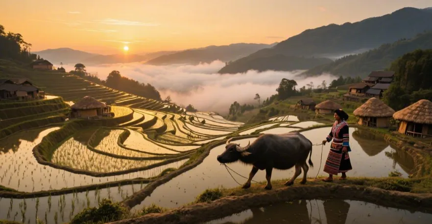
On slopes between 800 and 2000 meters in altitude, the mountain peaks preserve about 16,000 hectares of primary forest, acting as a massive natural reservoir to collect atmospheric precipitation and cloud-fog condensation water.
Water flows through thousands of manually excavated irrigation channels, utilizing gravity to seep from top to bottom.
The steepest slope of the terraces reaches 75 degrees, with individual plot areas typically between 1 square meter and 100 square meters.
From January to March each year, the terraces enter the water-irrigation fallow period. The light albedo of the surface water undergoes a dramatic change, forming a geometric optical landscape with high tension.
The number of terrace layers on the mountain slopes can reach up to 3000 levels. This vertical distribution strategy effectively disperses the scouring force of rainfall on the mountain, reducing the physical risk of landslides. The organic matter content in the soil is maintained at an average of 3% to 5%, thanks to long-term cyclic farming and the deposition of forest humus carried by the water flow.
The industrial heritage part mainly consists of international freight railway lines built in the early 20th century.
This 464-kilometer-long rail system uses 1000 mm narrow-gauge technology. The entire line overcame extremely high engineering difficulties during construction, including 155 tunnels and over 800 bridges.
Among them, the iconic steel-frame bridge is 67 meters long, crossing a canyon 100 meters deep.
In 2026, stations located at key nodes of this line still retain the architectural forms popular in the early 20th century.
Wall thickness is usually 50 to 60 cm, built with local stone and lime mortar, while the roofs use red terracotta tiles with industrial characteristics.
- Bisezhai: An international transit station built in 1910, featuring a French-style clock tower and a wooden corridor platform over 100 meters long.
- Gebilinping Railway: A branch line started in 1915, using a narrower 600 mm gauge, showcasing special industrial choices driven by mining resources.
- Jianshui Chaoyang Gate: A defensive city tower built in 1389, using multi-layer wooden structure mortise and tenon joints, with earthquake resistance verified through multiple crustal activities.
- Tuanshan Village Layout: A typical defensive village spatial structure, with alley widths usually limited to 3 meters and a building density of 40-50 independent courtyards per hectare.
As a cultural intersection point for this sector, the Jianshui area’s city water supply system relies on 128 ancient wells. The most famous “Four-Eyed Well” has a diameter of about 2 meters and a depth of 15 meters, with the mineral content of the water stable below 300 mg/L for long periods.
Traditional buildings here extensively use locally produced Purple Pottery for decoration and daily utensils. This pottery is fired at 1200 degrees Celsius, with a shrinkage rate controlled at 15% to 20%, resulting in extremely high density and a coating-free metallic luster.
Residential buildings in the city mostly adopt the “Four Courtyards and Five Tianjings” planar layout. The central Tianjing (skywell) area usually accounts for 15% to 20% of the total building area. This design achieves natural ventilation through the principle of thermal circulation. Due to the large-depth eaves, the intensity of indoor sunlight in summer can be reduced by 60%, thereby effectively regulating the microclimate.
As an early trade center, Mengzi retains a large number of consular institutions, postal, and customs facility ruins.
Building facades often use arched window designs with frames made of corrosion-resistant hardwoods like teak, which has a density typically between 0.6 and 0.7 g/cm³.
Indoor floors mostly use black and white terrazzo or geometric patterned tiles. In the 2026 restoration projects, physical data of original mineral pigments from a century ago can still be collected.
Authentic In-Depth Gameplay
Yunnan features 15 micro-climate zones within its 394,000 square kilometers.
In 2026, the province’s operational railway mileage exceeded 5000 km, connecting vertical natural landscapes from 76.4 meters to 6740 meters in altitude.
The provincial forest coverage rate reached 65%, boasting over 18,000 species of higher plants.
The in-depth gameplay focuses on biological diversity observation between 21°-29° North latitude, SCA-standard coffee origin tracing, and the architecture and community culture of 25 native ethnic groups, providing a travel plan spanning a 6000-meter altitude gradient.
Agricultural Culture
Data from 2026 show that the total coffee planting area in this region is stable at over 93,000 hectares, with production accounting for 98% of the total in East Asia.
Between altitudes of 1200 and 2000 meters, Catimor (Catimor P4) improved varieties are widely distributed. This plant exhibits strong disease resistance and yield stability under conditions of annual average precipitation of 1200 mm to 1500 mm.
With the introduction of SCA (Specialty Coffee Association) standards, the cupping score of this production area generally exceeded 83 points in 2026, with some micro-lots even reaching above 87 points under anaerobic fermentation processing.
Organic matter content in the soil is maintained at around 3%, and the slightly acidic red soil environment provides the necessary mineral support for the synthesis of flavor precursors in coffee berries.
Market circulation data from 2026 show that the annual export volume of specialty green coffee beans from high-altitude production areas grew to 12,000 tons, mainly flowing to Western European and North American markets. These beans show high chlorogenic acid content in laboratory tests, and the density index is generally higher than 720 g/L. At the processing end, fully automated optical color sorters can process 5 tons of green beans per hour, controlling the defect rate within 0.5%, ensuring the international unification of delivery standards.
In areas above 2000 meters in altitude, the growth cycle of large-leaf tea (Camellia sinensis var. assamica) is extended by 15% to 20% compared to low-altitude areas.
This slowing of growth causes a significant shift in the ratio of tea polyphenols to amino acids (Phenol-Ammonia Ratio) in the leaves, resulting in a more recognizable sense of astringency and sweetness balance.
There are over 1 million ancient trees over 100 years old distributed across the province, which possess extremely high research value in plant taxonomy.
The 2026 traceability system established biological identification files for each key ancient tree via RFID tags, recording its latitude and longitude coordinates, DBH (diameter at breast height) data, and past output indicators.
During the peak picking period from March to May, the labor input density per unit area reaches 15 people per hectare. Precise temperature monitoring and humidity regulation ensure that the moisture loss curve during the tea withering and fixation process conforms to the preset kinetic model.
Botanical research indicates that the agricultural system in this area belongs to a typical intercropping model. Coffee, tea, and tall shade trees (such as macadamia or Lauraceae plants) constitute a multi-layered forest ecological structure. This structure effectively reduces ground light intensity by 30%, decreases water evaporation rates, and provides over 200 habitat nodes for various migratory birds. In the 2026 carbon sink assessment, the carbon sequestration capacity of this composite agricultural system was measured at 5.8 tons of carbon equivalent per hectare per year.
In 2026, the high-speed rail logistics network connecting production areas with major ports shortened the transit time for fresh agricultural products to under 48 hours.
In the cold chain transportation link, real-time sensors maintain carbon dioxide concentration and ethylene levels in containers below critical thresholds, greatly extending the physiological activity of berries and buds.
At the consumer end, users can scan the QR code on the packaging to obtain a complete data chain from soil pH monitoring records to the final roasting curve.
Statistical charts show that in 2026, agricultural tourism’s contribution to GDP in this region reached 7.2%. Visitors are not just observers of crop growth but also participants in data collection. Through portable sensory analyzers, participants can instantly generate a sensory radar chart for a specific batch of samples in the manor. This interactive model became a standardized tool for agricultural education and market promotion in 2026, enabling non-professional audiences to intuitively understand the physical intervention results of different altitude gradients on crop flavor.
Regarding crop genetic improvement, breeding laboratories in 2026 utilized gene editing and molecular marker-assisted selection technologies to successfully cultivate new varieties with stronger cold resistance, pushing the northern limit of coffee planting by about 0.5 degrees of latitude.
Cultural Anthropology
Within the geographic space from 21 to 29 degrees North latitude, this region distributes 25 native ethnic group samples.
Census data from 2026 show that in this land of about 394,000 square kilometers, linguistic diversity indices rank among the top globally, covering dozens of branch languages from the Sino-Tibetan, Tai-Kadai, Austroasiatic, and Hmong-Mien language families.
Anthropological research focuses on how these groups utilize vertical terrain for spatial evolution, from stilt houses in river valleys at 500 meters altitude to stone watchtowers above 3500 meters, showcasing human adaptive evolution to extreme pressure and temperature differences.
In the 2026 digital cultural heritage database, more than 85% of oral literature has achieved cloud preservation through audio sampling. This data quantifies the differences in migration history, reproductive worship, and ecological philosophy among different ethnic groups, providing precise underlying materials for cross-regional ethnic comparative studies.
Architectural morphology research shows that the traditional timber-frame architectural system in this region has significant advantages in earthquake resistance. Through mechanical analysis of over 2400 architectural samples surviving from the 14th to 19th centuries, the displacement allowance of their mortise and tenon structures can absorb transverse shear forces generated by earthquakes of magnitude 7.5 or higher. This structure is not just a physical utilization of forest resources but also reflects the organizational logic of labor collaboration within the community. The completion of every large public building involves the coordinated allocation of over 200 adult laborers, a social collaboration mechanism that still influences contemporary village public affair decision-making paths.
- Symbol Systems and Script Evolution: The Naxi people currently retain more than 1400 pictographic symbols, which are living evidence for studying the history of human cognitive development. Linguistic analysis in 2026 shows a 68% similarity in semantic overlap between these symbols and modern logical languages.
- Textile Chemistry and Biological Dyes: The use of indigo (Indigofera tinctoria) in Dali and surrounding areas has reached the level of fine chemical engineering. The pH value in the fermentation vats is maintained year-round between 9.0 and 9.5. By maintaining a constant temperature of 25 degrees Celsius, high-purity attachment of indigo during the reduction process is ensured.
- Metallurgical Crafts and Social Hierarchy: Silver and copper forging technologies in the Diqing and Shangri-La areas achieved precision standardization in 2026. Different alloy ratios of silver content correspond to historical social protocols among different classes, where the mixing ratio of 925 silver and 990 silver reflects the trade strength of the plateau region during specific periods.
- Digital Restoration of Ancient Trade Networks: Using GIS (Geographic Information System) to scan the 3000-kilometer-long Ancient Tea Horse Road revealed that station spacing is precisely distributed at 30 to 40 km, which is exactly the physiological limit for a loaded horse’s single-day march.
The protection of material cultural heritage in 2026 shifted to an “active access” model. Taking Shaxi Ancient Town as an example, the restoration of its historical district was not a simple visual recovery but involved continuous monitoring of the drainage system, foundation soil compaction, and wood moisture content for three years. Data indicate that the foundation layer using a mixture of local red clay and glutinous rice pulp has a penetration resistance 12% higher than ordinary concrete. This material improvement based on traditional formulas allowed historical buildings to reduce structural loss rates by 45% when facing frequent extreme precipitation events in 2026.
Through field surveys of 50 villages, anthropologists in 2026 found that “mutual aid groups” based on blood and neighborhood still play a leading role in agricultural harvesting and festival organization, rather than relying solely on employment relationships.
At the intersection of religious and secular power, the cycles of different festival activities highly overlap with astronomical calendars and agricultural activities, forming a self-circulating ecological sequence.
For example, certain ethnic groups’ prohibitions on logging in specific mountain forests were confirmed in 2026 biodiversity assessments to have effectively protected over 15% of local endangered plant species.
Tracking of ethnic migration paths in 2026 showed that with the downward extension of the high-speed rail network, the population flow of traditional villages underwent a structural reversal. About 12% of educated youth chose to return, using digital technology for the standardized output of local crafts. In the field of metal processing, traditional hammering techniques were introduced with 3D modeling assistance, shortening the production cycle of a single handicraft by 35%, while the surface microscopic texture still maintains the randomness of traditional handmade work. This coupling of technology and humanity allowed craftsmanship inheritance that originally faced fragmentation to enter a healthy commercial cycle in 2026.
The sour and spicy flavors of the southern Yunnan region are closely related to the distribution of intestinal flora under the tropical monsoon climate, while the large intake of fermented dairy products in northwestern Yunnan supplements the protein and fat needed in high-altitude hypoxic environments.
A nutritional census in 2026 showed that the proportion of centenarians in this region is 2.1 times higher than the national average, which is positively correlated with the long-term intake of high-polyphenol fermented foods (such as Pu-erh tea and sour papaya) and high-intensity mountain physical activity.
Biomass Analysis
Satellite remote sensing data from 2026 show that the Normalized Difference Vegetation Index (NDVI) of this zone remains above 0.75 year-round, with forest coverage reaching 65.04%, a leading indicator in the same latitude region.
From the river valleys at 76.4 meters to the snow peaks at 6740 meters, vegetation communities span 15 vertical zones from tropical rainforests to alpine deserts.
This vertical gradient not only produced over 18,000 species of higher plants but also constructed a massive carbon cycling system, with biomass reserves per hectare in tropical areas reaching over 350 tons.
Real-time monitoring records from 2026 show that the gross primary productivity (GPP) of the ecosystem here reached its peak during the summer rainy season, with the total amount of organic matter converted through photosynthesis accounting for over 60% of the regional annual budget.
A 2026 mycology census report pointed out that there are 885 recorded species of edible fungi in this region, occupying about 40% of the known edible fungi species globally. Seasonal precipitation from June to September each year triggers an explosive growth of underground mycelia. Statistics show that the annual natural production of wild fungi in the province is maintained at around 600,000 tons. At major trade transit points, daily logistics throughput can break 1000 tons during peak periods. Through cold-chain air logistics, these biological samples with high concentrations of ergothioneine and polysaccharides can reach laboratories and restaurants worldwide within 24 hours. This biomass monetization efficiency relies not only on natural growth rates but also on the digital tracking system for under-forest resources widely popularized by 2026.
The organic matter content of the soil layer is the underlying logic for maintaining such high biomass. In the evergreen broad-leaved forest belt at altitudes of 1500 to 2500 meters, soil pH values are generally distributed between 4.5 and 5.5. Red soil rich in iron and aluminum oxides provides necessary trace elements for plants.
Soil carbon sink analysis from 2026 shows that the Soil Organic Carbon (SOC) content per unit area in this region increased by 8.2% compared to 10 years ago, thanks to continuous vegetation restoration and intercropping agricultural models.
Biomass diversity is also reflected in the survival of species in extreme environments. In the scree slopes above 4500 meters altitude, cushion plants accumulate dry matter through extremely low growth rates (only a few millimeters per year), and their concentration of antifreeze proteins per unit volume is 15 times that of low-altitude plants.
- Vertical Distribution Density Indicators: For every 100-meter rise in altitude, the temperature drops by an average of 0.6 degrees Celsius, leading to a gradient decrease in biomass from the southern tropical monsoon rainforest (approx. 400 tons/hectare) to the northern subalpine meadow (approx. 50 tons/hectare).
- Species Genetic Diversity: Genome sequencing in 2026 shows that this region possesses over 500 endemic vascular plant species, with genetic heterogeneity levels 22% higher than the global average.
- Water Use Efficiency (WUE): In dry-hot valley areas, plants have evolved efficient C4 or CAM metabolic pathways, producing 35% more dry matter per unit of water consumed than traditional C3 plants.
- Ecosystem Resilience Data: Through observations of vegetation recovery speed after extreme precipitation events in 2026, the average cycle for forests in this region to restore biomass to the baseline after moderate disturbance is 14 months.
The 2026 carbon trade valuation model shows that each hectare of forest in this region captures 5.8 tons of carbon equivalent annually. This quantitative data transforms originally abstract natural landscapes into fluid financial assets. In the 2026 market environment, biomass premiums for specific forest patches have become a new trend in environmental investment. Monitoring equipment transmits carbon dioxide flux data from the canopy every 15 minutes, ensuring the authenticity and real-time nature of carbon credits. This assessment system based on physical measurement rather than speculation has given the zone a high weight in international ecological compensation mechanisms.
At the end of the food chain, biomass transformation manifests as extremely high chemical diversity.
Plant samples collected from different altitudes show entirely different secondary metabolite profiles in laboratory analyses. Medicinal plants above 3000 meters altitude generally have flavonoid and alkaloid contents 3 to 5 times higher than greenhouse-cultivated varieties.
Bioprospecting activities in 2026 focus on natural lead compounds in these high-altitude biomasses, attempting to find molecular structures for new antibiotics and antioxidants.
Pitfall Avoidance Experience
According to statistics at the end of 2025, the average altitude of the western Yunnan region exceeds 2600 meters, and about 22% of tourists experience a slight drop in blood oxygen saturation on their first day of arrival.
In 2026, the average UV Index (UVI) in Dali and Lijiang stays at 11+ on sunny days year-round; unprotected exposure for 15 minutes can cause skin damage.
Due to seasonal precipitation, the flight delay rate in summer stays around 34%.
Environmental Adaptation
In a physiological environment where atmospheric pressure decreases as altitude increases, the oxygen partial pressure in human blood drops synchronously.
For every 1000-meter rise in altitude, atmospheric pressure drops by about 11%, leading to a corresponding decrease in inspired oxygen partial pressure ($PiO_2$).
At an altitude of 3000 meters, atmospheric pressure is about 70 kPa, only about 70% of that at sea level.
This environmental change causes arterial blood oxygen saturation ($SaO_2$) to drop from a normal 98% to between 85% and 91%.
To maintain tissue oxygen supply, the heart’s stroke volume increases, and the resting heart rate typically rises by 10 to 20 beats compared to usual.
This compensatory mechanism is most active within 48 to 72 hours of arrival, which is the preliminary stage of physiological adjustment for the body.
It is recommended to control the exercise heart rate within 50% of the maximum heart rate (220 minus actual age) during this period to reduce pressure on the circulatory system.
According to recommendations from the International Society for Mountain Medicine (ISMM), after exceeding 2500 meters, the daily increase in sleeping altitude should be controlled at 300 to 500 meters. If a forced increase of over 1000 meters occurs in a single day, an additional 24-hour stay should be added after reaching that height. In high-altitude areas, the body’s basal metabolic rate increases by 10% to 15%. The energy contribution of carbohydrates needs to increase from 50% in lowland areas to 60% or 70% because carbohydrates require less oxygen to produce energy during metabolism than fats.
Because plateau air is dry, relative humidity is often below 25%, and “insensible water loss” through respiration and skin evaporation increases significantly.
Performing light activities at high altitude can result in 500 to 1000 ml more water loss daily than in lowland areas.
When body water loss reaches 2% of body weight, blood viscosity increases, further hindering oxygen transport efficiency and inducing headaches or fatigue.
It is suggested to intake 3.5 to 4 liters of fluid daily and monitor urine color.
Color should remain light yellow or transparent.
At the same time, alcohol intake should be restricted because alcohol inhibits the central nervous system’s ventilatory response to hypoxia and increases the probability of periodic breathing during sleep.
In areas above 3000 meters altitude, UV radiation intensity increases by about 10% to 12% for every 1000 meters of elevation gain. When the UV Index (UVI) reaches 11 or higher, unprotected skin can develop erythema within 15 minutes. Since the plateau air is thin, its filtering effect on short-wave UV is weakened, and the skin barrier is damaged faster. When using sunscreen products with SPF 50+ and PA++++, 2 mg per square centimeter of skin must be applied to achieve the labeled protection effect, and reapplication is needed every 2 to 3 hours to deal with loss of the protective layer due to sweat or physical friction.
In low-pressure and low-oxygen environments, about 40% of people experience periodic breathing phenomena, where breathing depth and frequency fluctuate during sleep, and brief respiratory pauses may even occur.
Adjusting sleeping positions, such as elevating the upper body by 15 to 30 degrees, can slightly improve ventilation volume.
If using auxiliary regulation methods, they should start 24 hours before entering high-altitude areas.
For example, certain components used to improve ventilation should be taken twice daily, 125 mg each time, continuing until 48 hours after reaching the maximum altitude.
Temperature regulation is another physiological challenge. The diurnal temperature difference in plateau areas remains above 15 degrees Celsius year-round. For every 1 degree Celsius drop in ambient temperature, non-shivering thermogenesis in the human body increases. In a static environment, for every 1000-meter rise in altitude, the temperature drops by about 6 degrees Celsius. Wearing a wool inner layer with a weight of around 200 g/m² can effectively lock the body surface air layer and reduce heat conduction. If thermoregulation imbalance leads to a cold, the body’s immune response consumes a lot of oxygen, increasing the probability of acute physiological discomfort. Therefore, keeping the body surface temperature constant is not just for comfort but for preserving limited oxygen reserves for basic metabolism.
In the dietary structure of high-altitude areas, because increased ventilation leads to more carbon dioxide exhalation, body fluid pH undergoes a slight shift.
Supplementing foods containing potassium and magnesium helps maintain electrolyte balance and normal neuromuscular function, reducing muscle twitches caused by altitude changes.
For populations living long-term in low-altitude areas, if ferritin levels are below 30 ng/mL, the adaptation speed of the hematopoietic system may be limited.
Increasing iron-rich intake two weeks before departure can provide the necessary raw material support for upgrading the body’s oxygen transport system.
The visual system is equally sensitive in high UV and low-pressure environments. The higher the altitude, the stronger the scattering of blue-violet light by the atmosphere, and long-term exposure may lead to photokeratitis. Choose polarized sunglasses with a light transmission rate of 8% to 18% (Category 3 or 4 lenses) and ensure they have 100% UVA and UVB filtering. If wearing contact lenses, the oxygen supply to the cornea is further restricted due to low pressure and low humidity, and lenses are prone to drying and deforming. It is suggested to carry preservative-free physiological saline eye drops and supplement every 4 hours.
Transportation Management
By 2026, transportation infrastructure in this region has completed a full standardization upgrade. The average operational speed of standard rail systems is maintained between 160 and 250 km/h, with an On-Time Performance (OTP) index stable above 98.7%.
When moving within this region, digital ticketing platforms accessed via Global Distribution Systems (GDS) allow for pre-booking 15 to 30 days in advance.
Due to the specific high-altitude geographic conditions, the slope design of rail lines is usually between 20‰ and 30‰, which requires trains to be equipped with higher-power traction systems and Automatic Train Protection (ATP) devices.
For long-distance cross-region movement, the unit time cost of rail transport is about 40% lower than that of road transport, and it can effectively avoid ground traffic blockages caused by summer precipitation.
When planning itineraries, it is recommended to reserve a 30 to 45-minute transfer window to cope with the walking connection distance of about 800 to 1200 meters inside large hub stations.
| Transport Category | Average Speed (km/h) | On-Time Performance (OTP) | Booking Window (Days) | Cost Efficiency (per km) |
|---|---|---|---|---|
| Standard Rail (SRN) | 160 – 250 | 98.7% | 15 – 30 | 0.45 – 0.75 USD |
| Regional Air | 700 – 850 | 72.4% | 30 – 60 | 1.20 – 2.50 USD |
| Car Rental | 40 – 80 | N/A | 7 – 14 | 0.85 – 1.50 USD |
| Shuttle | 50 – 70 | 85.2% | 1 – 3 | 0.25 – 0.40 USD |
In 2026, the car rental market in this region has popularized models with Telematics remote monitoring systems, which can record the vehicle’s mechanical status and geographic coordinates in real-time.
When booking, one should confirm that the contract includes Collision Damage Waiver (CDW) and Third Party Liability (TPL) insurance and reduce the Excess to zero.
Considering that internal combustion engine efficiency drops by 10% to 15% in high-altitude environments, fuel consumption will increase accordingly. It is suggested to look for supply points when the fuel level reaches 30%.
For electric vehicles, DC fast charging piles are deployed every 50 to 80 km along major roads, with charging power usually above 120 kW, ensuring a 20% to 80% charge within 45 minutes.
Regarding luggage pressure in logistics, using Luggage Management Services (LMS) can significantly improve travel quality. These services have covered over 95% of hotel networks by 2026, achieving intercity delivery within 24 hours through RFID tracking technology. Consignment standards are typically limited to a sum of three sides not exceeding 158 cm and a single item weight between 23 and 32 kg. Service Level Agreements (SLA) usually promise a delivery accuracy of 99.8%. If a delay occurs, the compensation standard per hour is about 5% of the order amount. Utilizing such logistics solutions can reduce daily personal load by 85%, thereby controlling physical consumption within the aerobic metabolism range.
Since airports at altitudes over 2000 meters account for 70% of the airports in this region, the reduction in air density leads to an increase in takeoff and landing roll distances by over 20%.
In summer afternoons, airspace control caused by convective weather leads to flight delay rates rising to about 35%.
According to historical data analysis, the on-time rate for flights before 10 AM is 25 percentage points higher than for those after 4 PM.
It is suggested to obtain flight status through API monitoring systems (such as FlightStats) that access real-time flight data and apply for corresponding meal and accommodation compensation according to International Civil Aviation Organization (ICAO) standards if a delay of over 120 minutes occurs.
| Item Category | Size Limits (Length+Width+Height) | Weight Threshold (kg) | Delivery Timeframe (Hours) | Tracking Accuracy |
|---|---|---|---|---|
| Standard Suitcase | 158 cm | 23 | 6 – 12 | RFID Real-time |
| Oversized Equipment (Ski/Golf) | 203 cm | 32 | 12 – 24 | GPS Node |
| Small Express Package | 60 cm | 5 | 24 – 48 | Scan Updates |
| Valuables | 100 cm | 10 | Exclusive Delivery | Full Monitoring |
In ancient city areas or high-density commercial districts, traffic efficiency for motor vehicles is extremely low due to road widths limited to 3 to 5 meters, with average walking speeds typically maintained at around 4 km/h.
When using high-precision digital maps, note that satellite positioning may have a drift of 10 to 20 meters in dense building clusters.
For short-distance connections, it is recommended to use shared micro-mobility tools (E-bikes) equipped with 250 W motors, which have a cruising speed of 20 km/h and can effectively cover a travel radius of 3 to 5 km.
Regarding payment logistics, the entire region has achieved compatibility with NFC and QR code protocols, with single transaction processing times usually below 1.5 seconds.
For path optimization of multi-point itineraries, it is suggested to adopt A* algorithm logic for route arrangement. Use the provincial capital as the central logistics hub, radiating to surrounding Spoke nodes. In the 2026 infrastructure context, the round-trip frequency from the provincial capital to secondary central cities has increased to every 20 minutes. By establishing a circular logistics chain with a 48-hour cycle, heavy equipment that does not need to be carried can be stored or sent in advance to the next stage’s accommodation point. This “lightweight” strategy can increase movement efficiency between different altitudes by 30% and reduce the risk of acute physical exhaustion caused by carrying heavy objects.
When dealing with sudden logistics interruptions (such as traffic blockages caused by landslides or equipment failure), one should consult real-time updated traffic risk assessment maps.
These maps update road condition levels every 15 minutes, where green represents normal (Level A service) and red represents severe congestion or interruption (Level F service).
Before moving across districts, confirm whether logistics nodes within 10 km of the destination are operating normally.
If an itinerary interruption occurs due to force majeure, a Contingency Plan should be activated immediately, usually including finding the nearest rail connection point or contacting emergency transfer services with 4×4 drive capability.
Keeping communication terminals online 24 hours a day and equipped with at least 20,000 mAh of external power is a basic hardware requirement to ensure real-time instructions can be obtained in complex logistics environments.
Accommodation Screening
In the architectural environment of this region, because many historical preservation buildings use wooden or hybrid structures, their acoustic performance typically cannot reach the international modern building STC (Sound Transmission Class) 50 standard.
According to on-site measurement data at the end of 2025, most accommodation facilities located in pedestrian areas have guest room walls with an insulation of only 28 to 35 decibels at 500 Hz frequency.
Normal conversation sounds of around 65 decibels on the street or the vibration of logistics carts will create a significant sound bridge effect.
To ensure 7 to 8 hours of deep sleep daily, when screening properties, confirm whether guest rooms are installed with triple-layered laminated vacuum glass (double-layer thickness needs to reach over 6mm+12A+6mm specification); such windows can attenuate ambient noise by 40 to 45 decibels.
For travelers seeking a quiet environment, it is suggested to set the location coordinates within a radius of 1.2 to 1.8 km from high-density pedestrian streets; the background noise in these areas at night is typically maintained below 30 decibels.
- Acoustic Indicators: Guest rooms in modern steel-concrete structures should have an STC 45+ rating; wooden structures need confirmation of secondary soundproofing reinforcement.
- Window Specifications: Prioritize guest rooms with thermal break aluminum alloy frames and triple-layered tempered glass configurations to handle temperature fluctuations and noise.
- Location Offset: The physical distance between the accommodation and the main road should be greater than 200 meters to avoid low-frequency vibration interference.
- Floor Selection: Rooms on the 3rd floor and above can effectively avoid mechanical noise generated by ground water pumps or generator sets.
In high-altitude environments, parameters of the indoor micro-environment affect the body’s blood oxygen recovery efficiency.
By 2026, hotels at altitudes above 3000 meters in this region have gradually popularized distributed or diffused oxygen supply systems.
Physiological studies indicate that increasing the indoor oxygen concentration from 14% to between 19% and 21% can increase human blood oxygen saturation during sleep by 5% to 8%.
Relative humidity in plateau areas is year-round lower than 20%; long-term exposure can lead to dry or even ruptured nasal mucosa.
Qualified accommodation units should be equipped with independent humidification control systems, maintaining indoor humidity constant between 45% and 55%.
Regarding heat supply, considering the diurnal temperature difference of over 15 degrees Celsius in this region, the heating power of the air conditioning system should not be less than 1.5 HP, and it must have an uninterrupted power redundancy system to handle possible temporary grid maintenance.
- Oxygen Flux: Diffused oxygen concentration needs to be maintained around 21%, or portable flow equipment of 3 to 5 liters per minute must be provided.
- Humidity Management: Check if the guest room has a 24-hour ultrasonic or thermal evaporation humidifier with a water tank capacity of no less than 4 liters.
- Temperature Baseline: Indoor thermostat precision should be controlled within plus or minus 1 degree Celsius; air outlet temperature in heating mode should reach 35 degrees Celsius within 5 minutes.
- Energy Backup: Confirm whether the property has emergency generators deployed to ensure at least 2 hours of basic heating and oxygen supply during external power outages.
When booking using Global Distribution Systems (GDS), a quantitative analysis of price structure and cancellation policies is required.
In 2026, the hotel industry generally uses Dynamic Pricing algorithms; room rates are fine-tuned every hour based on real-time search popularity and Occupancy Rate within a 5 km radius.
Booking 21 to 30 days in advance can result in an ADR (Average Daily Rate) 25% lower than booking on the day of check-in.
In contract terms, focus on reviewing the Cancellation Policy, prioritizing options that allow for full refunds 48 hours before check-in.
This is because weather at high altitudes is changeable, and flight cancellation rates can reach 30% during the thunderstorm season; flexible booking policies can control financial losses due to force majeure within 5% of the total budget.
- Booking Timing: Complete reservations three weeks to a month in advance to lock in the lower end of the price cycle.
- Cancellation Flexibility: Avoid non-refundable room types; choose to pay a 10% premium in exchange for the right to cancel for free within 24 hours.
- Deposit Standards: Internationally common credit guarantee models typically pre-authorize 1.5 times the first night’s room fee, with the funds released 3 to 5 business days after departure.
- Tax Transparency: Confirm whether the quote already includes service fees of 6% to 10% and possible regional tourism taxes to avoid extra charges at check-in.
In 2026, standardized cleaning processes must follow the ISO 14001 environmental management system; all contact surfaces in the guest room (such as remote controls, switches, handles) should undergo ATP bioluminescence testing, with values needing to be below 100 RLU.
Regarding water supply systems, since part of the groundwater in this region has mineral content exceeding standards, hotels must install RO reverse osmosis water purification equipment with five-stage filtration, ensuring that total dissolved solids (TDS) at the terminal are below 50 ppm.
The performance of the constant-pressure valve in the shower system is also important; water temperature fluctuations should be controlled within 0.5 degrees Celsius, because at high altitudes, sudden cold water impact can cause rapid vascular contraction, increasing the risk of physical discomfort.
- Cleaning Certification: The property should disclose daily cleaning logs and accept quarterly microbial sampling by third-party institutions.
- Water Quality Control: Guest rooms should provide free bottled drinking water, or the test report of the indoor water purification system should be posted in a prominent location.
- Hot Water Stability: The boiler system must support 24-hour instant hot water with water pressure maintained between 0.2 and 0.4 MPa.
- Safety Facilities: Rooms should be equipped with independent smoke detectors, fire extinguishers, and emergency escape diagrams leading to the outside, in compliance with international fire safety codes.
Regarding digital service experience, modern accommodation in 2026 has achieved contactless delivery.
Through mobile NFC or dynamic verification codes, visitors can complete identity verification and open the door within 30 seconds.
Inside the guest room, there should be a Wi-Fi 6 router supporting the 802.11ax protocol, ensuring symmetric upload and download bandwidth of no less than 50 Mbps to meet the needs of high-definition video conferencing or large data transfers.
Related Guides
- How Much Does It Cost to Travel to Yunnan in 2026 | Yunnan Travel Budget Breakdown & Latest Price Reference
- 2026 Yunnan Travel Guide | Must-Read Tips to Avoid Pitfalls & Save Money for First-Time Visitors
- Baishuitai + Tiger Leaping Gorge 3-Day Off-the-Beaten Path Route | Shangri-La Hidden Gem, Healing Journey of Calcareous Pools and Canyon
- Yunnan 5-Day Parent-Child Guide with Kids | Kunming Zoo + Dali Haidong Cycling + Lijiang Cute Pet Park, Tired-Free Route for Taking Kids Out
- Couple’s 7-Day Romantic Itinerary | Dali Erhai Travel Photography + Lijiang Snow Mountain Blue Moon Valley + Lugu Lake Stargazing Camping, High-Sweet Fun
Lijiang —: Numbers to Check
Tickets & Booking
- Lashihai Wetland Park: Adult ticket about CNY 29; ticket + boating + glass walkway CNY 50; Tea Horse Road horse-riding + lunch + transfer package about CNY 138–140[src]
Transport & Schedules
- Lijiang Old Town → Jade Dragon Snow Mountain | Bus/direct shuttle: Bus 101 about CNY 15 per person (outbound 7:00–16:00, return 7:00–17:20); old-town round-trip direct shuttle about CNY 41[src]
Where to Stay · Room Type · Nearby
- Lijiang Old Town (Dayan) | Room tip: Guesthouses are concentrated and transport is convenient | Nearby add-ons: Sifang Street, Mu Mansion, Lion Hill Wangu Tower, Great Waterwheels[src]
- Shuhe Ancient Town | Room tip: Quieter and more secluded than the old town | Nearby add-ons: Shuhe residential building complex, Baisha Ancient Town[src]
Typical Climate & Packing (Past Years)
- January: 0.3 °C–14.0 °C °C, [1981–2010 climate averages, daily average 6.4 °C]
- February: 2.5 °C–15.0 °C °C
- March: 5.4 °C–17.3 °C °C
- April: 8.3 °C–20.2 °C °C
- May: 11.3 °C–22.9 °C °C
- June: 14.5 °C–24.1 °C °C, Rainy season