


Dali
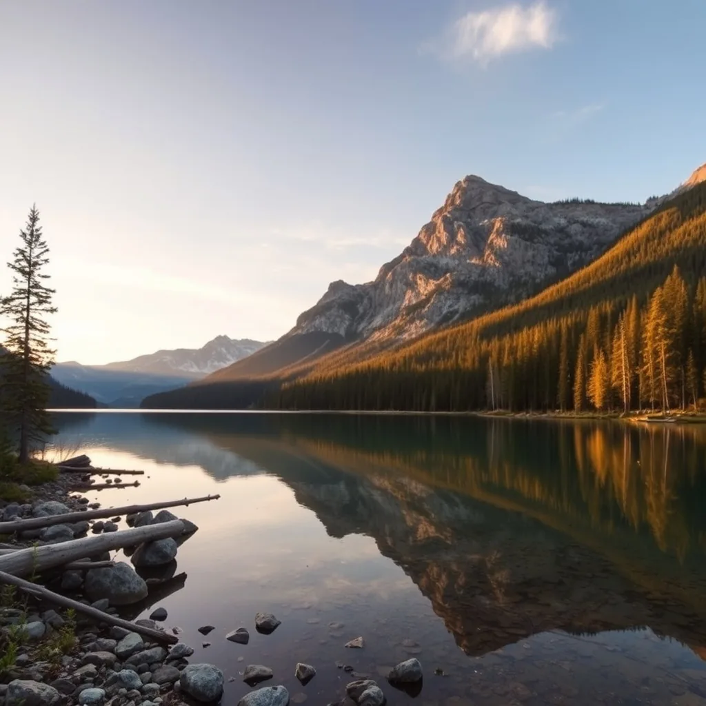
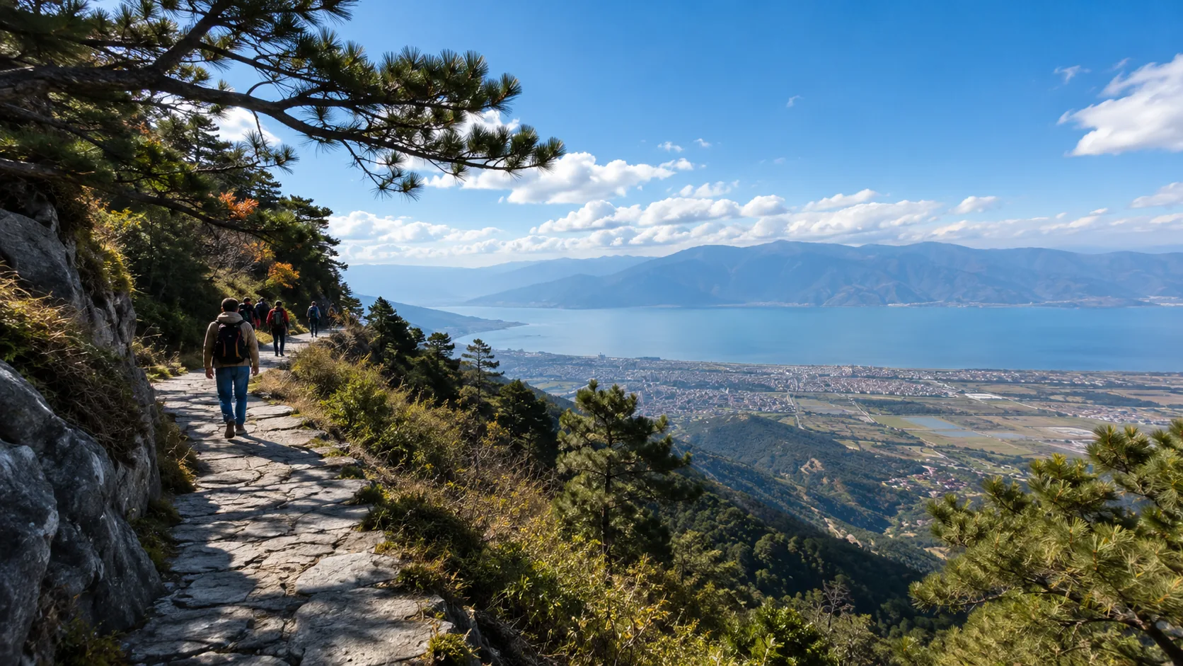
Dali is located at 100 degrees east longitude, with an average altitude of 1976 meters. The main landscapes include the 256 square kilometer Erhai Lake and Cangshan Mountain with a maximum altitude of 4122 meters.
The annual average temperature is 15.1 degrees Celsius, and the average annual sunshine exceeds 2300 hours.
In 2026, motor vehicles are prohibited on the entire 129-kilometer Erhai Lake Ecological Corridor.
There are approximately 35,000 permanent remote workers here, and the forest coverage rate remains above 45%. It is a typical low-latitude plateau residential area.
Climate and Environmental Parameters
Dali has a subtropical plateau monsoon climate, with an average temperature of 8.2 degrees in January and 20.1 degrees in June.
Due to its location in a high-altitude area, the UV intensity here is consistently above level 4, and the oxygen content is approximately 80% of that in plain areas.
Cangshan consists of 19 peaks, and the snow cover on the mountain top lasts for about 4 months a year on average. The transparency of Erhai Lake is approximately 2.5 meters, and the water quality has long been maintained at the Grade II standard.
Transportation Details
In 2026, Dali has achieved full coverage of high-speed trains, taking only 2 hours to reach from Kunming South Railway Station.
| Mode of Transport | Cost/Time Reference | Notes |
|---|---|---|
| High-speed Train (Kunming-Dali) | 145 RMB / 120 minutes | About 60 trips per day |
| Ecological Corridor Bicycle Rental | 30-60 RMB / day | Only non-motorized vehicles allowed |
| Shared Electric Bikes | 2-5 RMB / 15 minutes | Mainly distributed in the Ancient City and surroundings |
| Cangshan Grand Cableway | Around 180 RMB / Round trip | Total length 5555 meters, reaching altitude 3900 meters |
Regional Distribution and Stay Suggestions
Dali’s sightseeing areas are mainly divided into three parts, with a suggested stay of 4 to 6 days.
Dali Ancient City and Surroundings
The Ancient City covers about 3 square kilometers, maintaining a standard chessboard street layout. There are 14 key protected buildings inside.
In 2026, the Ancient City is filled with remote office spaces, with an average rental cost per workstation between 40 RMB and 80 RMB per day.
Erhai West Bank and East Bank
The West Bank is dominated by farmland and Bai natural villages. Xizhou Ancient Town has more than 100 typical Bai residences from the Qing Dynasty and Republic of China periods.
Shuanglang Town on the East Bank is the main sunshine observation point, featuring over 200 boutique homestays, with mid-range homestays averaging 400 RMB to 600 RMB.
Cangshan Area
Cangshan has three main cableways: Ximatan Cableway, Gantong Cableway, and Zhonghe Cableway.
The hiking route is mainly concentrated on the Yudai Road at an altitude of 2600 meters, with a total length of 11.5 kilometers and a slope gradient kept within 5 degrees, suitable for most fitness levels.
Lijiang
Lijiang is located in the connecting zone between the Yunnan-Guizhou Plateau and the Qinghai-Tibet Plateau, at an altitude of approximately 2400 meters.
Dayan Ancient City covers 7.27 square kilometers and was founded in the late Song and early Yuan dynasties. The annual average temperature is 12.6 degrees Celsius, and the forest coverage rate is over 70%.
The territory has three main ancient towns: Dayan, Shuhe, and Baisha. In 2026, the total number of registered star-rated hotels and boutique homestays in Lijiang exceeded 5000, and the average annual sunshine duration is 2530 hours.
Infrastructure and Resource Overview
Lijiang has 1 World Cultural Heritage site and 2 5A-level tourist attractions. Sanyi International Airport is 28 kilometers from the city. In 2026, more than 60 domestic and international cities are connected.
Lijiang High-speed Railway Station handles about 50 pairs of trains daily, with the fastest journey from Kunming taking 165 minutes.
The water system inside the Ancient City is over 3000 meters long, introduced from Black Dragon Pool spring water, covering the entire block.
Regional Characteristics and Distribution
| Region Name | Area/Scale | Characteristics |
|---|---|---|
| Dayan Ancient City | 7.27 square kilometers | Chessboard streets, concentrating 80% of commerce and catering |
| Shuhe Ancient Town | About 2 square kilometers | 6 km from the city, high vegetation coverage, relatively quiet |
| Baisha Ancient Town | About 1.5 square kilometers | Preserves Ming and Qing dynasty murals, the earliest Naxi settlement |
Service Details and Cost Structure
Main Functions: Providing tours of World Cultural Heritage architectural groups, Naxi Dongba culture experiences, and plateau health services.
Price Reference: The daily price of mid-range boutique homestays is between 450 RMB and 850 RMB, and the average daily catering consumption is about 120 RMB to 200 RMB per person.
Suitable Target Users: People with deep needs for architectural history and ethnic intangible cultural heritage, and long-term residents seeking high sunshine hours.
Climate and Physical Parameters
Lijiang has distinct dry and wet seasons, with the rainy season from May to October accounting for more than 80% of the annual precipitation.
Due to altitude, the oxygen content is about 75% of that at sea level, with high atmospheric transparency. From December to February of the following year, the temperature difference between day and night can reach 15 degrees Celsius.
The pedestrian streets in the ancient city are paved with Wuhua stones, and the slope fluctuation is controlled within 8 degrees, suitable for all ages walking.
Jade Dragon Snow Mountain
Jade Dragon Snow Mountain is located at 27 degrees north latitude, with a total length of about 35 kilometers. The main peak, Shanziduo, is 5596 meters above sea level.
There are 19 modern maritime glaciers distributed here, with a total glacier area of 11.6 square kilometers.
In 2026, the scenic area implements a full-staff real-name time-slot reservation system, with a daily visitor limit of 25,000.
The vegetation in the area is clearly distributed vertically, including more than 2900 species of seed plants.
The main observation points cover from Blue Moon Valley at 2900 meters to the Glacier Observation Deck at 4680 meters.
Cableway System and Capacity Indicators
| Cableway Name | Running Range (Altitude) | Length/Running Time | Characteristics |
|---|---|---|---|
| Glacier Grand Cableway | 3356m to 4506m | 2916m / 11 minutes | Directly to Glacier Park, requires 7-day advance booking in 2026 |
| Spruce Meadow Small Cableway | 2400m to 3240m | 1000m / 5 minutes | Reaches alpine meadows, suitable for low-oxygen adaptation training |
| Yak Meadow Mid Cableway | 2400m to 3600m | 1200m / 8 minutes | Wide field of vision, can observe panoramic views of 13 peaks |
Blue Moon Valley and Hydrological Parameters
Blue Moon Valley is located at the eastern foot of the snow mountain, about 3 kilometers long, consisting of Yuye Lake, Jingtan Lake, Lanyue Lake, and Tingtao Lake.
The lake water is mainly replenished by ice and snow meltwater, containing a large amount of copper ions and calcium sediments.
The average water depth of the lakes is between 2 meters and 5 meters, and the water temperature remains at 5 to 10 degrees Celsius year-round.
There is a wooden plank road about 4 kilometers long along the line, with a width of 2.5 meters and an average slope of less than 5 degrees.
Service Details and Cost Structure
Main Functions: Providing high-altitude glacier landform observation, plateau wetland tours, and large-scale live performance viewing services.
Price Reference: Scenic area entry fee 100 RMB, Glacier Grand Cableway including shuttle bus 200 RMB, live performance tickets starting from 280 RMB.
Suitable Target Users: Healthy tourists with a need to observe high-altitude natural landscapes for the first time in Yunnan.
Environmental and Physical Constraint Indicators
Due to the altitude being above 3000 meters, the oxygen content here is about 65% to 70% of that at sea level.
The average annual temperature on the mountain top is about minus 5 degrees Celsius; even in summer, the maximum temperature on the mountain top usually does not exceed 10 degrees Celsius.
In 2026, the scenic area is equipped with more than 20 medical emergency stations and provides 99% concentration medical oxygen cylinder rental services.
Air pressure decreases as altitude increases; it is recommended to stay for more than 20 minutes for every 1000 meters of ascent to adapt to the environment.
Shangri-La
Shangri-La is located in Diqing Tibetan Autonomous Prefecture, with an average altitude of 3300 meters.
In 2026, the Lijiang-Shangri-La railway achieves more than 15 train pairs per day, shortening the travel time from Kunming to 4.5 hours.
The territory includes Potatso National Park, Songzanlin Monastery, and other key areas, with a forest coverage rate of over 75%.
The annual average temperature is 5.5 degrees Celsius, and from December to February, temperatures are often lower than minus 10 degrees.
The entire territory can carry more than 20 million tourists annually, serving as an important node for high-altitude Tibetan area tourism.
Transportation and Time Efficiency Parameters
| Transportation Category | Running Section | Time/Frequency | Notes |
|---|---|---|---|
| High-speed Train (Lijiang-Shangri-La) | 139 km | 1.5 hours | About 10 round trips per day |
| Diqing Shangri-La Airport | 5 km from city | About 20 flights daily | Connects Kunming, Chengdu, Shanghai, etc. |
| Scenic Shuttle Bus (Potatso) | 69 km loop | About 1.5-2 hours | Included in the ticket fee |
| Chartered/Self-drive | City to major sights | 30-60 minutes | Mainly relies on G214 National Highway |
Physical Characteristics of Main Scenic Areas
Potatso National Park
The total area is 602 square kilometers, with an altitude between 3500 meters and 4159 meters.
The park features Shudu Lake and Miliatang Alpine Pasture; Shudu Lake can reach a depth of 10 meters.
In 2026, the open area of the park accounts for about 10% of the total area, with a complete wooden walking plank road with a width of 2.2 meters.
Songzanlin Monastery
Founded in 1679, at an altitude of 3380 meters, covering an area of about 33 hectares.
As the largest Tibetan Buddhist architectural complex in Yunnan Province, its main building is a 5-story wood-stone structure, housing a large collection of 18th-century artifacts and murals.
Dukezong Ancient City
With a history of 1300 years, the ancient city is at an altitude of 3280 meters.
Inside is a giant prayer wheel with a diameter of 21 meters and a weight of 60 tons, supported by a bottom bearing, requiring at least 6 people to turn it simultaneously.
Service Details and Cost Structure
Main Functions: Providing high-altitude subalpine landscape observation, Tibetan cultural relic tours, and plateau hiking experience services.
Price Reference: Potatso National Park ticket plus shuttle bus is about 138 RMB, Songzanlin Monastery ticket 90 RMB, and the Ancient City is open for free.
Suitable Target Users: People in good physical condition with a deep research need for Tibetan culture and plateau natural ecology.
Environmental and Health Constraint Indicators
Shangri-La has a cold-temperate climate with about 2180 annual sunshine hours. Since the altitude exceeds 3000 meters, the oxygen content in the air is about 65% to 70% of that in plain areas.
From October to May is the dry season, with air humidity often lower than 30% and a UV index consistently above level 5.
In 2026, more than 90% of hotels in the city are equipped with diffused oxygen supply systems, and major scenic spots have oxygen supply stations every 500 meters.
Lugu Lake Shore
Lugu Lake is located at 27 degrees north latitude, with an average altitude of 2690 meters, a lake area of 50.6 square kilometers, and a maximum water depth of 93.5 meters.
Water quality is maintained at Grade I year-round, with naked-eye transparency reaching 12 meters. In 2026, the 76-kilometer ring road achieved full asphalt paving.
The average annual temperature in the area is 12.8 degrees Celsius, and sunshine hours exceed 2500.
There are 25,000 hectares of natural woodland here, serving as the main survival area for the Mosuo matriarchal culture, with over 1200 registered traditional dwellings.
Hydrological and Geographical Parameters
Lugu Lake is a deep-water type lake with a storage capacity of about 2.25 billion cubic meters.
The lake is jointly managed by Yunnan and Sichuan, with an area of 31.4 square kilometers in Yunnan.
There are 5 islands, 3 peninsulas, and 1 causeway-connected island in the lake.
In 2026, the wetland area around the lake is maintained at 15,000 mu, with the main vegetation being Ottelia acuminata, whose coverage peaks from May to October.
Transportation and Accessibility Data
| Transportation Category | Path/Mileage | Duration | Cost/Frequency |
|---|---|---|---|
| Ninglang Lugu Lake Airport | Airport to Daluoshui Village (25 km) | 40 minutes | Bus 30 RMB, about 5-8 flights daily |
| Tourist Shuttle Bus | Lijiang to Lugu Lake (200 km) | 3.5-4 hours | 140-160 RMB round trip |
| Ring Lake Car Charter | One full loop (76 km) | 4-6 hours | 300-500 RMB / car |
| Pig-trough Boat Tour | Wharf to Liwubi Island | 40-60 minutes | 30-100 RMB / person |
Regional Distribution Characteristics
Daluoshui and Lige Areas
Daluoshui Village is the earliest developed area, with complete power and 5G network coverage.
Lige Peninsula is located on the north shore, mainly for landform observation.
In 2026, these two areas concentrate more than 60% of the accommodation facilities in the lake area, with mid-range homestays averaging 500 RMB to 900 RMB per guest.
Grass Sea and Marriage Bridge
The Grass Sea is located on the east side of the lake, with an area of about 10 square kilometers and an average water depth of 1.5 meters.
The Marriage Bridge is a wooden plank road crossing the Grass Sea, with a total length of over 300 meters.
This area is the main location for observing plateau wetland birds, with about 30,000 migratory birds in winter.
Service Details and Cost Structure
Main Functions: Providing high-altitude lake landform observation, Mosuo matriarchal intangible cultural heritage research, and plateau wetland ecological tour services.
Price Reference: Scenic area ticket 70 RMB, daily comprehensive per capita consumption (including accommodation) about 600 RMB to 1200 RMB.
Suitable Target Users: Professional travelers with a need for deep recording of anthropological social samples and high-transparency lake landscapes.
Environmental and Physiological Constraint Indicators
The atmospheric pressure in the Lugu Lake area is about 730 hPa, and the oxygen content is around 70% of that in plain areas.
The temperature difference between day and night is between 12 and 18 degrees Celsius, and the average annual humidity is about 60%.
In 2026, electric shuttle buses are fully promoted in the scenic area, and fuel-powered motorboats have been completely cleared.
Since the UV intensity is consistently above level 4, physical skin protection is recommended every 2 hours during outdoor activities.
Xishuangbanna
Xishuangbanna is located at 21 degrees north latitude, with an altitude between 500 meters and 1000 meters, and a tropical rainforest coverage rate of 81%.
In 2026, the China-Laos railway daily capacity exceeds 30,000 people, and the running time from Kunming to Jinghong is about 175 minutes.
The annual average temperature in the area is 21.7 degrees Celsius, housing 25% of the animal species and 20% of the plant species in the country.
There are 13 indigenous ethnic groups in the territory, and over 3000 registered traditional Dai buildings.
Infrastructure and Resource Overview
Xishuangbanna has 50,200 hectares of natural reserves.
Gasa International Airport in 2026 has opened international routes connecting 5 Southeast Asian countries, with an annual throughput exceeding 10 million people.
The number of stalls in the Starlight Night Market in Jinghong exceeds 3500, with daily peak flow reaching 100,000 people.
The Lancang River flows through 158 kilometers in the territory, serving as the main inland navigation and landscape axis.
Regional Distribution Characteristics
| Region Name | Distance/Scale | Characteristics |
|---|---|---|
| Jinghong City | Main gathering area | Concentrates 90% of hotel facilities, a major station on the China-Laos Railway |
| CAS Botanical Garden | About 11 square km | Collects over 13,000 species of living plants with 38 specialized areas |
| Wild Elephant Valley | 3.7 square km | Observed about 300 wild Asian elephants, with a 2280m skywalk |
| Manting Park | 26.6 hectares | 1300-year history, preserves the complete Dai royal architectural group |
Service Details and Cost Structure
Main Functions: Providing tropical rainforest ecological inspection, Dai intangible cultural heritage experience, and cross-border trade commodity exhibition services.
Price Reference: Daily average price for mid-range hotels is 350 RMB to 600 RMB, daily per capita catering consumption about 80 RMB to 150 RMB.
Suitable Target Users: People with research needs for biodiversity, and families seeking high forest coverage environments for winter health retreats.
Climate and Physical Parameters
Xishuangbanna is divided into dry and wet seasons. From November to April is the dry season, with average humidity maintained around 65%.
From May to October is the rainy season, with precipitation accounting for more than 85% of the annual total.
Due to its low-altitude tropical monsoon climate, the annual sunshine duration is about 2000 hours.
In 2026, more than 400 kilometers of rainforest hiking trails have been built, with a standardized supply station every 10 kilometers on average.
The peak content of negative oxygen ions in the air can reach 100,000 per cubic centimeter.
Tengchong
Tengchong is located at 98.5 degrees east longitude, with an average altitude of 1640 meters.
The territory has 99 dormant volcanoes and 88 geothermal hot springs, with a maximum water temperature of 102 degrees Celsius.
In 2026, the city’s forest coverage rate remains above 75%, and the annual average temperature is 15.1 degrees Celsius.
Here lies the 600-year-old Heshun Ancient Town, with over 20 registered Ming and Qing ancestral halls.
The proportion of good air quality days in the area remains above 99% year-round. It is a plateau health resort area with highly concentrated geothermal resources.
Geological and Resource Parameters
Tengchong is in the collision zone between the Eurasian and Indian plates, with active crustal movements.
The Rehai (Hot Sea) Scenic Area covers about 9 square kilometers, with a total discharge of underground hot water at approximately 0.12 cubic meters per second.
The Volcano Geothermal National Geological Park features well-preserved volcanic craters, among which the Dagunguo (Big Boiling Pot) has a diameter of 6.12 meters and a depth of 1.5 meters.
The area is distributed with more than 2000 species of higher plants, including over 30,000 protected century-old ginkgo trees.
Transportation and Accessibility Data
| Transportation Category | Path/Mileage | Duration | Notes |
|---|---|---|---|
| Tengchong Tuofeng Airport | 12 km from city | 25-minute drive | Connects over 30 domestic cities in 2026 |
| Kunming-Tengchong Expressway | Total length 600 km | 7-8 hours | Via Baolong Expressway and Longjiang Grand Bridge |
| Baoshan-Tengchong Special Line | 140 km | 1.5-2 hours | Runs via G5621 Expressway |
| Scenic Shuttle Bus | City to major sights | 20-40 minutes | Average frequency 15-30 minutes per trip |
Regional Feature Distribution
Rehai and Geothermal Zone
Main observation points include Dagunguo, Huaitai Well, and Pearl Spring.
In 2026, over 20 standardized hot spring bathing points have been built in the area, with water quality rich in sulfur and silicate.
Heshun Ancient Town
The architectural area is about 6 square kilometers, with a permanent population of about 6000.
The town’s library has over 100,000 volumes, one of the earliest rural libraries in the country.
The ancient town streets are paved with volcanic stones, with widths between 3 and 5 meters.
Gudong Ginkgo Village
Possesses over 10,000 mu of continuous ginkgo forest. Mid-November to early December is the best observation period, when the average thickness of fallen leaves can reach 3 to 5 cm.
Service Details and Cost Structure
Main Functions: Providing geothermal hot spring health care, border historical cultural inspection, and ginkgo ecological landscape tour services.
Price Reference: Daily price for mid-range boutique homestays is 400 RMB to 700 RMB, and single hot spring ticket price 120 RMB to 280 RMB.
Suitable Target Users: Middle-aged and elderly groups seeking long-term health environments, and personnel researching modern history and geology.
Climate and Environmental Parameters
Tengchong has a plateau temperate monsoon climate, with annual rainfall of about 1500 mm, mainly from June to September.
The atmospheric pressure is about 830 hPa, with oxygen content around 85% of that in plains.
Annual sunshine hours are about 2100, and UV intensity is usually level 3 to 4.
Due to geothermal activity, local surface temperatures are often 2 to 3 degrees Celsius higher than surrounding areas year-round.
In 2026, major scenic spots have implemented fully automated environmental monitoring, with real-time water quality and temperature display terminals every 500 meters.
Puzhehei
Puzhehei is located in Qiubei County, Wenshan Prefecture, at an altitude of approximately 1450 meters, with a total scenic area of 165 square kilometers.
There are 312 isolated peaks, 54 lakes, and 80 caves distributed in the territory, with lakes connected by 120 kilometers of rivers.
In 2026, Puzhehei High-speed Railway Station handles about 45 trains daily, with the fastest journey from Kunming taking 70 minutes.
There are over 20,000 mu of wild lotuses here, with peak flowering from June to August.
The forest coverage rate is 46%, and lake water quality is maintained at Grade II year-round. It is a high-density karst rocky wetland landscape area.
Geological and Hydrological Characteristics
Puzhehei belongs to a typical developing karst rocky landform, with isolated peaks averaging 50 to 150 meters in height.
The 54 lakes are interconnected via underground rivers and surface rivers, forming a water area of 40,000 mu.
In 2026, the length of explored caves in the scenic area ranges from a few hundred meters to several kilometers. Open caves like Huoba Cave feature constant temperature monitoring systems, staying at 18 degrees Celsius year-round.
There are over 200 wild lotus varieties, concentrated in Xianren Lake and Puzhehei Lake.
Transportation and Accessibility Parameters
| Transportation Category | Path/Mileage | Duration | Notes |
|---|---|---|---|
| High-speed Train (Kunming-Puzhehei) | 287 km | 70-90 minutes | Over 40 round trips per day in 2026 |
| Railway Station to Scenic Area | About 10 km | 15-20 minutes | Tram Line 1 and dedicated buses available |
| Scenic Willow-leaf Boat | Boat distance about 5 km | 60-90 minutes | Main waterway from Puzhehei Lake to Qinglong Mountain |
| Scenic Shuttle Bus | Loop length about 20 km | Hop-on hop-off | Covers Xianrendong Village, Puzhehei Village, etc. |
Regional Distribution Characteristics
Xianrendong Village and Puzhehei Village
These two natural villages are the main accommodation gathering areas.
Xianrendong Village has over 500 existing traditional-style residential buildings, with daily guest prices for mid-range homestays staying at 300 RMB to 500 RMB in 2026.
Puzhehei Village is closer to Qinglong Mountain and features over 200 catering service points.
Qinglong Mountain Observation Point
Qinglong Mountain is the highest point in the scenic area, at an altitude of about 1550 meters, with a relative height of about 100 meters.
The mountain trail is about 1.2 kilometers long, taking about 25 minutes to walk.
There are 3 main observation platforms on the mountain top, providing a 360-degree view of over 300 isolated peaks and surrounding lakes.
Service Details and Cost Structure
Main Functions: Providing karst wetland boat tours, wild lotus observation, and pastoral village living experiences.
Price Reference: Core scenic area entry is free, willow-leaf boat tour about 170 RMB, mid-range homestays average 260 RMB to 450 RMB.
Suitable Target Users: Travel groups seeking low-intensity outdoor activities, water town landscape photography, and parent-child rural life.
Climate and Physical Environment Indicators
Puzhehei has a subtropical monsoon climate with an annual average temperature of 16.2 degrees Celsius.
Summer (June to August) average temperature is 24 degrees Celsius, the peak tourist season of the year.
In 2026, the atmospheric oxygen content is about 85% of that in plains, with UV levels fluctuating between 3 and 5.
Due to the large water area, the average annual humidity remains above 70%.
Fuel-powered boats have been fully banned in the scenic area; water transport is completely done by manual rowing or electric thrusters, with a maximum daily visitor capacity set at 35,000.
Kunming
Kunming is located at 25 degrees north latitude, with an average altitude of 1891 meters, serving as a comprehensive transportation hub connecting inland China and Southeast Asia.
The annual average temperature is 15 degrees Celsius, and annual sunshine hours exceed 2200.
In 2026, the annual passenger throughput of Kunming Changshui International Airport is designed at 53 million people, and the daily sending capacity of the cross-border section of the China-Laos Railway is maintained at 35,000 people.
The city hosts Asia’s largest fresh-cut flower trading center, Dounan Flower Market, with over 30 million flowers traded daily and a forest coverage rate stable at 52.6%.
Transportation Hub and Capacity Parameters
As the province’s tourism transfer center, Kunming has a railway and aviation network covering Southeast Asian countries.
| Transportation Category | Operational Coverage | Time/Scale | Notes |
|---|---|---|---|
| Changshui International Airport | Over 180 cities | 25 km from city center | T2 terminal fully operational in 2026 |
| High-speed Rail (Kunming South) | National high-speed rail network | 2h to Dali, 3h to Banna | Start point for international section of China-Laos Railway |
| City Metro | 6 operational lines | Total length 185 km | Covers high-speed rail, airport, and major commercial areas |
| Kunming Railway Station | Mixed regular and high-speed trains | Central Second Ring area | Main inner-city passenger distribution point |
Physical Characteristics of Main Resource Areas
Dianchi Area
Dianchi is the largest freshwater lake in Yunnan Province, with a water area of about 300 square kilometers and a shoreline of 163 kilometers.
In 2026, the number of black-headed gulls migrating here every November to March remains stable at around 40,000.
After the landscape improvement of Caohai Dam, the traversable width increased to 15 meters, and carrying capacity improved by 40%.
Dounan Fresh Flower Trade Zone
Covers about 1000 mu, distributing more than 80% of the province’s flower production.
In 2026, the area achieved full digital transaction, processing over 2000 orders per minute.
Main traded varieties include roses, carnations, lilies, etc., across 40 categories, with median prices fluctuating about 15% to 30% seasonally.
Green Lake and Military Academy Area
Located in the city center, Green Lake (Cuihu) has a water area of 15 hectares. Surrounding it are historical buildings like the Yunnan Military Academy, the main area for urban history observation.
In 2026, the area achieved 100% pedestrianization, with total walking path length exceeding 5 kilometers.
Service Details and Cost Structure
Main Functions: Providing regional transportation transfers, large-scale wholesale procurement of fresh-cut flowers, and subtropical plateau urban health services.
Price Reference: Daily average price for mid-range business hotels is 300 RMB to 500 RMB, daily per capita catering consumption (including specialty mushroom hot pot) about 100 RMB to 180 RMB.
Suitable Target Users: Travelers needing cross-regional transfers in Yunnan, and personnel with professional needs for botanical observation and flower trade.
Climate and Physical Environment Indicators
Kunming has a North Subtropical low-latitude plateau mountain monsoon climate, with average temperatures of 7.5 degrees in January and 19.7 degrees in July.
Atmospheric pressure is about 810 hPa, with oxygen content around 80% of that in plains.
Annual rainfall is about 1000 mm, concentrated from May to October.
In 2026, the inner-city green rate reached over 40%, and the annual air quality excellent rate is near 100%.
Since UV intensity is level 3 to 5 year-round, physical shielding measures are recommended for outdoor stays exceeding 1 hour.
Jianshui
Jianshui is located in Honghe Hani and Yi Autonomous Prefecture at 102.8 degrees east longitude, with an average altitude of 1310 meters and a historical span of over 1200 years.
In 2026, the Mi-Meng high-speed railway achieves approximately 30 stops daily, with the fastest travel time from Kunming to Jianshui shortened to 60 minutes.
There are over 50 key cultural relic protection units preserved in the county, with the ancient city area in the center covering about 3.3 square kilometers.
The average annual temperature is 19.8 degrees Celsius, featuring a 7.6-hectare Confucian Temple and Zhu Family Garden with a building area of 20,000 square meters, serving as the concentrated carrier of Southern Yunnan Confucian culture and architectural craftsmanship.
Infrastructure and Historical Resource Overview
Jianshui Ancient City (Lin’an Town) preserves the urban layout of the Ming and Qing dynasties.
The Confucian Temple was founded in the Yuan Dynasty, ranking third among similar buildings nationwide in terms of scale.
In 2026, over 1000 registered traditional residences and historical buildings are inside the Ancient City.
Furthermore, Jianshui Purple Pottery, one of China’s four famous potteries, has over 2000 related production and processing units in the region.
The water supply network coverage inside the Ancient City reached 100%, and electricity and communication infrastructure can support an instantaneous flow of 50,000 people daily.
Transportation and Accessibility Parameters
| Transportation Category | Path/Mileage | Duration | Cost/Frequency |
|---|---|---|---|
| High-speed Rail (Kunming South-Jianshui) | About 200 km | 60-75 minutes | Ticket 55-70 RMB / Over 15 daily trips |
| Century-old Mini Train (Meter-gauge) | Lin’an to Tuanshan (13 km) | 1.5-2 hours | 100-120 RMB round trip / 2-3 trips daily |
| City Bus/E-hailing | City to major sights | 10-20 minutes | Starting price 8 RMB / Covers all heritage sites |
| Inter-city Bus | Jianshui to Yuanyang (110 km) | 2.5-3 hours | Ticket 40-50 RMB / Multiple daily trips |
Regional Distribution Characteristics
Confucian Temple and Zhu Family Garden Area
The Confucian Temple’s north-south axis is more than 600 meters long, with complete halls and ritual spaces.
Zhu Family Garden is a typical group of buildings with a “four vertical and three horizontal” layout, with 214 rooms and 42 patios.
In 2026, as a key area for cultural research, the daily guest price for mid-range homestays remains at 280 RMB to 500 RMB.
Tuanshan Residences and Double Dragon Bridge
Double Dragon Bridge is a 17-arch stone bridge, 148 meters long and 3 to 5 meters wide.
Tuanshan Village is about 13 kilometers from the city, fully preserving its architectural style from the late 19th century.
In 2026, the repair rate of residences here reached 90%, with a specialized ancient building restoration exhibition area.
Service Details and Cost Structure
Main Functions: Providing Ming and Qing architectural craft observation, purple pottery handicraft research, and traditional meter-gauge railway experience services.
Price Reference: Confucian Temple ticket about 38 RMB, Zhu Family Garden ticket about 35 RMB, and Ancient City public areas open for free.
Suitable Target Users: Scholars and travelers with a need to professionally record Chinese traditional architectural structures, Confucian history, and ceramic crafts.
Climate and Physical Environment Indicators
Jianshui has a South Subtropical monsoon climate, with annual rainfall of about 800 mm.
Atmospheric pressure is about 870 hPa, with oxygen content around 90% of that in plains.
Due to lower altitude, temperatures here are 4 to 6 degrees Celsius higher than in Kunming year-round.
In 2026, water quality monitoring for ancient wells like Daban Well is conducted once a month, with physical and chemical indicators meeting drinking water standards.
The road gradient in the city center is mostly below 3 degrees, suitable for large-scale walking tours.
You May Also Like
- Yunnan Travel Precautions 2026 | Essential Knowledge for Visiting Yunnan & High Altitude Sickness Prevention Guide
- 2026 Yunnan Independent Travel | Deep Travel Tips for Yunnan You’ll Regret Missing
- How Much Does It Cost to Travel to Yunnan in 2026 | Yunnan Travel Budget Breakdown & Latest Price Reference
- 2026 Yunnan Travel Guide | Must-Read Tips to Avoid Pitfalls & Save Money for First-Time Visitors
- Baishuitai + Tiger Leaping Gorge 3-Day Off-the-Beaten Path Route | Shangri-La Hidden Gem, Healing Journey of Calcareous Pools and Canyon
Dali — — Key Facts
Tickets & Booking
- Xizhou Ancient Town: Free; Yan Family Residence about CNY 18, Yan Family Courtyard Museum about CNY 21–30; Xizhou wheat-field mini-train CNY 35; no booking required[src]
- Erhai cruise: About CNY 142 per person (the Greater Shuanglang line one way and other ticket types)[src]
Transport & Schedules
- Dali station → Kunming South station | EMU: E.g., D8784/D8781: Dali departs 15:40–Kunming South terminates 18:22, 2 h 42 min total, 356 km; stops at Yunnanyi, Chuxiong, Guangtong North, Lufeng South, Kunming[src]
Where to Stay · Room Type · Nearby
- Dali Ancient Town | Reference price Moderate range (mostly OTA guesthouses) | Room tip: Convenient for food, lodging and transport, suitable for a first visit to Dali | Nearby add-ons: Chongsheng Temple Three Pagodas, Renmin Road night market, Cangshan Gantong cableway[src]
- Shuanglang Ancient Town | Reference price On the high side (lake-view guesthouses) | Room tip: Right by Erhai with a good view but relatively inconvenient transport | Nearby add-ons: Nanzhao Customs Island, Yuji Island[src]
Typical Climate & Packing (Past Years)
- January: 2 °C–16 °C °C, [Travel climate reference]
- February: 4 °C–18 °C °C
- March: 6 °C–21 °C °C
- April: 9 °C–24 °C °C
- May: 12 °C–25 °C °C
- June: 15 °C–25 °C °C, Rainy season