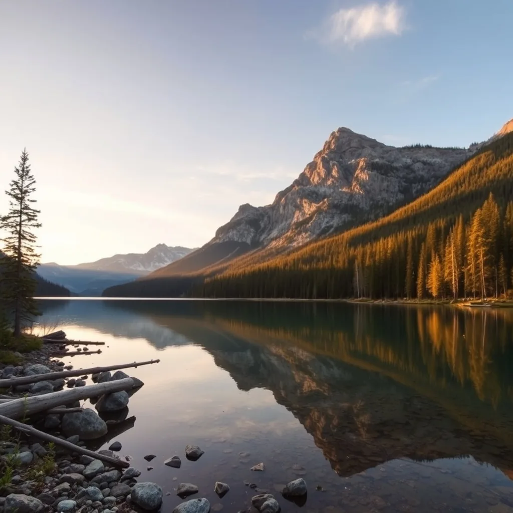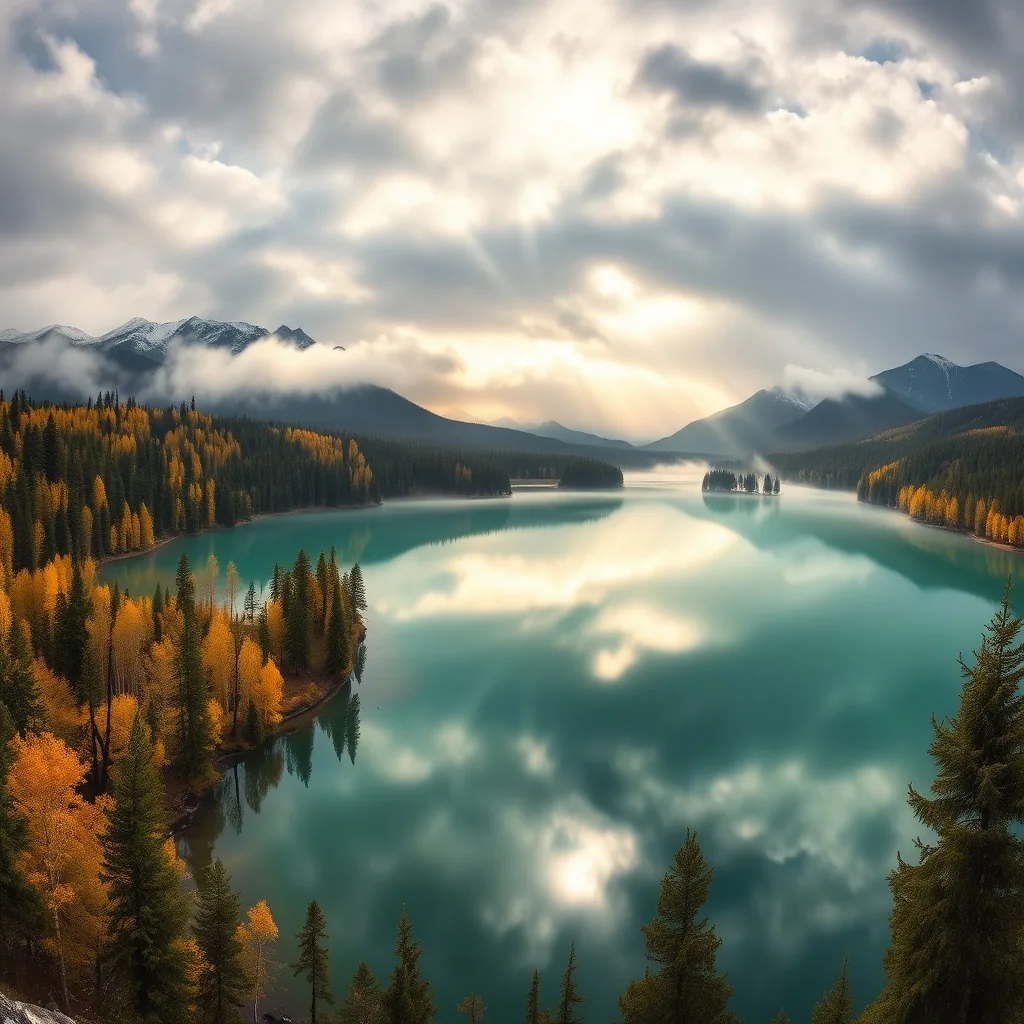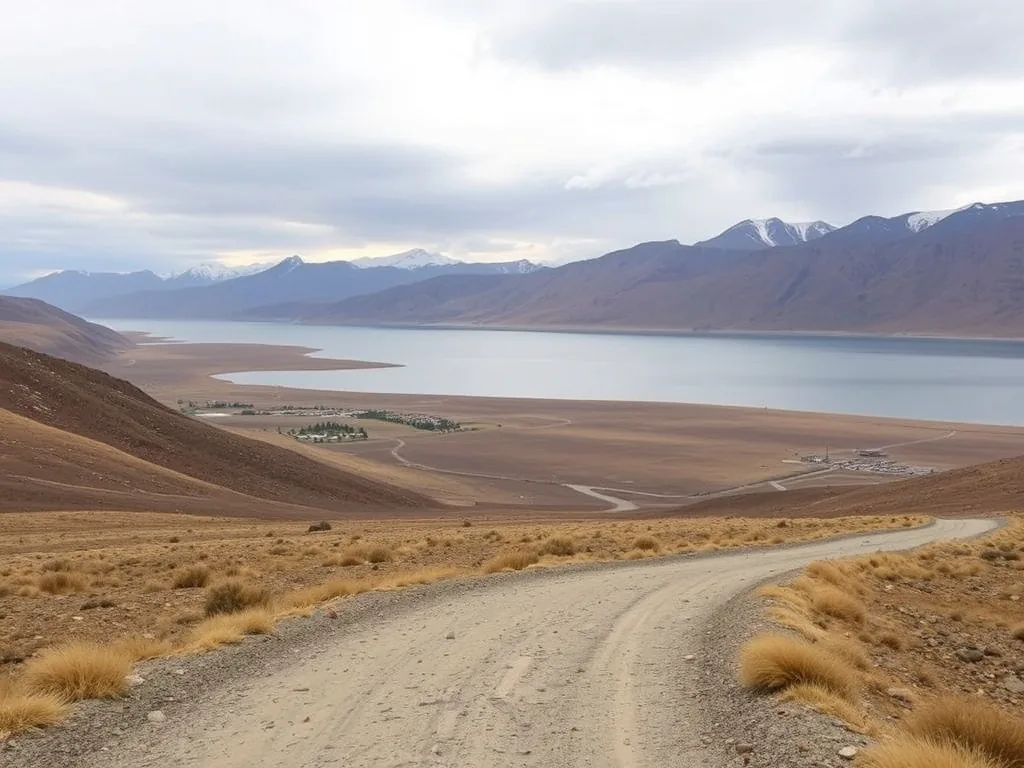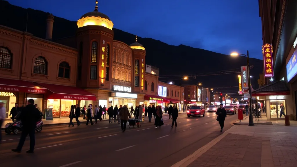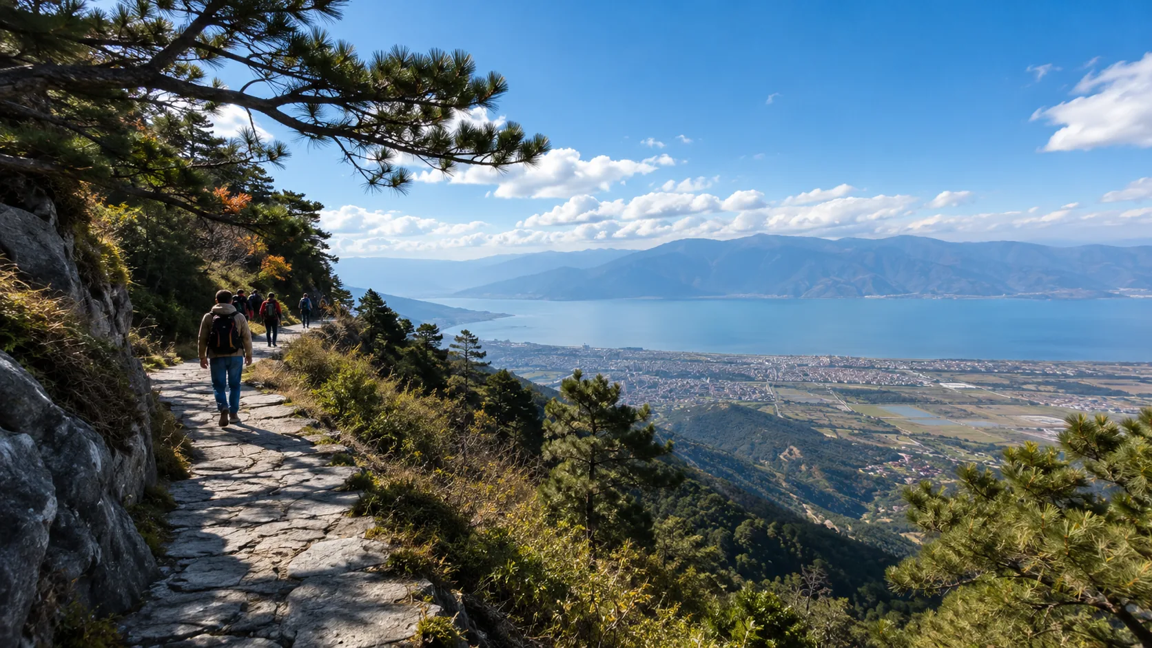



The best travel seasons for Yunnan are from March to May and September to November, with an ideal average temperature of 15°C.
Enjoy flower seas in Dali during spring, and witness the golden ginkgo trees in Tengchong during autumn.
A 6-day tour of Kunming, Dali, and Lijiang is recommended; avoiding the rainy season from June to August ensures a more comfortable experience.
Which months offer the most beautiful scenery
According to meteorological records and geographical data, March to May and October to December are the cycles with the highest landscape presentation quality.
During these periods, the province’s average precipitation is lower than 50mm, and air visibility remains above 25km year-round.
In areas at an altitude of approximately 2000 meters, daily sunshine duration is about 8-10 hours, with temperatures stabilizing between 12°C and 24°C.
In March, over 15,000 species of vascular plants can be observed entering their flowering phase, while November is the month with the highest success rate—exceeding 80%—for observing the “Golden Mountain under Sun” phenomenon on peaks above 6000 meters.
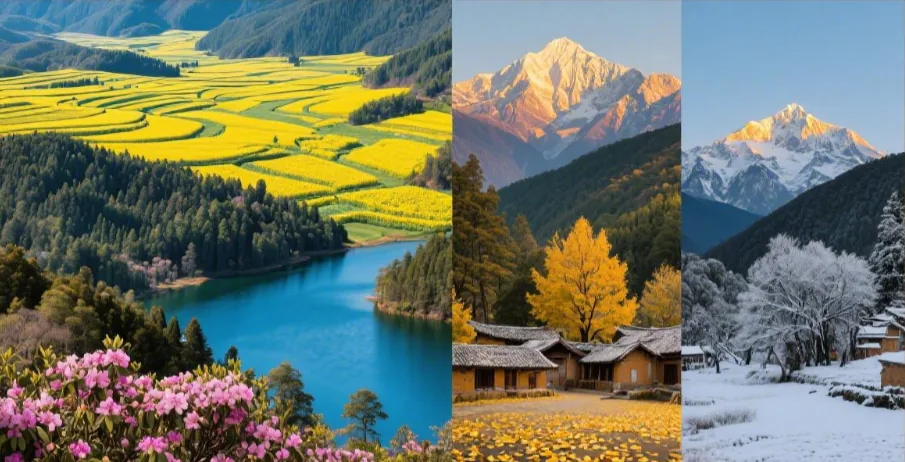
Landscape Timing
Extremely high mountains exceeding 5000 meters in altitude exhibit the highest atmospheric transparency from December to the following February.
Influenced by the prevailing descending air currents of the Westerlies, the atmospheric water vapor content during this stage is typically below 5 mm, leading to a weakened Rayleigh scattering effect and significantly reduced interference as light passes through the atmosphere.
In the Meili Snow Mountain region near 28 degrees North latitude, observation records show that the probability of morning sunlight refracting on the 6740-meter main peak is as high as 85% or more in January.
During this time, air visibility consistently remains above 40 kilometers, making distant glacier textures and snowline outlines clearly visible.
As winter precipitation is less than 15 mm per month and relative air humidity stays below 25%, the snow reflectivity in ultra-high altitude areas reaches its peak, providing excellent conditions for long-distance optical recording.
Meteorological monitoring data indicates that from December to February, areas above 3500 meters in altitude receive an average of 9.5 hours of sunshine per day. This high intensity of sunlight, combined with extremely low atmospheric aerosol concentrations, makes distant observations of snow mountain topography exceptionally clear.
From low-altitude tropical zones to high-altitude subalpine meadows, the flowering periods of vegetation exhibit a stepped succession from south to north and from low to high altitudes.
In river valley zones below 1000 meters in altitude between 21 and 25 degrees North latitude, over 15,000 species of vascular plants enter their growth period from February to March.
As heat moves toward higher altitudes, when the soil temperature above 3000 meters reaches the 5°C threshold (roughly between May and June), plants of the Rhododendron genus begin a 30-day reproductive cycle.
According to biodiversity surveys, there are over 200 species of Rhododendrons distributed in this region, ranging from altitudes of 2500 meters to 4500 meters.
At this time, the average daytime temperature stabilizes at around 15°C, providing an ideal window for observing the vertical distribution of forests and species diversity.
In late May, the vegetation coverage of high-altitude grasslands rapidly climbs from 30% in early spring to over 85%. This surge in biomass is attributed to the rise in temperature and soil moisture coordination prior to the monsoon rains.
Agricultural geographical landscapes shaped by human intervention enter their highest optical presentation “irrigation period” from November to the following April.
In the 190,000-acre stepped agricultural distribution area near 23 degrees North latitude, these terraces are filled with freshwater to maintain soil fertility and prepare for subsequent crops.
At this stage, the ground loses its vegetation cover, and the water surface acts as a natural mirror, increasing ground light reflectivity from 0.15 to approximately 0.60.
The long shadows and refraction produced by the solar incidence angle at dawn and dusk give the hillsides—with altitude drops exceeding 1000 meters—a strong sense of geometric lines.
Despite the scarce rainfall during this period, evaporation rates remain low due to the influence of cold air, ensuring the stability of the water-filled landscape.
Statistics show that from January to March, the daily average sunshine duration for such agricultural landscapes is 9.2 hours. High-density sunshine provides ample light, allowing the water surface reflection effect to reach its physical extreme at sunrise every day.
From July to September, controlled by the Southwest Monsoon from the Indian Ocean, the region enters its peak precipitation period.
In some micro-climatic zones, total annual precipitation can exceed 1000 mm. This abundant moisture supply causes cloud base heights to frequently descend to between 2500 and 3000 meters.
For observation points above 3500 meters, this is the phase with the highest frequency of “sea of clouds” phenomena.
When warm, moist air currents condense upon being lifted by terrain, they form cumulonimbus cloud layers covering areas exceeding 100 square kilometers.
Although the visibility of extremely high mountains is limited at this time, the air humidity inside the forests remains above 90% for long periods, providing conditions for the germination of 1,500 species of fungi.
During the rainy season, forest canopy density reaches its annual maximum. The growth rate of ground moss and epiphytes accelerates, covering about 70% of tree trunk surfaces and constructing an extremely complex composite ecosystem of rainforests and temperate forests.
Entering the transition period of October and November, atmospheric circulation changes, and humidity drops rapidly.
In the broad-leaved forest belts at an altitude of 2000 meters near 25 degrees North latitude, the decline in chlorophyll content leads to a significant transformation in vegetation color.
According to forestry department observations, the weekly leaf discoloration rate can reach 12%, causing the ground to shift from green to a mixed palette of yellow and ochre within just 20 days.
Wind speeds increase to 3-5 meters per second, effectively clearing fine particulate matter from the air and causing atmospheric transparency to rise again.
At this time, high-altitude crops such as buckwheat and late-maturing rice enter the harvest period, and the color saturation of the ground reaches its peak in mid-November, reflecting the visual expression of this geographic belt during the energy cycle.
In mid-November, the forest discoloration rate at altitudes around 2500 meters typically reaches 90%. As the temperature difference between day and night increases to over 15°C, the accumulation efficiency of plant pigments improves, creating distinct layers of geographical landscape.
The combination of different altitudes and latitudes creates a highly segmented timeline of landscapes throughout the year.
Mid-November to mid-December is a cycle with relatively low crowd density, approximately 60% lower than the peak data in August.
For those pursuing atmospheric purity and long-range photography quality, this stage offers clear advantages in terms of both physical environment and cost distribution.
Average daily temperatures in areas above 3500 meters drop below 5°C at this time, and the increase in air density further enhances the visual sharpness of distant snow peaks.
Suggestions based on specific needs
For professional needs pursuing extreme optical clarity and long-distance landscape photography, November to the following January is the period with the lowest concentration of atmospheric suspended particles throughout the year.
According to long-term atmospheric quality monitoring, the Aerosol Optical Depth (AOD) in the vertical geographic belt near 28 degrees North latitude is typically below 0.10, resulting in minimal light loss in the atmosphere.
For permanent glaciers above 5000 meters, the angle of sunlight incidence between 7:30 and 8:15 in the morning and the resulting shadows on the ground provide an excellent geometric 3D effect for photography.
During this phase, monthly precipitation usually stabilizes below 10 mm, with a sunshine percentage exceeding 75%, making the success rate of observing high-altitude peaks extremely high.
Due to the low-humidity environment, the risk of lens fogging is reduced to below 5%, and air visibility remains above 40 kilometers year-round, with distant glacier textures and snowline outlines clearly visible.
Needs focused on biodiversity observation and botanical scientific expeditions should target mid-May to late June.
During this time, the average temperature in the subalpine zone between 3000 and 4000 meters rises above 10°C, triggering the reproduction of high-mountain vegetation such as the Rhododendron genus.
According to plant distribution surveys, this region boasts over 200 species of Rhododendrons, 60% of which will bloom concentratedly within this 45-day window.
At this time, relative forest humidity gradually climbs from 30% in March to 60%. Plant physiological metabolism reaches its peak, and the rate of photosynthesis increases.
Observers can see significant species turnover for every 100-meter increase in altitude, and vegetation coverage rapidly climbs from 30% in early spring to over 85%.
While the average daily UV index is high during this stage, cloud cover begins to increase moderately, and scattered light provides a softer light source for photographing interior forest details.
- In November, average wind speeds remain at 2.5 meters/second, effectively clearing fog from river valleys; morning visibility is usually greater than 30 kilometers.
- For budget-sensitive travelers seeking low population density, hotel occupancy from mid-November to mid-December typically stays around 45%, representing a drop in accommodation costs of up to 55% compared to 95% in August.
- In April, the average daily temperature in tropical regions (around 22 degrees North latitude) is 26°C, and the probability of rain is below 20%, making it suitable for large-scale outdoor vegetation research and ecological recording.
- The forest oxygen content during the rainy season (July-August) is the highest of the year; negative oxygen ion concentrations can exceed 10,000 per cubic centimeter after rain, reaching high values in the ecological dimension.
- In areas at an altitude of approximately 2000 meters, March sees about 8-10 hours of sunshine per day, with temperatures stable between 12°C and 24°C, suitable for long-duration outdoor walking.
Those interested in large-scale agricultural landscapes and reflective optics should choose to depart between December and the following March.
During this 120-day cycle, 190,000 acres of stepped water bodies distributed at 23 degrees North latitude are in a water-filled state, and the surface solar radiation reflectivity (Albedo) jumps from 0.1 when covered by vegetation to 0.6.
Due to the lack of vegetation cover, the water surface produces a strong mirror effect under the low-angle light between 17:00 and 18:30 in the afternoon.
The uniqueness of this physical landscape lies in its extremely high contrast, suitable for capturing High Dynamic Range (HDR) imagery.
Furthermore, the temperature difference between day and night in this area remains around 15°C year-round, driving local airflow cycles that help form low-altitude cloud seas about 200 meters thick in the early morning, creating multi-layered overlays with the lines of the terraces.
October is the best node for observing the transition of forest color gamuts, driven by falling temperatures and shortening sunshine hours.
In the deciduous broad-leaved forest belts between 2500 and 3500 meters, the decomposition rate of chlorophyll within leaves significantly accelerates after October 15, and the proportion of carotenoids and anthocyanins increases.
Forestry data indicates that this process can complete 80% of color coverage within just 14 days.
As it is in the transition from the rainy season to the dry season, atmospheric moisture content is falling, but surface vegetation still maintains high water content, resulting in higher color saturation than in the dry month of January.
For those seeking neutral temperatures (daily average 18°C) and high color richness, this is a period of excellent physical balance.
For research on specific fungal groups, biomass production reaches its peak in August.
Over 1,500 species of wild fungi are distributed in this region, their growth induced by soil moisture levels above 80%.
Although the number of rainy days per month may exceed 22 at this time, this extreme synchronization of water and heat is the driving force maintaining the region’s complex ecosystem.
Forest canopy density reaches 90% at this time, providing a strong shielding environment that keeps ground temperatures constant at around 20°C.
For observers who do not rely on long-range visibility and instead seek microscopic biodiversity, the species density during this phase is more than 12 times that of winter, and the frequency of biological activity per unit area is at its annual high.
- In December, average snow depth in high-altitude areas (above 3500 meters) can reach 15 centimeters, and increased air density enhances the visual sharpness of distant snow peaks.
- The soil temperature in late May stabilizes above the 5°C threshold, marking the physical turning point where subalpine meadow vegetation shifts from withered yellow to green.
- Waterfall flow reaches its annual peak in September; supplemented by monsoon rains, the impact force of some waterfalls with vertical drops exceeding 100 meters is 400% higher than in January.
- In January, the nighttime atmospheric stratification is extremely stable; for astronomical observation and astrophotography, the sky background intensity is at its lowest, and the limit of visible stellar magnitude is higher.
If you are more focused on the physical structure of glaciers above 6000 meters, the dry air currents of winter are a prerequisite;
If you prefer the species density of tropical zones at 21 degrees North latitude, the warm climate of April is more advantageous.
How to choose attractions across the four seasons
The choice of attractions is mainly influenced by the probability of precipitation (June-August accounts for 60% of the annual total) and altitude drops (from 76 meters to 6740 meters).
From March to May, the provincial average temperature is 13-22℃, and the vegetation coverage index is in an upward phase;
From June to August, the average temperature in areas above 2000 meters is about 20℃, with precipitation between 500-800mm, suitable for high-vegetation areas;
From September to November, atmospheric transparency improves, the average monthly number of rainy days drops below 8, and snow mountain visibility increases by about 50% compared to summer;
From December to February, areas south of 24° North latitude receive more than 7 hours of sunshine per day, making them a preferred choice for avoiding the cold at low altitudes.
First Quarter (March – May)
In the low-latitude, high-altitude belt between 21° and 29° North latitude, March to May marks the physical process of transition from the dry season to the rainy season.
Atmospheric circulation during this stage is controlled by the residual forces of the Westerlies; the air in the lower and middle troposphere is dry, with average relative humidity maintained at 35% to 50%.
Since altitudes are generally between 1500 and 2500 meters, the atmospheric layer is relatively thin. The solar altitude angle increases rapidly after the spring equinox, leading to a significant rise in shortwave radiation energy received by the ground.
Daytime maximum temperatures typically fluctuate between 20°C and 26°C, while nighttime temperatures drop to 8°C to 12°C due to ground longwave radiation cooling.
This diurnal temperature range exceeding 15°C drives the phenological evolution of vegetation in the region.
During this period, atmospheric transparency is extremely high, and Aerosol Optical Depth (AOD) is at an annual low, providing physical conditions for long-distance observation of the longitudinal mountain systems of the Hengduan Mountains.
Influenced by low-pressure trough activity, the average wind speed during this phase remains between 3.5m/s and 5.2m/s, with instantaneous wind speeds in local valley areas potentially exceeding 10m/s as dry-hot winds. Evaporation far exceeds precipitation, and soil surface moisture content continues to decline. This meteorological environment increases the forest fire hazard rating while also promoting large-scale flowering bursts of specific plants such as Cerasus (cherry) and Brassica napus (rapeseed).
In the karst plateau regions at an altitude of about 1500 meters, approximately 800,000 acres of Brassica napus enter full bloom in March.
According to Normalized Difference Vegetation Index (NDVI) monitoring, the green coverage of this region is replaced by high-saturation yellow pigments within two weeks.
The formation of this landscape relies on the unique winter-spring temperature balance of this latitude belt, where daily average temperatures stabilize above 10°C with no persistent frost.
Entering April, the focus of phenological evolution shifts toward basin areas above 2000 meters in altitude.
Jacaranda mimosifolia in cities like Kunming and Dali begin to bloom concentratedly in late April once accumulated temperatures reach the threshold, with the flowering period lasting 20 to 25 days depending on rainfall probability.
At this time, pollen concentrations in the atmosphere rise significantly; for individuals sensitive to respiratory issues, the proportion of bioaerosols in the PM10 component of air quality monitoring data will increase accordingly.
The Ultraviolet Index (UVI) frequently breaks 12 during clear noon periods. Because the scattering effect of the atmosphere on UV rays is weakened in high-altitude areas, the amount of UVB radiation received on the skin surface increases by about 25% to 30% compared to plains at the same latitude. Physical shielding and the application of high-SPF broad-spectrum sunscreen are necessary technical measures for maintaining physical comfort, rather than optional choices.
Irrigated agricultural landscapes exhibit unique optical characteristics in the first quarter.
Stepped irrigation systems located near 23° North latitude enter the water-filling phase. Since plant coverage is low at this time, the specular reflection effect formed by the water surface is clearly visible on satellite remote sensing imagery.
At sunrise or sunset, the angle between the incident light rays and the water surface produces Fresnel Reflection, giving the terrace areas a high-contrast spectral performance.
The observation quality of this landscape depends on the radiation fog concentration in the early morning; usually around 10 AM, as temperatures rise and the inversion layer breaks, atmospheric visibility reaches its peak.
Entering May, the initial disturbances of the Southwest Monsoon begin to appear. Air humidity rises daily, and cloud cover increases from 1-2 units (Octas) to 4-5 units. The increase in the proportion of diffuse light changes the color saturation of the plateau surface.
In the subalpine belt above 3000 meters, the phenophase of Rhododendron starts slightly later, usually beginning in mid-May. Due to growth limitations caused by accumulated heat in high-altitude areas, these plants have evolved thick leathery leaves to withstand strong UV radiation and low-temperature drought. Observing these plants requires considering vertical climate zone differences; for every 100-meter increase in altitude, the phenophase is delayed by approximately 3 to 4 days. This geographical gradient determines the layered sense of vegetation landscapes in cross-altitude itineraries.
Second/Third Quarter (June – August)
Driven by the summer monsoon from the Indian Ocean, the low-latitude, high-altitude belt between 21° and 29° North latitude enters a heavy precipitation cycle from June to August.
According to regional meteorological station data, precipitation during this period accounts for 60% to 75% of the annual total, with average monthly rainfall maintained between 180mm and 260mm.
Atmospheric circulation is characterized by strong convective activity, with cloud cover consistently at 6 to 8 Octas. This effectively blocks shortwave radiation, keeping daily average maximum temperatures in areas above 2000 meters stable between 22°C and 26°C.
In subalpine meadow zones above 3000 meters, influenced by the vertical lapse rate (a 0.6°C drop for every 100 meters), daily average temperatures fall to 12°C to 19°C.
Precipitation patterns during this phase are highly discrete, mostly occurring as convective showers from afternoon to evening. Although these short-duration heavy rains increase surface runoff, atmospheric transparency in the middle troposphere improves rapidly after the rain, causing the UV Index (UVI) to soar from 3-5 on rainy days to extreme levels above 11. During outdoor activities, the decrease in Aerosol Optical Depth (AOD) increases reflected light intensity, making radiation exposure to retinas and skin tissues much higher than in mid-latitude plain areas.
Biomass reaches its annual peak in this season. Because soil Volumetric Water Content (VWC) remains in a saturated state above 35% for long periods and ground temperatures stay between 15°C and 20°C, fungal communities enter a burst period.
In original forest areas between 2500 and 3500 meters, the mycelia of Tricholoma matsutake and Boletus edulis mature and break through the ground.
This ecological process is strictly controlled by humidity and temperature parameters; the 24 to 48 hours following rainfall is the best window for observing this biodiversity.
In terms of alpine flora, species of Delphinium and Gentiana enter their flowering period in the periglacial zones above 3500 meters. These plants accumulate anthocyanins to withstand high-intensity radiation, forming unique subalpine landscape features.
Hydrological systems in the region reach peak flow in August. Supplemented by monsoon rainfall, the water exchange rate of high-altitude lakes accelerates. While water transparency slightly decreases due to suspended sediment, primary productivity around the lake areas significantly improves due to the synchronization of water and heat. For the upper reaches of transboundary rivers, flow velocity usually increases by 30% to 50%. When observing geographic forms like waterfalls or river terraces, one should refer to real-time rainfall data from the upstream basin to estimate geological risks from water level fluctuations.
Transportation and logistics efficiency are interfered with by meteorological parameters during this stage. Cloud base height (Ceiling) frequently drops below 500 meters, causing punctuality rates at high-altitude branch airports to fluctuate, with average delays increasing by 35 minutes compared to the dry season.
In road transport, slope stability in the longitudinal ridge-and-valley areas of the Hengduan Mountains is affected by rainfall infiltration; the shear strength of saturated soil decreases, and local road sections may be blocked by landslides or mudflows. It is recommended to use real-time traffic monitoring software based on Geographic Information Systems (GIS) for route planning.
During itineraries spanning altitude changes of over 1000 meters, as air pressure drops from standard atmospheric pressure to about 700hPa, human blood oxygen saturation changes. Combined with the increased humidity from rain, the Apparent Temperature is often 3°C to 5°C lower than the actual observed temperature, placing high demands on the waterproofness and breathability of layering systems.
Tropical regions (around 22° North latitude) exhibit completely different tropical rainforest climate characteristics. In valleys below 600 meters, relative humidity stays above 85% year-round. This high-humidity environment accelerates the decomposition rate of organic matter. Species activity reaches its peak in summer, with the probability of observing various arthropods and amphibians increasing by about 2.5 times compared to the first quarter. Due to the heat island effect and complex terrain, the frequency of thunderstorms in this area is the highest in the province, with a daily average thunderstorm duration of about 1.2 hours, posing some pressure on power supply and communication base station stability.
Total rainy days between June and August amount to approximately 55 to 65 days, but this does not mean all-day rainfall.
Fourth Quarter (September – November)
In the low-latitude plateau between 21° and 29° North latitude, September to November marks the thermodynamic transition from the monsoon wet period to the dry radiation period.
The atmospheric physical characteristics of this stage are defined by the complete withdrawal of the Southwest Monsoon and the re-coverage of the subtropical high-pressure system, leading to a significant drop in atmospheric water vapor content and Aerosol Optical Depth (AOD).
According to meteorological observations from the past decade, atmospheric transparency in October improves by about 45% compared to August, with vertical visibility consistently maintained above 30 kilometers.
This atmospheric environment greatly reduces the scattering loss of shortwave radiation as it penetrates the troposphere, increasing the proportion of parallel light reaching the ground and creating high-contrast optical landscapes.
At this time, the average dry-bulb temperature in the 2000 to 2500 meter altitude range stabilizes at 15°C to 22°C, but driven by ground longwave radiation cooling, the diurnal temperature range expands from 12°C to 22°C as latitude increases.
November enters the biochemical conversion period for deciduous broad-leaved forest communities in the region.
Influenced by the initial disturbance of cold air moving south from high and middle latitudes in the Northern Hemisphere, minimum temperatures in the 1600 to 2200 meter belt begin to frequently touch the biological threshold of 8°C.
This temperature signal triggers abscisic acid synthesis within plants like Ginkgo biloba, leading to rapid chlorophyll degradation and the dominance of carotenoids and xanthophylls.
In the mountain ecosystems near 25° North latitude, over 30,000 Ginkgo biloba specimens with ages exceeding 100 years form high-saturation spectral coverage in mid-to-late November, with reflected wavelengths primarily concentrated in the 570-590 nm region.
Meanwhile, in subalpine forest zones above 3000 meters, the needles of Larix potaninii (larch) also complete their color shift from deep green to caramel tones.
The duration of this landscape is influenced by the rate of cooling, usually reaching peak density within 14 days of the arrival of the first strong cold air mass.
- High-altitude glacier observation probability: In the folded mountain regions of 27° to 28° North latitude, cloud cover (Octas) drops rapidly from 7 units in summer to below 2.5 units after September. Due to the refraction of light by ice crystals in the atmosphere, the visibility probability of glacier peaks above 5000 meters increases by about 300% compared to summer. In mid-October, at dawn, as light penetrates thicker layers of the atmosphere, short-wavelength blue-violet light is scattered, while long-wavelength red-orange light forms high-brightness reflections on snow and ice surfaces; this optical window typically lasts only 15 to 20 minutes.
- Thermal infrared performance of artificial water systems: Large-scale stepped agricultural irrigation devices near 23° North latitude enter the water-filling fallow period in November. Due to extremely low plant coverage, the water surfaces form massive specular reflection zones. On satellite imagery, the Albedo of these areas is significantly higher than that of surrounding forests. For observers, this geographic form produces strong Fresnel reflection effects under low-angle sunlight, especially before 10 AM when radiation fog from the inversion layer hasn’t completely dissipated. The water surface and fog create a complex multiple scattering model, forming a unique sense of spatial depth.
- UV exposure and photochemical reactions: Despite entering autumn, UVB radiation (290-320 nm) remains high due to extreme atmospheric transparency. The UVI index in October can reach 9 to 11 (Extreme) at noon. For long-duration outdoor scientific research or expeditions at high altitudes, the photon energy received per unit of skin does not decrease simply because the environment temperature has dropped. Infrared reflectance and UV shielding coefficients of physical barrier materials remain technical parameters for maintaining human thermal balance and tissue protection.
Energy compensation models for migratory birds also enter an active phase during this quarter. With the establishment of the Siberian High, large numbers of waterbirds move along the East Asian-Australasian Flyway, with some groups staying for long periods at plateau lakes around 1900 meters in altitude. Due to biomass accumulation from summer rains, lake wetlands provide rich protein and carbohydrate supplies. Through long-focus optical equipment, one can record the fluid dynamic characteristics of these creatures’ flight in low-pressure environments; this instantaneous gathering of biodiversity usually peaks in early November.
Fifth Quarter (December – Next February)
In the low-latitude, high-altitude belt between 21° and 29° North latitude, December to the following February is the most stable dry season period of the year.
As the southern branch of the Westerly jet stream bypasses the plateau, creating strong descending air currents, the atmospheric layers during this time exhibit extreme vertical stability.
Absolute Humidity (AH) in the lower and middle troposphere typically drops to 3g/m³ to 5g/m³, a decrease of over 75% compared to summer.
This extremely dry atmospheric environment eliminates the absorption of infrared radiation by water vapor, leading to intense longwave radiation cooling at night. This causes the diurnal temperature range in basin areas around 2000 meters to frequently exceed 20°C.
According to radiation monitoring data from ground stations, while the intensity of shortwave radiation at noon decreases due to the altitude angle, the total radiation received by the ground remains above 500W/m² because of the extremely low atmospheric extinction coefficient, constituting the physical characteristic of “high winter radiation.”
Atmospheric circulation in this season is controlled by the edge of the powerful Siberian High. However, blocked by the longitudinal barriers of the Hengduan Mountains, cold air undergoes dynamic subsidence warming as it moves south, forming a significant dry-warm air mass stagnation in areas between 1500 and 2200 meters. This terrain-induced temperature inversion allows plateau basins to maintain daytime temperatures between 15°C and 22°C, whereas low-altitude plains at the same latitude often have much lower apparent temperatures due to cloud cover and humidity.
In low-altitude tropical regions south of 24° North latitude (altitudes below 800 meters), December to February marks the biological “cool-dry season.”
Average monthly rainfall during this period is usually below 20mm, and soil moisture stays near the wilting point, limiting the primary productivity of tropical rainforests.
However, because this latitude belt effectively avoids the invasion of polar cold vortices, average daily maximum temperatures consistently stay within the physiological comfort range of 24°C to 28°C.
In this ecological zone, forest coverage remains above 80%, and vegetation adapts to the drought by reducing transpiration rates, forming a heat surplus landscape completely different from high-altitude areas.
Global bird migration models show high-density energy aggregation during this quarter. Represented by Larus ridibundus (Black-headed Gull), migratory bird populations move south from high-latitude regions like Siberia along the East Asian-Australasian Flyway, choosing plateau wetlands at about 1900 meters for overwintering. According to 15 years of biomass statistics, about 40,000 to 50,000 individuals gather here annually. The specific heat capacity of lake water serves a thermal regulation function in winter, keeping surface temperatures between 8°C and 12°C and providing a stable energy supply environment for waterbirds; this coupling of biology and geography peaks in mid-January.
Atmospheric optical performance at high altitudes reaches its annual optimum in winter.
As Aerosol Optical Depth (AOD) is at a minimum, Rayleigh scattering dominates the sky, making the firmament appear as a deep blue with high saturation.
At altitudes above 3000 meters, horizontal visibility can reach mountain outlines 150 kilometers away.
From late December to early February, because the ground is dry and free of vegetation canopy interference, the shadow contrast of geological formations is extremely strong, making it a golden window for geomorphological remote sensing and astrophysical recording.
During this period, snowfall is mainly concentrated on isolated peaks above 4000 meters. The snowline position adjusts dynamically between 3800 and 4200 meters based on temperature fluctuations, creating a clear vertical natural zone boundary.
- Geothermal fluid dynamics: Volcanic geothermal systems near structural fracture zones exhibit the strongest surface heat exchange in winter. As ambient air temperatures drop to 5°C to 10°C, the condensation efficiency of water vapor from hot springs increases, causing the visual density of geothermal landscapes to increase by about 40% compared to summer.
- Human physiological adaptation parameters: Dry high-altitude air leads to a significant increase in Transepidermal Water Loss (TEWL), with passive daily water loss increasing by about 500ml compared to sea-level environments. Combined with respiratory rate compensation in low-pressure environments, the body’s demand for electrolytes grows non-linearly.
- Transportation meteorology risk model: The frequency of radiation fog affecting high-altitude road sections increases after December, especially during dawn and sunrise, where visibility may suddenly drop below 50 meters. While aircraft takeoff lift performance improves as air density increases with falling temperatures, the frequency of wind shear at branch airports—intensified by valley wind systems—places higher precision requirements on flight control.
Agricultural landscapes during this stage are characterized by high levels of human intervention. Winter wheat and rapeseed in low-latitude regions enter a slow growth phase, with Fractional Vegetation Cover (FVC) between 30% and 45%. Driven by drought, farmers use irrigation systems to maintain surface moisture, creating distinct thermal differences in the infrared spectrum. In tropical crop areas, coffee and rubber trees enter the late harvest stage, with their biochemical components completing final flavor accumulation under the influence of continuous high diurnal temperature ranges.
While the dryness of the physical environment poses challenges for skin and mucous membranes, it eliminates geological risks from mold growth and heavy precipitation, making scientific expeditions, precision photography, and high-altitude trekking based on optical observation highly predictable.
The best routes to follow
In 2026, Yunnan’s 394,000 square kilometers of land are highly connected via a 3000-kilometer high-speed rail network, increasing commuting efficiency between major node cities by 45%.
The Northwest Loop is approximately 850 kilometers long, with altitudes rising from 1890 meters to 3459 meters.
This path covers 3 UNESCO World Heritage sites.
With an average temperature of 12°C to 23°C, it is recommended to reserve 7 to 9 days, with a daily base budget for transportation and accommodation of 60 to 180 yuan.
Northwestern Region
In 2026, the electrified railway network spanning the Northwest has achieved full automated dispatching. The line is approximately 630 kilometers long, with design speeds maintained at 200 to 250 km/h.
This line connects a regional center at 1890 meters with a plateau terminal at 3459 meters, forming a graded ascending transport framework.
The Kunming hub serves as the starting point, operating over 45 pairs of high-speed trains daily, with capacities between 576 and 1152 passengers per train.
| Route Segment | Distance (km) | Avg Time (min) | Frequency (Trips/Day) |
|---|---|---|---|
| Kunming – Dali Region | 330 | 112 | 50+ |
| Dali – Lijiang Region | 158 | 55 | 18+ |
| Lijiang – Shangri-La | 139 | 74 | 12+ |
| Shangri-La – Kunming (Direct) | 627 | 270 | 6+ |
The Dali region is located at 25° North latitude; influenced by the Westerlies and Southwest Monsoon, the annual average temperature remains at 15.1°C.
Marble geological structures are widely distributed in this area, with an average physical density of 2.6-2.8g/cm³.
2026 data shows that the 129-kilometer loop around Erhai Lake has completed a full green energy upgrade, equipped with 280 fast-charging piles with a maximum power of 480kW.
In architecture, the area follows strict height limits for buildings near World Heritage sites, with most resort facilities not exceeding 12 meters.
The density of international brand hotels has significantly increased, now offering over 1200 five-star standard rooms. Their HVAC systems are typically equipped with H13-grade HEPA filters to filter out spring pollen, ensuring indoor PM2.5 levels stay below 10 micrograms/cubic meter.
Lijiang, at 2400 meters, is a midway point for adapting to high-altitude environments. Atmospheric pressure at this height is about 76kPa (compared to 101kPa at sea level), and oxygen content is about 80% of sea level. According to medical advice, travelers should stay here for more than 48 hours to induce increased erythropoietin production, thereby reducing the probability of acute respiratory discomfort when traveling to higher altitudes.
The Lijiang Ancient Town building complex covers an area of approximately 7.27 square kilometers. Its complex water network exceeds 11 kilometers in total length, utilizing natural slopes to achieve automatic water circulation.
In 2026, digital coverage in this area reached 99.8%. Visitors can use AR navigation systems to view the structural stress parameters and historical construction dates of every bridge.
The nearby Glacier Park features a cableway terminal at 4506 meters. The cableway is 2968 meters long with a vertical rise of 1150 meters, capable of transporting 1200 people per hour in one direction.
The cableway cabins utilize an anti-gust design, allowing stable operation in winds of 15 meters/second.
Observation data shows glacier movement speeds of about 5 to 10 meters per year, with surface crevasse depths measured at 30 to 50 meters in 2026.
| Environmental Parameters | Dali (2000m) | Lijiang (2400m) | Shangri-La (3400m) |
|---|---|---|---|
| Avg Air Pressure | 80.5 kPa | 76.2 kPa | 67.8 kPa |
| Oxygen Percentage | 84% | 79% | 70% |
| UV Index (Summer) | 10 – 12 | 11 – 13 | 13 – 15+ |
| Annual Precipitation (mm) | 1050 | 950 | 620 |
In the Shangri-La region, the terrain alternates between alpine meadows and coniferous forests, with total altitudes between 3200 and 5500 meters.
Potatso National Park, opened in 2026, covers approximately 1313 square kilometers and preserves landform remains from the Cretaceous period.
The ecological monitoring system uses satellite IoT technology to update soil moisture, air temperature, and wildlife migration tracks every 15 minutes.
Hotel buildings here usually employ double-glazed tempered glass (typically 6mm+12A+6mm) to cope with diurnal temperature fluctuations of up to 20°C.
Indoor climate control systems keep temperatures at around 22°C and relative humidity between 45% and 55%.
Due to the high altitude, UV radiation is 40% higher than in plains, so UPF 50+ protective equipment is recommended for outdoor activities.
2026 logistics statistics show that the density of convenience facilities along the Northwest Loop has reached 1.5 per 10 square kilometers. Major international logistics providers have established drone delivery stations in the region, capable of delivering emergency medicine or high-altitude supplies to remote trekking points within 30 minutes.
Payment systems are highly integrated across the loop, supporting 12 mainstream settlement methods including digital currency.
All major train stations and international hotels feature self-service currency exchange machines supporting 24-hour real-time exchange rates.
For self-drive travelers, 2026 highway tolls utilize sensor-based billing, with average pass waiting times reduced to 0.5 seconds.
Power supply in the Northwest relies primarily on regional hydroelectric and wind power units, with green electricity accounting for over 90%.
Xishuangbanna
This region is located between 21.1° and 22.6° North latitude, belonging to a typical tropical monsoon climate zone, with a total area of about 19,000 square kilometers.
2026 meteorological data shows the annual average temperature remains at 21.9°C, with a frost-free period of 365 days.
Forest coverage is currently stable at 81.3%, making this the most intact oasis on the Tropic of Cancer.
The main gateway for travelers is Jinghong City, at an altitude of only about 550 meters. The low altitude and abundant vegetation ensure high oxygen levels, with negative oxygen ion concentrations in forest areas exceeding 30,000 per cubic centimeter.
In 2026, the efficiency of the China-Laos Railway (Pan-Asia Railway) significantly improved, shortening the commute from Kunming to Jinghong to 175 minutes, with 32 daily round trips, providing high logistical support for cross-regional ecological expeditions.
In terms of biodiversity, the international plant research institution in Menglun covers 11.25 square kilometers and is divided into 38 specialized gardens.
It preserves over 13,000 species of tropical plants, including ex-situ conservation populations of about 30 critically endangered species.
The digital guide system completed in 2026 covers 95% of the garden’s walking areas, allowing visitors to get real-time carbon sequestration data and photosynthetic rate models for plants via mobile terminals.
For research on tall plants, an 800-meter skywalk is available, with the highest point 36 meters above ground, allowing observers to conduct ecological sampling at the forest canopy level.
Wildlife observation is concentrated in the northern part of a nature reserve 45 kilometers from the city, home to about 300 Asian elephants.
In 2026, a monitoring network of 700 infrared thermal imaging sensors was deployed to accurately track elephant coordinates and movement trajectories.
The observation walkways exceed 2000 meters in length, with a design load of 300kg per square meter, ensuring structural safety when observing large mammals.
Dipterocarp plants distributed in these rainforests often exceed 40 meters in height, constituting a complex multi-layered vertical ecosystem.
Statistics show that vascular plant species in Xishuangbanna account for 1/6 of the regional total, bird species for 1/4, and mammal species for over 1/2 of the national total, a density leading among similar latitudes.
Regarding architecture, urban planning is deeply influenced by Indochinese aesthetics, utilizing roofs with slopes greater than 45 degrees and gold decorative elements to adapt to high-intensity tropical rainfall.
In 2026, the main commercial complex in central Jinghong covers over 250,000 square meters and includes Southeast Asia’s largest open-air trade market.
This market sees peak crowds of up to 45,000 people at night (19:00-23:00), featuring over 3,000 standardized stalls offering tropical fruits, handicrafts, and South Asian-fusion cuisine.
Accommodation infrastructure is highly internationalized. In 2026, the area boasts over 15 five-star international resorts and hotels.
These facilities typically use passive cooling designs to reduce air conditioning energy consumption by 20%. Average room sizes exceed 45 square meters, with most featuring private pools.
Service systems generally support multi-language communication and integrate global mainstream non-cash payment gateways.
Car rental services (including EVs) are highly prevalent, with charging pile coverage on major roads reaching a 15-kilometer radius.
The region has distinct wet and dry seasons. November to April is the dry season, with average monthly rainfall below 50mm, the golden period for outdoor trekking and ecological photography; May to October is the rainy season, accounting for over 80% of annual precipitation, when the forest landscape is at its lushest.
The food system shows strong local character, emphasizing a balance of sour, spicy, bitter, and salty tastes.
The 2026 food safety supervision system allows for full-chain traceability; visitors can scan QR codes on menus to view ingredient origin and pesticide residue reports.
Local specialties often use lime juice, lemongrass, and basil for seasoning, with protein sources mainly consisting of freshwater fish and poultry.
Southeastern Region
Located near 23° North latitude, this region has formed a complex ecosystem with altitudes ranging from 140 meters to 3000 meters, influenced by the South Asian monsoon and vertical topography.
2026 field measurements show forest coverage remains above 45%, with an annual average precipitation of about 1400 mm.
The system relies on a four-in-one circular structure of forests, villages, terraces, and water systems. Without mechanical power, it uses gravity to manage a 400-kilometer network of irrigation canals.
On steep mountain slopes between 1500 and 2000 meters, terrace slopes range from 15° to 75°. A single slope can have over 3000 layers. This geometric arrangement effectively slows surface runoff, keeping soil erosion below 500 tons per square kilometer per year.
- Water Cycle Parameters: During the irrigation period from November to March, solar radiation reflectivity on terrace water surfaces stays between 0.15 and 0.40.
- Temperature Regulation: The thermal capacity of the water bodies narrows the diurnal temperature range in the terrace area by about 3.5°C compared to nearby dry land.
- Biological Load: This agricultural system supports a production of over 600 kg of red rice per hectare along with abundant freshwater organisms.
- Optical Performance: From 7:00 to 9:00 AM, the atmospheric refraction and water surface angle are around 30 degrees, producing extremely high color saturation.
In architectural history, this route includes a narrow-gauge railway system built in the early 20th century.
The 1000mm international gauge, which entered operation in 1910, differs from the then-standard 1435mm gauge; this design better suited the turning radius requirements of mountainous environments.
In 2026, some sections still preserve steam locomotive repair shops and neoclassical station buildings from that era.
These structures used local timber and imported steel; their roof slopes, arched doors, and louver designs reflect European industrial adaptation to tropical environments.
The historical building complex in Jianshui covers about 35,000 square meters, with layouts following strict axial symmetry. Individual structures use precise mortise and tenon joints, capable of maintaining structural integrity in geological activity above magnitude 6 on the Richter scale.
- Material Specs: Walls are typically made of blue bricks with thicknesses of 360mm or 480mm, with compressive strengths over 10MPa.
- Spatial Proportions: The ratio of courtyard lighting area to building projection area is usually maintained at 1:3 to ensure interior ventilation and natural light.
- Woodwork: Beams and pillars mainly use local high-density hardwoods, naturally dried for 5 years to reduce moisture content below 12%.
- Drainage System: Perfect stone-paved drainage ditches under foundations ensure no water accumulation even during storms of 50mm per hour.
Extending north to the Mile region, the landscape exhibits typical red soil plateau characteristics.
The soil has high levels of iron oxide (Fe2O3) and aluminum oxide (Al2O3), appearing as bright brick red.
A large-scale red brick art building complex completed in 2026 utilized these soil properties. Through sintering at over 1000°C, the produced bricks reached a density of 1800kg/m³.
These buildings use no steel reinforcement or concrete beams, relying entirely on the gravity of the bricks and arched supports to span space.
The forms reference traditional local vessels, creating a unique postmodern geometric landscape.
Highway network density in the region has reached 15 km per 100 square kilometers, with average speeds of 80km/h.
5G base station coverage ensures centimeter-level GPS accuracy even in deep canyons.
For researchers and travelers, there are over 120 professionally maintained observation points, each with a QR code providing multi-language geological and architectural history parameters.
2026 accommodation stats show about 50 boutique guesthouses converted from historical buildings and 3 international brand hotels in the area. Rooms integrate smart environment controls that adjust fresh air based on outdoor PM2.5 and humidity, keeping indoor oxygen at the standard 20.9%.
- Transit Connections: Bus intervals from the Kunming South Hub to major nodes have been shortened to 30 minutes, supporting real-time e-ticket verification.
- Energy Facilities: 200 new super-charging terminals with powers up to 350kW have been added to meet EV self-drive needs.
- Medical Support: Node cities are equipped with medical centers meeting international rescue standards, supporting settlement via major global commercial insurance.
- Language Environment: Main service windows and signs are marked in Chinese, English, French, and Vietnamese, reflecting the region’s history of multi-national exchange.
“`
Related Reading
- 2026 Yunnan Travel Attractions | Top 10 Must-Visit Destinations for First-Time Visitors to Yunnan
- Yunnan Travel Precautions 2026 | Essential Knowledge for Visiting Yunnan & High Altitude Sickness Prevention Guide
- 2026 Yunnan Independent Travel | Deep Travel Tips for Yunnan You’ll Regret Missing
- How Much Does It Cost to Travel to Yunnan in 2026 | Yunnan Travel Budget Breakdown & Latest Price Reference
- 2026 Yunnan Travel Guide | Must-Read Tips to Avoid Pitfalls & Save Money for First-Time Visitors
Shangri-La —: Numbers to Check
Tickets & Booking
- Tiger Leaping Gorge (Shangri-La section, Upper Tiger Leaping): Adult CNY 45; ticket + round-trip sightseeing escalator (Pingbu Qingyun escalator) CNY 125[src]
Where to Stay · Room Type · Nearby
- Inside Dukezong Ancient Town | Room tip: Convenient for getting around, but vehicles cannot enter, so confirm with the guesthouse whether they carry luggage | Nearby add-ons: Great Buddha Temple, prayer wheel, Guishan Park, Moonlight Square[src]
- Along Napahai | Room tip: Good views and quiet, but far from the city | Nearby add-ons: Napahai Yila Grassland, Shika Snow Mountain[src]
Typical Climate & Packing (Past Years)
- January: -7 °C–9 °C °C, [Travel climate reference]
- February: -5 °C–11 °C °C
- March: -2 °C–14 °C °C
- April: 2 °C–17 °C °C
- May: 5 °C–19 °C °C, The meadow turns green again
- June: 8 °C–20 °C °C