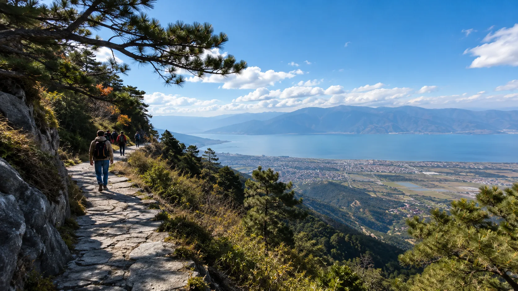



Yunnan is currently in the rainy season from July to August. Although the temperature is comfortable at 15-25℃, the weather is highly unpredictable. Please keep this trap-avoidance guide in mind: First, transportation safety is paramount. Landslides are prone to occur in mountainous areas during the rainy season. It is strongly recommended to prioritize high-speed trains and avoid long-distance self-driving in dangerous sections like the Nujiang River. Second, itinerary flexibility is necessary; the probability of the Jade Dragon Snow Mountain cableway closing on rainy days is as high as 30%, and the water transparency of lakes like Erhai will decrease. You must follow official scenic area announcements to adjust plans at any time. Third, essential equipment includes the “rainproof, sun-proof, and quick-drying” trio. UV rays remain extremely strong on cloudy days in Yunnan, and the air is humid, making clothes difficult to dry. It is suggested to bring waterproof shoes and disposable underwear. Finally, prepare gastrointestinal medicine.

Weather Anxiety
Checking mobile weather apps in July-August often shows continuous rain for 30 days across major cities in Yunnan. The reality is that, influenced by the topography of the Hengduan Mountains, rainfall during the local rainy season consists mostly of localized orographic rain lasting 30 to 120 minutes. While it may be raining in Dali Ancient City, it is often sunny in Xiaguan, just 5km away. Rain can cause the temperature to drop from 26℃ to 15℃ within 20 minutes. Provincial or municipal weather forecasts have low reference value; instead, check township-level meteorological radar maps (the accuracy rate for 2-hour predictions can reach 85%). Preparing a single-layer hardshell jacket and non-slip shoes is sufficient for normal travel.
Judging Weather Independently
Give up on planning itineraries based on the sun or umbrella icons on weather app homepages; use the meteorological radar map function instead. Major weather software menus feature “minute-level radar maps.” Clicking this displays a dynamic map with a timeline covered in different colored radar echo blocks. The radar echo intensity (dBZ) value is strictly proportional to actual rainfall. Observing the movement trajectory of color blocks over the next 120 minutes allows you to judge the scale of precipitation about to occur at your coordinates.
According to historical radar data from the Yunnan Meteorological Bureau for July-August, different colored blocks correspond to specific physical precipitation states:
- Light Blue (15-20 dBZ): Air humidity exceeds 85%, mountain fog occurs, no perceptible precipitation.
- Green (20-30 dBZ): Drizzle, precipitation at 0.1 to 1.0 mm/h; one can walk normally with a hat.
- Yellow (30-40 dBZ): Showers, precipitation at 2.0 to 5.0 mm/h; road surfaces develop 1 to 2 cm of standing water.
- Red (40-50 dBZ): Short-term heavy rain, precipitation exceeds 10 mm/h; outdoor visibility drops below 500m.
- Purple (greater than 50 dBZ): Strong convective thunderstorms; a single peak precipitation process usually lasts about 40 minutes.
The average wind speed in plateau regions remains at level 3 to 4 (5.4-7.9 m/s) year-round, pushing cloud clusters at speeds of 15 to 25 km/h. Drag the timeline on the radar map to calculate the movement speed of high-intensity precipitation clouds. If a yellow cloud cluster of about 10 square kilometers is drifting toward your location, staying in a nearby convenience store for 30 minutes will allow the rain belt to pass.
Using real-time satellite cloud imagery to assist in judging the day’s weather trend is also feasible. The National Meteorological Center website provides free high-definition cloud images from the Fengyun-4 satellite, refreshed every 15 minutes. Visible light cloud images clearly show the physical thickness and edge contours of convective cloud layers. Observing the cloud map over Northwest Yunnan at 8:00 AM, if large areas of continuous bright white are present, the sunshine hours for the day will be less than 2 hours.
Predicting meteorological changes through natural environment markers: Dali’s Cangshan has 19 peaks exceeding 3500m. When the Southwest monsoon carries moisture from the Bay of Bengal, it is forced to rise by the mountains. Observing Malong Peak at 3966m, if clouds accumulate and stay lower than the Ximatuan Cableway middle station at 2800m, the probability of rain in the Ancient City area within 2 hours is as high as 80%.
Combining wind direction changes and temperature fluctuations: The base daytime temperature in summer in Yunnan is mostly between 22℃ and 26℃. When a sudden gust of over level 4 occurs in a dead-calm environment, and the thermometer shows a temperature drop of 3℃ to 5℃ within 15 minutes, it is a sign of an approaching cold air shear line. Find a brick-and-concrete building with lightning protection wires to take shelter, as precipitation will pour down within 10 minutes.
The Yunnan Provincial Department of Transport website provides real-time monitoring signals for highways and national/provincial trunk roads. If planning to drive from Lijiang to Shangri-La, check the real-time monitoring of the Tiger Leaping Gorge section of National Highway 214 and the Baima Snow Mountain Pass in advance.
Monitoring screens can provide the following intuitive meteorological data:
- Road surface reflection: Judging the current presence of continuous precipitation and the depth of standing water.
- Vehicle wiper frequency: The wiper speed of oncoming cars can help estimate the rainfall intensity 5km away.
- Tree branch sway: Estimating wind force to roll down windows early to avoid side-winds causing vehicle tilting.
- Visibility distance: Observing the clarity of highway mileposts to evaluate whether front and rear fog lights need to be turned on.
Within scenic areas, real-time weather can be checked via live stream functions on short-video platforms. Searching for “Jade Dragon Snow Mountain Glacier Park Live” or “Pudacuo National Park Live” will show current lighting conditions, visitor clothing thickness, and precipitation status. If the Glacier Park cableway upper station at an altitude of 4506m is shrouded in thick fog with visibility less than 20m, buying a cableway ticket from Lijiang City at an altitude of 2400m will result in failing to see the full view of the snow mountain.
Responding to Sudden Temperature Drops
In July-August, because the altitude in Yunnan is generally above 2000m, the day-night temperature difference remains at 10℃-12℃ throughout the year. On a sunny noon in Dali Ancient City (altitude 1976m), the perceived temperature can reach 28℃ due to strong UV radiation, but once blocked by cumulonimbus clouds with rainfall of 5 mm/h, the ambient temperature will rapidly drop to 14℃-16℃ within 20 minutes. At this time, if one is only wearing short sleeves, the rapid loss of body heat will cause shivering.
Quantitative Standards for the Three-Layer Dressing Method:
- Base Layer: Choose a polyester quick-drying shirt with a weight of 120g-150g; the moisture-wicking efficiency should ensure drying within 20 minutes.
- Thermal Layer: Prepare a 100-weight or 200-weight fleece jacket providing a thermal insulation of 0.1-0.2 Clo.
- Protective Layer: Configure a single-layer hardshell jacket with a waterproof rating of 10000mm and a breathability of 10000g/m²/24h.
When moving between cities like Kunming, Lijiang, and Shangri-La, the temperature drops by an average of about 6℃ for every 1000m of altitude gain. Traveling from Lijiang City (altitude 2400m) by cableway to Jade Dragon Snow Mountain Glacier Park (altitude 4506m), the altitude drop is 2106m, with a theoretical temperature difference of about 12.6℃. If wind force reaches level 6 (10.8-13.8 m/s), the wind-chill effect will make the perceived temperature drop by another 5℃-8℃.
The road friction coefficient in Yunnan drops by 30%-50% after rain, especially on the Wuhua stone roads of Lijiang Ancient City. Purchasing hiking shoes with a sole rubber hardness (Shore A) between 60-70 provides the strongest grip. Avoid wearing 100% cotton trousers; cotton fibers increase in weight by 3 times after absorbing water and are difficult to dry, which can cause thigh muscle chills and cramps.
Field-Tested Data for Footwear and Accessories:
- Sole Tread: Depth should be greater than 4mm and spacing greater than 5mm to ensure mud and standing water can be discharged quickly.
- Sock Choice: Outdoor socks with 30%-50% wool content can maintain basic thermal insulation even when soaked by rain.
- Head Protection: Bring a windproof neck gaiter or light knit hat with a thickness of over 1.5mm to cover the temples and reduce the chance of catching a cold.
The metabolic rate in plateau regions is 15%-20% higher than in the plains; combined with energy consumption from cooling, the backpack must always contain high-calorie supplies. It is suggested to carry dark chocolate or nuts with an energy density exceeding 500 kcal/100g.
Adjusting the Itinerary
Rainfall in Yunnan during July-August is mostly concentrated between 14:00 and 18:00, during which the probability of convective precipitation is as high as 75%. Scheduling outdoor itineraries for Dali’s Cangshan or Jade Dragon Snow Mountain above 3000m between 08:00 and 11:30 allows for utilizing the more stable meteorological window of the early morning. Morning cloud thickness is usually below 500m, UV transmittance is about 40%, and the perceived temperature remains around 18℃, suitable for high-intensity hiking.
| Time Slot | Expected Weather Features | Suggested Activity Type | Quantitative Risk Indicators |
|---|---|---|---|
| 07:00-11:00 | Morning fog dissipates, stable light | Snow mountain cableway, Erhai cycling | Visibility > 5km, wind level 2-3 |
| 11:00-14:00 | Cumulus accumulation, peak temp | Indoor dining, intangible heritage experience | UV Index 8-11, perceived temp 26℃ |
| 14:00-17:00 | Peak period for convective showers | Museums, bookstores, indoor cafes | Precipitation prob 65%, temp drop 8℃ |
| 18:00-21:00 | Post-rain sea of clouds, high sunset prob | Ancient city stroll, night market, photography | Humidity > 90%, stone road slip coeff 0.4 |
After 14:00, if the radar map shows yellow echoes above 30 dBZ approaching, one should immediately switch from open-top cars or bicycles by Erhai to indoor locations. There are over 10 cultural courtyards with different themes in Lijiang Ancient City, such as the Naxi paper-making workshop and embroidery halls. Staying in these indoor places for 60 to 90 minutes can usually help avoid the day’s strongest wave of precipitation, during which the outdoor instantaneous rain intensity can reach 15 mm/h.
Within 30 minutes after rain ends, the aerosol concentration in the plateau air will drop by over 60%, making it the best time to shoot the “face-washing clouds” of Jade Dragon Snow Mountain or Cangshan. Utilize the high transparency after rain for landscape photography; shutter speeds can be appropriately increased to 1/500s or faster. If the subsequent plan is to drive to Lugu Lake or Shangri-La, verify whether there are heavy rain warnings for cumulative precipitation exceeding 50mm in the next 12 hours.
The logic for dynamic itinerary adjustments based on different rain grades is as follows:
- 24-hour cumulative precipitation < 10mm (Light Rain): Maintain the original plan. Put on a hardshell jacket with a waterproof index of 8000mm to visit Pudacuo or Napa Lake; the color saturation of meadows in the rain is 20% higher than on sunny days.
- Single-hour precipitation > 20mm (Short-term Rainstorm): Cancel all road travel involving landslide risks, such as the Tiger Leaping Gorge hiking line. Under this rain intensity, the stability of scree slopes will drop by 40%.
- Continuous rain exceeding 48 hours: Abandon all wild camping and unpaved road itineraries. Turn to pure indoor in-depth tours like the Dali Bed Sheet Factory Art Zone or Kunming Museum; environment interference from weather drops below 5%.
If the itinerary is near a workplace or involves commuting, it is suggested to refer to the pick-up habits of Xia Yizhou. In city areas at 2000m altitude, rain causes the traffic congestion index to rise by 1.5 times. An originally 20-minute drive usually extends to 45-50 minutes on rainy days. Booking rides on ride-hailing platforms in advance and allowing a 15% error margin for the driver can effectively reduce the risk of itinerary delays caused by weather.
The focus of itineraries after 20:00 at night is on slip prevention. When completely wet, the bluestone roads of Lijiang and Dali Ancient Cities have a friction coefficient of only about 0.3, far lower than the 0.7 when dry. At this time, itineraries should reduce frequent uphill and downhill movements, prioritizing flat bar streets or cultural and creative markets. If returning to a hotel, avoid alleys with a slope greater than 15 degrees, choose well-lit main roads, and control walking speed to under 50 meters per minute.
In the face of possible extreme rainstorms (precipitation exceeding 50mm/24h), the itinerary should be resolutely switched to “long-distance motorized movement within the province.” Due to terrain barriers, Yunnan often sees “heavy rain in West Yunnan, sunny in South Yunnan.” If the Dali region experiences continuous rain for more than 3 days due to a shear line, one can transfer to Xishuangbanna via high-speed train within 2.5 hours.
Attraction Selection
In July and August, the average monthly rainy days in Yunnan reach 15 to 20, with precipitation accounting for more than 60% of the annual total. During this time, prioritize indoor venues or mature ancient towns where the impact of rain is less than 30%. For high-mountain attractions above 3000m and water system lakes, visibility is often below 50m and water reflection rates drop, leading to a significant decrease in the viewing experience. Rationally allocating the proportion of natural scenery to cultural experiences (suggested 3:7) can reduce itinerary delays and ticket losses due to weather.
Areas for Rainy Day Travel
Rainstorms with precipitation exceeding 50mm cause outdoor visibility to drop to within a hundred meters. Adjusting itineraries to fully enclosed areas or those with perfect sheltering facilities can maintain a regular tour duration of 6 to 8 hours per day.
The Yunnan Provincial Museum has a building area of 60,000 square meters, with 6 basic permanent exhibition halls displaying over 10,000 items, including bronzeware and cultural relics from the Dali Kingdom of the Tang and Song dynasties. The interior is kept at a constant 22℃, and a regular walking tour takes about 3.5 to 4 hours. The Chengjiang Fossil Site Natural History Museum is 50km from Kunming City, with an indoor display area of 18,000 square meters showing Cambrian fossil specimens from 518 million years ago.
Underground karst caves remain at a constant 15℃ to 18℃ year-round and are unaffected by surface precipitation. The internal tour route of Jianshui Swallow Cave is 3km long with an average cave height of 50m; the walking tour combined with a subterranean river cruise takes 2 hours.
- Kunming Dounan Flower Market: The largest fresh-cut flower trading market in Asia, with the main venue covering 60,000 square meters.
- Yunnan Art Museum: Located in the central area of Kunming with an exhibition area of 3,000 square meters, regularly exhibiting local woodblock prints.
- Dali Bai Autonomous Prefecture Museum: Tang-style architectural style housing 15,000 cultural relics; a walking tour takes about 1.5 hours.
- Ancient Tea Horse Road Exhibition Hall in Pu’er: Displays over 1000 items of horse caravan equipment; the venue provides free ginger tea when daily rainfall exceeds 30mm.
Settlements paved with bluestone or volcanic stone with a micro-slope design usually drain standing water within 30 minutes after rain stops.
The main streets of Lijiang Dayan Ancient City are about 4 to 6 meters wide, and the eaves of shops along the street extend outward by 0.8 to 1.2 meters. Walking close to the outside of the shops on rainy days can reduce rain splashing by more than 60%. There are over a thousand indoor experience stores in the Ancient City, with intangible heritage experience projects taking an average of 45 to 90 minutes.
Over 50 purple pottery workshops are distributed along the streets of Jianshui Ancient City. A single clay-kneading and throwing experience costs between 50 and 80 RMB, and the fired products can be sent via courier. Shaxi Ancient Town’s Sifang Street is about 300 square meters, surrounded by over 10 independent cafes with rain awnings, all within a 200m walking distance.
- Jianshui Purple Pottery Making: Takes 2 hours from kneading to trimming in a constant temperature indoor environment.
- Dali Zhoucheng Tie-Dye: A traditional Bai technique; dye houses often have rainproof roofs, and making a single square towel takes 1 hour.
- Lijiang Dongba Paper-making: Uses Daphne bark through processes like pulping and drying; 1.5 hours of indoor experience.
- Heqing Silverware Forging: Hundreds of silverware workshops in Xinhua Village allow visitors to sit indoors and participate in the hammer-forming process.
It is common in Northwest Yunnan for temperatures to drop with rain; daytime temperatures in Dali and Lijiang in July can drop to around 15℃ on rainy days. Turning to geothermal resource areas or tropical rainforest areas in West or South Yunnan will bring perceived temperatures back above 25℃.
The Hot Sea scenic area in Tengchong Volcanic Geothermal National Geological Park features over 80 hot spring groups. The highest water temperature in the “Big Boiling Pot” reaches 97℃, and the steam emitted can raise the air temperature within a 10m radius. Most hot spring resort hotels are equipped with pools featuring semi-open roofs, where visitors can experience metasilicic acid springs while avoiding rain; a single soak duration is suggested to be controlled at 15 to 20 minutes.
The average rainfall in Xishuangbanna in July is 250mm, with 90% of precipitation being afternoon convective rain. Single rainfall amounts are often between 20 and 30 mm, lasting no more than 2 hours. The Xishuangbanna Tropical Botanical Garden of the Chinese Academy of Sciences covers 1125 hectares, with over 20 tour bus stops equipped with rainproof roofs deployed inside the park. Within 15 minutes after the rain stops, the temperature recovers to around 28℃.
- Tengchong Heshun Ancient Town: Features a large number of century-old ancestral halls and rural libraries with enclosed inner courtyards.
- Baoshan Pupiao Hot Spring: Daily water output reaches 1500 cubic meters, with the output temperature remaining at 50℃ year-round.
- Manting Park: The main part of the Mekong River Night Bonfire Party is held in a roofed theater with a capacity of 2000 people.
- Jinghong Starlight Night Market in Gaozhuang Xishuangjing: Large rainproof canopies are pulled over specific areas, covering an area of more than 2000 square meters.
Comparison of Weather Impact on Attractions
Yunnan enters the main flood season in July-August. Kunming’s average monthly rainfall is about 200mm, Dali about 180mm, and Shangri-La about 230mm. Most precipitation is concentrated between 14:00 and 19:00, lasting 1 to 3 hours at a time. Natural landscapes are highly dependent on light, visibility, and wind speed; when sunshine is less than 2 hours or cloud cover exceeds 80%, the visual experience drops significantly.
High-altitude snow mountains are most sensitive to weather changes.
Jade Dragon Snow Mountain Glacier Park is at 4506m altitude with a cableway length of 2914m; the operating wind speed limit is 15m/s. Summit temperatures in July are often between 5℃ and 10℃, with perceived temperatures even lower after adding rain. When cloud cover exceeds 80%, the peak can be completely obscured, compressing visibility to 30-50 meters.
The main peak of Meili Snow Mountain is 6740m, and the Feilai Temple observation point is at about 3400m altitude. The probability of seeing the “Golden Mountain under Sun” in the early morning in July-August is less than 5%. If rain is continuous for more than 3 days, it is common for the mountain to be covered by low clouds. Traveling from Deqin county town to Feilai Temple is about 20km; waiting for 2-3 days typically incurs accommodation costs exceeding 900 RMB.
| Indicator | Jade Dragon Snow Mountain | Meili Snow Mountain |
|---|---|---|
| Altitude | 4506m | 6740m |
| Cableway/Viewing Distance | Cableway 2914m | Viewing point 10km from county town |
| Closure Trigger Conditions | Wind speed ≥ 15m/s | Cloud cover ≥ 80% |
| Summer Visibility | 30-100m | Frequently below 100m for multiple days |
| Time Cost | 4 hours round-trip | 2-3 days waiting |
Lake-type landscapes are mainly affected by lighting and wind speed.
Lugu Lake has an area of about 50 square kilometers, and transparency on sunny days can reach over 12m. On cloudy days, UV intensity drops, the water appears grayish-blue, and photo saturation drops by about 50%. When wind speed reaches level 4 (approx. 6m/s), dugout boats stop operating, and single boat tickets of 50-100 RMB cannot be used.
The Erhai Lakeside Ecological Corridor is 129km long, with cycling at an average speed of 15-25 km/h. July sunshine hours are about 120 hours, nearly half of those in the dry season. The road friction coefficient drops by about 30% on rainy days, lengthening braking distances; an originally planned 6-hour cycling trip around the lake might extend to 8-9 hours.
| Item | Lugu Lake | Erhai |
|---|---|---|
| Area | 50 sq km | Approx. 250 sq km |
| Sunshine Impact | Color drops 50% when sunshine < 2h | Sunshine reduced by 50% |
| Closure/Risk Conditions | Boats stop when wind speed ≥ 6m/s | Slippery road accident rate rises |
| One-way Transport | Approx. 10 hours round-trip from Lijiang | Accessible from Dali city area |
Tiger Leaping Gorge flow in August can exceed 3000 cubic meters/second with a drop of 213m. The visual impact increases with the water force, but when daily rainfall exceeds 50mm, the lower observation deck is closed. An originally 2-hour walking route might be reduced to a 40-minute accessible area.
The Nujiang Grand Canyon is 316km long, with some national highway sections close to cliffs. Continuous rain brings soil moisture to saturation, and debris flow volumes can reach 10-50 cubic meters. One-way road repairs often take 4-12 hours; cross-prefectural travel requires reserving more than half a day of buffer time.
- Tiger Leaping Gorge: Lower walkway is 3-5m from the water surface; rain spray radius is about 50m.
- Nujiang: Speed limit of 30 km/h on some sections.
- Rainstorm Warning: Parts of the viewing area close during yellow warnings.
Yuanyang Terraces cover about 170,000 mu; rice height in July-August is 60-80cm. The mirror reflection of the irrigation period disappears, and surface reflectivity drops from 80% to less than 10%. When advection fog thickness exceeds 200m, visibility is compressed to within 20m.
Vegetation coverage in Dongchuan Red Land increases to over 70% in the rainy season, reducing exposed red soil area. After 3 days of continuous rain, the surface color appears dark reddish-brown and contrast decreases. Photography success rate is below 30%.
Stone Forest Scenic Area covers about 400 square kilometers with stone pillars 20-30m high. After continuous rain for more than 48 hours, the rock surfaces become slippery, and the friction coefficient drops by about 40%. The narrowest stone gap is 0.8m, restricting the use of umbrellas.
Pudacuo National Park is at an altitude of 3500-4159m; the Shudu Lake walkway is 3.3km long. The lake surface is covered by low clouds on rainy days, and the silhouettes of distant mountains disappear. Temperatures can drop to 7℃, with the perceived temperature being quite cold. If the tread depth of hiking shoes is less than 3mm, the grip on wet wooden planks decreases significantly.
Transportation Safety
Average rainfall across Yunnan Province in July-August exceeds 300mm, concentrating 60% of the annual rainfall. 94% of Yunnan’s terrain is mountainous and plateau; rain causes road friction coefficients to drop by 40%. In popular tourist areas in Northwest Yunnan like Dali, Lijiang, and Diqing, average road altitudes are between 2000 and 3000 meters, featuring numerous long downhill stretches and U-turns. Short-term heavy rain in mountains increases the probability of localized road flooding and rockfalls; frequent thick fog at night often reduces visibility to below 30m.
Comparison of Mountain Driving vs. Plains
National and highway roads in North or East China plains have an average altitude below 500m, mostly straight with gradients generally less than 3%. 84% of Yunnan’s highway and provincial road network is distributed in high-mountain valleys at altitudes between 1500 and 3500 meters. The engine air intake of internal combustion vehicles decreases by about 10% for every 1000m rise in altitude. In areas like Diqing at 3000m altitude, the power output of naturally aspirated vehicles decreases by more than 20% compared to the plains.
Power decay causes acceleration times needed for overtaking on two-way single-lane roads to lengthen. In plains, completing an overtaking maneuver of a truck at 80 km/h takes about 4 to 5 seconds over a distance of 100m. On high-altitude sections of National Highway G214, the time needed for the same speed will stretch to 8 to 10 seconds, and the distance occupied in the oncoming lane will exceed 250m.
Beyond limited climbing power, long downhill stretches are extreme road conditions rarely encountered in plain driving. The 27km continuous long downhill stretch between Yuxi and Yuanjiang on the Kunmo Highway features a vertical drop of 1100m. Frequent braking can cause brake pad temperatures to soar above 400℃ within 15 minutes. Boiling brake fluid triggers brake fade; the habit from the plains of coasting in neutral plus tap-braking can easily lead to brake failure here.
| Road Conditions & Hardware Indicators | Rainy Season Highway in Plains | Rainy Season Highway in Yunnan Mountains | Data Comparison |
|---|---|---|---|
| Road Curve Radius | Generally > 200m, gentle curves | Numerous U-turns, radius often < 30m | Full turns of the steering wheel increase over 5x |
| Braking Distance (100-0 km/h) | Water on asphalt, approx. 45-50m | Asphalt with mud, approx. 70-85m | Braking distance extends at least 40% |
| Oxygen Content & Fuel Consumption | Oxygen partial pressure 21%, normal fuel consumption | Oxygen partial pressure drops to 14%, poor combustion | Fuel consumption for same displacement increases 1.5-2L/100km |
| Night Road Visibility | Streetlights or clear reflective markings | No lighting, markings often covered by mud | High beam visibility shortened from 100m to 30m |
The damage caused by precipitation to road friction coefficients is geometrically magnified in mountainous areas. Rainfall in Yunnan reaches 300 to 400mm in July-August. Plain highways often have good drainage cross-slopes, with standing water thickness rarely exceeding 2mm. Some provincial roads in Yunnan have ruts 3 to 5cm deep due to years of heavy truck traffic. During heavy rain, water fills the ruts, and a family sedan can easily hydroplane when driving over them at 60 km/h.
Hydroplaning cuts off the physical contact between the tire and the asphalt, causing steering resistance to drop to below 10% of normal. Cross-wind speeds in open plain areas rarely exceed 15 m/s. Mountain terrain produces canyon wind effects, with gusts jumping from level 3 to level 8 within 3 seconds. Driving out of a tunnel at 70 km/h with a combination of side-winds and standing water can cause the vehicle to drift more than 0.5 meters.
Limited sight distance is another major data gap for self-driving in the rainy season mountains. In heavy rain in the plains, with wipers on high, drivers can still maintain a dynamic sight distance of about 150m. In the mountains of Northwest Yunnan above 2500m altitude, July afternoon rain clouds often gather at a height of only 50m from the ground. Clouds mixed with heavy rain compress physical visibility to less than 20m.
- Cold tire pressure in the plains is usually set at 2.3 to 2.5 bar. Before heading to Shangri-La, lower the cold tire pressure by 0.1 to 0.2 bar to prevent tires from expanding and bursting due to lower atmospheric pressure at high altitude.
- Automatic cars in the plains drive in D-gear. On continuous mountain downhills, you must switch to M-gear or L-gear, using the 2nd or 3rd gear ratio of the gearbox to limit speed to within 40 km/h.
- When crossing the Ailaoshan or Wuliangshan mountains in the rainy season, the ambient temperature can drop from 30℃ to 12℃ in half an hour. The car air conditioner must be turned to warm-air defrost mode to prevent the windshield from fogging.
- Navigation software arrival estimates for the plains are usually within 5 minutes. For a 2-hour journey in the Yunnan mountains, you should plan for 3.5 hours for the itinerary and fuel margin.
Transportation Choice
High-speed trains are minimally affected by localized heavy rain; the on-time rate for provincial rail transport in July-August remains stable at 96.8%. Over 40 pairs of C-class intercity trains run daily between Kunming South Station and Dali Station, covering about 328km. The standard journey takes 1h 58m; in heavy rain, the maximum speed drops from 200 km/h to 160 km/h, adding about 20 minutes.
The Dali-Lijiang section is a high-altitude single-track railway, 161km long, passing through the Hengduan Mountains at the southern foot of Jade Dragon Snow Mountain. In the rainy season, 12 to 15 pairs of trains run daily with a standard travel time of 1h 25m. The journey from Kunming to Xishuangbanna crosses Ailaoshan, covering 480km in about 3h 20m.
- Tickets for summer go on sale at 8:00 AM 14 days in advance on 12306; a second-class seat from Kunming to Dali is 145 RMB.
- Second-class from Dali to Lijiang is 80 RMB; panoramic window carriages have a high standee rate, so waitlist 2 days in advance.
- Xishuangbanna Station is 7km from Jinghong city center; the average wait for a ride-hailing car after exiting in the rain is 25 minutes.
- A one-way ticket toward Puzhehei is 75 RMB; the occupancy rate for weekend morning trains reaches 100%.
Delay rates at Yunnan’s 15 civil airports are higher than the national average in summer. Kunming Changshui Airport sees thunderstorms 35% of the time in summer; during storms, take-offs and landings on a single runway drop from 40 per hour to fewer than 15.
Xishuangbanna Gasa Airport and Lijiang Sanyi Airport are typical high-altitude valley airports prone to thermal convective thunderstorms on summer afternoons. The flight cancellation rate peaks between 16:00 and 20:00. Diqing Shangri-La Airport is at 3280m altitude; when the cloud base is lower than 150m in the rainy season, passenger planes cannot land or take off normally.
The flight time from Kunming to Shangri-La is only 50 minutes. Due to precipitation, the probability of delays exceeding 2 hours for this route in July-August exceeds 25%.
- Prioritize buying provincial branch flights departing between 08:00 and 11:00 AM.
- After 12:00 PM, convective cloud clusters gather, increasing the probability of planes diverting to nearby airports by 50%.
- Refunds and changes should be handled through official airline apps; agent platform response times often exceed 4 hours.
- For same-airport transfers at Kunming Changshui, reserve at least 180 minutes between flights.
- There are only 1-2 direct flights daily from Lijiang to Xishuangbanna, with full-fare tickets often over 1200 RMB.
Some tourist destinations in West and South Yunnan do not yet have railways, making highway passenger transport the only public transport. Speed limits are strictly enforced for provincial long-distance transport on rainy days in July-August. The distance from Lijiang Bus Station to Lugu Lake Daluoshui Village is 200km, which takes 4 hours in normal weather. On rainy days, the speed limit on mountain roads is 40 km/h, extending the one-way time to 5.5 hours.
Border cities like Tengchong and Ruili are over 300km from Dali Railway Station. The Baoshan-Mangshi section of the Hangrui Highway has an altitude drop of 1500m and frequent thick fog; buses must use hazard lights and limit speed to 60 km/h during the day. All regular provincial highway passenger vehicles are mandatory-connected to the Department of Transport GPS platform.
Bus drivers are mandatory-restricted to 4 hours of continuous driving. Between 02:00 and 05:00 AM, buses must stop at service areas to rest and are prohibited from driving on highways. Rainy season highway travel times are usually 1 to 2 hours longer than navigation software estimates.
- Purchase electronic tickets 1 day in advance via official WeChat accounts of city bus stations.
- Ticket checking stops 15 minutes before departure; a missed departure requires a full price re-purchase.
- Nine-seater custom business vans cost 30 to 50 RMB more than 45-seater buses.
- Business vans provide pick-up within the city; as motor vehicles are prohibited on Ancient City stone roads, a walking meeting point is required.
Specific Road Conditions
The journey from Lijiang City to Lugu Lake is about 200km via the Lining Highway. This section altitude drops sharply from Lijiang’s 2400m to the Jinshajiang River valley’s 1400m, then rises steeply to Lugu Lake’s 2690m. The continuous V-shaped valley section includes over 400 sharp curves.
Average monthly rainfall in Ninglang Yi Autonomous County is 250mm in July-August. The “Eighteen Bends” section of the Lining Highway often has surface water during rain, and the asphalt adhesion coefficient drops from 0.7 on sunny days to below 0.3, with braking distances increasing by 40%.
Passenger buses take 4 hours on the Lining Highway on sunny days. In moderate rain or worse, the traffic police department enforces a 30 km/h limit for passenger vehicles with over 7 seats, extending the journey to 5.5 to 6 hours.
Extending west, the distance from Dali City to Shangri-La City in Diqing Prefecture is about 300km, with main roads being National Highway G214 and the Dali-Lijiang Highway. The altitude along the way rises continuously from Dali’s 1972m to Shangri-La’s 3280m.
The 60km section of G214 from Tiger Leaping Gorge to Xiaozhongdian is influenced by high-altitude cold and humid air in summer; thick fog often accompanies the period from 06:00 to 10:00 AM daily. Visibility in localized pockets of fog is often below 20m.
- Dali-Lijiang Highway is dual four-lane; the maximum speed limit on rainy days is lowered from 100 km/h to 80 km/h.
- Cross-winds are frequent passing through Jianchuan County; SUV vehicles exceeding 90 km/h are prone to side-slipping.
- Roadbeds in the Xiaozhongdian-Jiantang section have uneven settlement due to permafrost thawing; road surface height differences can reach 5cm.
- Night temperatures in Shangri-La drop to 10℃ in August; wet roads can easily develop a thin layer of ice in the early morning.
The Nujiang Grand Canyon road in the western border region is National Highway G219 (formerly Provincial Road S228), spanning about 280km from Liuku Town in Lushui City to Bingzhongluo Town in Gongshan County. The road is built along the east bank of the Nujiang River, with the towering Biluo Snow Mountains on the right and the rapid Nujiang River on the left.
Rainy days in Nujiang Prefecture exceed 22 per month, and heavy precipitation saturates the canyon rock layers. In the 45km section from Fugong County to Shiyueliang Township, there are 2 to 3 instances of minor rockfalls (under 5 cubic meters) weekly in July-August.
The 40km road from Gongshan county town to Bingzhongluo is only 6.5m wide with a single lane in each direction. On rainy days, passing must be done at designated widening zones, and average speeds for large SUVs cannot exceed 25 km/h.
Turning to South Yunnan, the drive from Jinghong City to the CAS Xishuangbanna Tropical Botanical Garden (Menglun Town) is about 60km. Sections of National Highway G213 pass through the edges of dense tropical rainforests.
Summer in Xishuangbanna often features sudden short-term afternoon thunderstorms and strong winds. When instantaneous wind speeds reach level 7 or higher, dead branches of tall trees along the road are easily broken and fallen. When rainfall in Menglun Town exceeds 40mm, some low-lying rural roads develop flooding zones over 15cm deep.
- Jinghong to Wild Elephant Valley is 35km; several bridge-tunnel connections on the Sixiao Highway develop standing water over 3cm deep in the rain.
- Traveling 140km to the Wangtianshu Scenic Area, provincial road double yellow lines in Mengla County are blurred, and there is no night lighting.
- Bluestone roads in rainforest attractions become as slippery as ice when wet; the pedestrian injury rate from slipping rises by 50%.
- Soil washed down by rain masks road markings, increasing the probability of drivers crossing into oncoming lanes.
Related Reading
- 2026 Lijiang Travel Guide | Beyond the Ancient Town: How to Explore Jade Dragon Snow Mountain & Shuhe Ancient Town
- 2026 Yunnan High-Speed Rail Timetable & Ticket Buying Guide | Travel Around Dali and Lijiang by High-Speed Train
- Best Time to Visit Yunnan | Recommended Attractions & Itineraries for Each Season
- 2026 Yunnan Travel Attractions | Top 10 Must-Visit Destinations for First-Time Visitors to Yunnan
- Yunnan Travel Precautions 2026 | Essential Knowledge for Visiting Yunnan & High Altitude Sickness Prevention Guide
Lijiang — — Practical Data
Tickets & Booking
- Lashihai Wetland Park: Adult ticket about CNY 29; ticket + boating + glass walkway CNY 50; Tea Horse Road horse-riding + lunch + transfer package about CNY 138–140[src]
Where to Stay · Room Type · Nearby
- Lijiang Old Town (Dayan) | Room tip: Guesthouses are concentrated and transport is convenient | Nearby add-ons: Sifang Street, Mu Mansion, Lion Hill Wangu Tower, Great Waterwheels[src]
- Shuhe Ancient Town | Room tip: Quieter and more secluded than the old town | Nearby add-ons: Shuhe residential building complex, Baisha Ancient Town[src]
Typical Climate & Packing (Past Years)
- January: 0.3 °C–14.0 °C °C, [1981–2010 climate averages, daily average 6.4 °C]
- February: 2.5 °C–15.0 °C °C
- March: 5.4 °C–17.3 °C °C
- April: 8.3 °C–20.2 °C °C
- May: 11.3 °C–22.9 °C °C
- June: 14.5 °C–24.1 °C °C, Rainy season