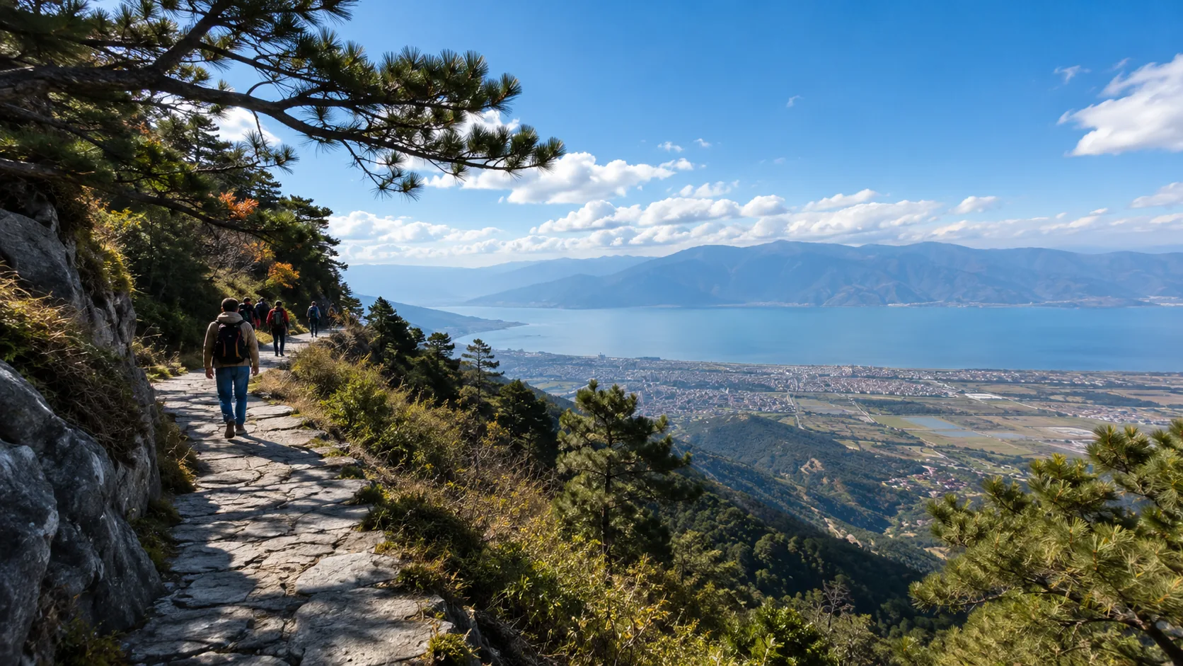



The total trekking distance in Yubeng is approximately 18–25km, with a cumulative ascent of 800–1200m. It typically takes an average person 6–9 hours to complete. Equipment recommendations: 30L backpack, hiking boots, waterproof hardshell jacket, trekking poles, 2L of water, and energy food of over 500kcal. The altitude ranges from 3200–3700m; it is suggested to acclimatize for 1 day in advance and avoid strenuous exercise. Pay close attention to weather and road conditions; during the rainy season (June–September), muddy sections increase physical exertion by approximately 30%. Traveling light and allowing ample time is recommended.
Equipment Checklist
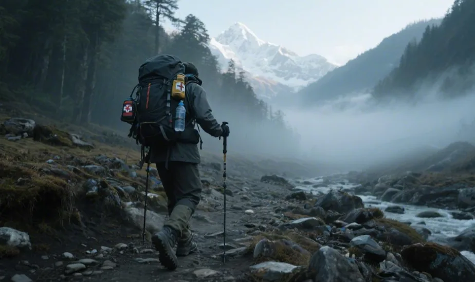
The altitude of the Yubeng route is about 3000–3700m, with a daily trekking distance of 12–18km. A backpack of 25–35L is suggested, with the total weight controlled at 6–8kg. Choose mid-cut waterproof hiking boots; the average daily step count is about 25000–32000 steps. Carry 1.5–2L of drinking water and energy supplements of about 600–900kcal. Clothing should follow the three-layer system (moisture-wicking layer + thermal layer + waterproof outer layer). Trekking poles can reduce 20–30% of knee joint pressure. Additionally, prepare a headlamp, offline maps, electrolyte supplements, and basic medicine.
Footwear Protection
The Yubeng trekking route includes forest mud paths, scree slopes, and continuous climbs. The daily distance is usually 12–18km, with most people taking 25000–32000 steps. The cumulative impact on the feet is much higher than city walking. Outdoor medical research shows that when trekking 15km, the feet endure over 30000 total impacts. The structure of the footwear and foot protection significantly affect walking stability.
Mountain dirt roads have higher water content after rain, causing the friction coefficient to drop by about 30%. The tread depth of ordinary city sneakers is usually about 2–3mm, while the deep-lug structure of hiking boots is generally 5–7mm. Deeper lugs increase friction on gravel roads and reduce sliding distance.
Hiking shoes are generally classified as low-cut, mid-cut, and high-cut. Mid-cut hiking boots are the most common choice for the Yubeng route. The mid-cut structure covers the ankle, with a height usually around 12–16cm. This structure can reduce ankle sway by about 20% during lateral stress. On scree or steep slopes, this supportive structure improves stability.
Sole materials usually employ a rubber composite structure. A common rubber hardness for hiking boots is about 60–70 Shore A. Harder rubber is more stable on gravel terrain, while softer materials are suited for city roads. Many international outdoor brands use rubber formulas similar to the Vibram structure, with wear tests often exceeding 1000km of walking distance.
Outdoor gear research indicates that for every 100g of weight added to the feet, it is equivalent to adding about 500g to the backpack. Most mid-cut hiking boots weigh 500–700g per shoe. The weight of a pair is approximately 1.0–1.4kg.
The routes to Yubeng’s Sacred Waterfall and Ice Lake have an elevation drop of about 600–800m. During long descents, the pressure on the knee joints can reach over 3 times body weight. The midsoles of hiking boots are usually made of EVA or PU materials, with a thickness of about 15–25mm, which can absorb some of the impact.
Feet swell slightly during trekking. After walking 10km, the width of the foot increases by an average of 3–5mm. Therefore, many trekkers choose hiking boots 0.5–1 size larger than their daily shoes. Hiking boots commonly have 6–8 pairs of eyelets. A larger number of eyelets allows for tension adjustment in different zones. During ascents, the heel tends to slip; during descents, toes tend to push forward. Properly adjusting the laces can reduce toe collisions.
Foot protection doesn’t rely solely on shoes. Hiking socks often use a double-layer knit with a thickness of 2–4mm. This structure reduces skin friction. Ordinary cotton socks have an absorption rate of about 8% and stay wet easily after sweating. Outdoor hiking socks usually use wool or nylon blends for more stable moisture absorption.
Sock pairing examples:
| Type | Thickness | Applicable Environment |
|---|---|---|
| Lightweight Hiking Socks | 2mm | High summer temperatures |
| Medium Thickness | 3mm | Common mountain trekking |
| Thick Socks | 4mm | Low-temperature environments |
Many trekkers carry two pairs of socks. Changing socks after 6–8 hours of trekking can lower skin moisture.
Foot friction is a common issue in long-distance trekking. Blisters usually require 3000–5000 repetitions of friction to form. When shoes are too tight or socks are damp, this process accelerates significantly. Applying anti-friction patches in advance can reduce the friction area.
Common foot protection items:
| Gear | Quantity |
|---|---|
| Adhesive Bandages | 4–6 pieces |
| Anti-friction Patches | 2–4 pieces |
| Medical Tape | 1 roll |
These items usually weigh less than 100g.
Foot temperature during trekking also affects comfort. The temperature of the human foot during exercise is usually about 30–33°C. If footwear breathability is poor, internal humidity increases. Most hiking boots use a waterproof-breathable membrane structure, with a breathability index of about 15000g/m²/24h.
Breathable structures allow sweat vapor to escape while reducing rainwater entry. The probability of afternoon rain in the mountains is about 30–40%; waterproof uppers prevent water accumulation inside the shoes.
Insoles also affect the walking experience. Original insoles in hiking boots are usually about 4–6mm thick. Some trekkers replace them with supportive insoles that have an arch support height of 10–15mm. The arch structure helps distribute pressure across the sole.
Foot pressure distribution example:
| Zone | Pressure Proportion |
|---|---|
| Heel | 35–40% |
| Forefoot | 40–45% |
| Arch | 10–15% |
Supportive insoles can reduce pressure on the forefoot.
Toe protection is also vital during trekking. Toes easily hit the front of the shoe during descents. Many hiking boots add a rubber protection layer to the toe area with a thickness of about 2–3mm. This structure reduces impact.
In a 15km trekking distance, the toes may undergo thousands of light collisions with the toe cap. A slightly wider toe box provides more comfort.
Footwear gear combination example:
- Mid-cut Hiking Boots ×1
- Hiking Socks ×2
- Anti-friction Patches ×3
- Adhesive Bandages ×5
Total weight is approximately 1.2–1.5kg.
When shoes, socks, and insoles are matched correctly, most trekkers can complete a daily route in 6–8 hours. When foot discomfort is minimized, the average walking speed usually stays at 3–4km/h.
Clothing for Temperature Differences
The altitude of the Yubeng trekking route is about 3000–3700m. In summer, daytime temperatures are usually 18–22°C, while early morning temperatures often drop to 6–8°C, with some shaded sections falling below 5°C. The route includes forests, canyons, and exposed slopes, where temperature differences can exceed 8°C. Clothing configurations must handle low temperatures, strong winds, and heat dissipation after sweating.
At a normal walking speed of about 3–4km/h, the human body generates about 250–350W of heat. If clothing breathability is insufficient and sweat cannot evaporate, the rate of body temperature drop increases significantly as clothing moisture rises. Mountain research data shows that wet clothes in an 8°C environment can increase the rate of surface body cooling by about 40%.
Therefore, most mountaineering associations recommend a three-layer system. The first layer (base layer) is responsible for moisture wicking. Common materials are polyester or Merino wool. Polyester quick-dry shirts usually weigh about 120–180g, with an absorption rate of less than 1% and a sweat evaporation time of about 15–25 minutes. Merino wool usually weighs 150–200g and has an absorption rate of about 30%, making it suitable for cooler temperatures.
When the trekking speed is stable, the hourly sweat rate is about 400–700ml. If the base layer’s moisture-wicking capacity is insufficient, the clothing will become noticeably damp within 30 minutes. The role of quick-dry materials is to spread moisture to the outer layers, thereby maintaining a stable skin temperature.
Add a thermal layer outside the first layer. Fleece jackets are a common choice, usually weighing 250–400g, with high air content and stable insulation efficiency. Fleece materials can reduce heat loss by about 20–30% in environments below 10°C. Another option is a lightweight down jacket. With a fill of 60–100g of down, the total weight is about 250–350g and the compressed volume is about 1L, making it suitable for rest periods or when temperatures drop.
When entering shaded forest areas or high-altitude zones, the average mountain wind speed is about 15–25km/h. Under conditions of 8°C air temperature and 20km/h wind speed, the wind chill temperature can drop to nearly 3°C. Therefore, the outer layer must have a windproof structure.
Common waterproof ratings for mountaineering jackets are about 10000–20000mm. In the Yubeng area, the probability of afternoon rain in summer and autumn is about 30–40%, with showers usually lasting 20–60 minutes. Waterproof materials prevent rain from entering while remaining breathable. Statistics show that for every 1kg added to a trekker’s pack, the physical exertion over long distances increases by an average of 6–8%. A three-layer clothing system usually weighs about 600–900g and maintains good comfort despite large temperature swings.
For every 1000m of altitude gain, UV intensity increases by about 10–12%. At 3500m, UV intensity can be 35–40% higher than at sea level. Long-sleeved quick-dry shirts and lightweight hats reduce skin exposure.
During the trek, many hikers sweat noticeably after 30–40 minutes of continuous ascent, at which point the thermal layer is usually removed. During descents or rest periods, heat production decreases by 30–50%, and the thermal layer becomes necessary again.
Clothing combination example (daily trek):
| Gear | Weight Range |
|---|---|
| Quick-dry Base Layer | 120–180g |
| Fleece Thermal Layer | 250–400g |
| Windproof/Waterproof Outer Layer | 300–450g |
| Lightweight Gloves | 40–60g |
Total clothing weight is usually about 700–1000g.
Clothing adjustment methods vary by climate. If temperatures approach 5°C, a thin down layer can be added. If temperatures are above 20°C, most trekkers stick to the base layer and outer shell.
Some detailed gear also improves comfort:
- Sun Hat (approx. 60g)
- Neck Gaiter (approx. 40g)
- Lightweight Gloves (approx. 50g)
- UV Protection Sunglasses
- Sunscreen SPF50+
These items usually weigh no more than 300g. Clothing breathability also affects the experience. Breathability is often measured by MVTR; common indices for mountaineering jackets are about 15000–20000g/m²/24h. This parameter represents the amount of water vapor that can pass through a square meter of fabric in one day.
Water and Energy Supply
The altitude of the Yubeng trekking route is about 3000–3700m. In this environment, the human respiratory rate is usually 20–30% higher than at sea level, and respiratory evaporation carries away more moisture. Outdoor medical statistics show that trekking for 6 hours at 3000m leads to an average fluid loss of 1.5–2.2L. If the temperature reaches 18–22°C during continuous ascent, total loss for some trekkers can approach 2.5L.
Most people entering Yubeng take a daily route of 12–15km, such as the Sacred Waterfall or Ice Lake. Walking time is usually 5–7 hours. Under this intensity, hydration frequency should be maintained at once every 20–30 minutes. Drinking 120–200ml each time reduces stomach discomfort while maintaining stable blood circulation.
There are two common ways to carry water. Bottles and hydration bladders are the most frequent solutions. Hard water bottles usually have a capacity of 750ml–1L and weigh 120–180g. Hydration bladders usually hold 1.5–2L and weigh 150–250g. For long-distance trekking, bladders are more convenient for continuous hydration because the straw allows drinking while moving.
Most trekkers carry 1.5–2L of water for the route. If the temperature is near 20°C, many increase this to 2.5L. When the backpack weight is controlled at 6–8kg, 2L of water accounts for 2kg, so hydration plans are usually considered alongside physical energy distribution.
When trekking for more than 3 hours, the body loses electrolytes through sweat. The sodium content in sweat is usually about 800–1000mg/L. If only pure water is supplemented, some trekkers may experience muscle fatigue. Electrolyte tablets usually contain 200–300mg of sodium; adding one to 500ml of water can replenish electrolytes.
During continuous ascents, a trekker weighing 70kg walking at 4km/h on mountain terrain consumes about 350–450kcal per hour. If the route involves prolonged climbing, consumption may approach 500kcal/h. Therefore, the daily energy expenditure for a 6-hour trek is typically 2000–2500kcal.
Large meals are usually avoided during the trek. Most outdoor guides suggest an intake of small energy snacks every 60–90 minutes. Each supplement should be about 150–250kcal to maintain stable blood sugar levels.
Common high-calorie foods include energy bars, nuts, and chocolate. Energy bars usually weigh 50–60g with about 200–250kcal. Nuts have a high fat content, with 100g of nuts providing about 550–600kcal. Dark chocolate has a caloric density near 520kcal/100g and a small volume, making it suitable for long distances.
According to outdoor gear statistics, foods with a caloric density higher than 400kcal/100g are better suited for trekking due to their compact size.
Energy supplement examples:
| Food | Weight | Calories |
|---|---|---|
| Energy Bar | 60g | 220kcal |
| Mixed Nut Pack | 80g | 450kcal |
| Dark Chocolate | 50g | 260kcal |
The combination provides about 900–1000kcal.
There are also water sources along the route. Some sections of the Yubeng mountains have streams and springs, but the water quality is not guaranteed. Many trekkers carry water purification equipment. Portable filters weigh about 60–120g with a filtration accuracy of about 0.1 microns, which can remove most bacteria.
When trekking time exceeds 5 hours and fluid loss reaches 2% of body weight, physical output capacity may drop by about 10–15%. For a 70kg trekker, losing 1.4kg of water will impact performance.
In high-altitude environments, many trekkers are reluctant to drink cold water frequently in temperatures below 10°C, so some use insulated flasks. Thermos capacity is usually 500–750ml, weighing 250–350g.
Item checklist example:
- Water 2L
- Electrolyte Tablets ×2
- Energy Bars ×3
- Nuts 80g
- Chocolate 50g
Total supplement weight is usually about 1.8–2.3kg.
For routes lasting 4–6 hours, when water and calorie intake remain stable, the average walking speed usually maintains 3–4km/h. When intake intervals are consistent, significant fatigue usually doesn’t set in until after 5 hours.
Physical Requirements
The traditional route into Yubeng from Xidang Village to Yubeng Village is about 13 km, with a cumulative ascent of nearly 900 m, reaching a peak at Nanzong Pass at 3700 m. Above 3000 m, oxygen is about 65–70% of sea level. Most people require 5–7 hours to complete the entry section; daily trekking distances are usually 12–18 km. If walking 10 km on flat ground takes more than 2 hours, you will likely experience significant fatigue on this route.
Three Types of Physical Exertion
Physical exertion in mountain trekking is usually a combination of three variables: distance, ascent height, and altitude environment. The traditional route into Yubeng covers about 13 km with an ascent of 900 m, peaking at Nanzong Pass at 3700 m. Average trekkers usually complete this in 5–7 hours, with an average speed of 2–2.5 km/h.
When walking on flat ground, the human body usually consumes about 50–70 kcal per 1 km (for a weight range of 65–75 kg). If the trekking distance reaches 15 km, the total energy consumption is about 800–1000 kcal. In mountain environments, due to uneven terrain and stride variations, energy consumption typically increases by about 20%.
Trekking research shows that walking 12 km on mountain terrain with an 8 kg backpack typically results in a total energy expenditure of 1100–1300 kcal.
After the distance adds up, most trekkers will take 16000–20000 steps on a 12 km mountain path. If the route extends to 16 km, the step count may approach 25000 steps. Prolonged repetitive strides keep the leg muscles in a state of low-intensity continuous load.
During a 5-hour trek, the quadriceps and calf muscles will undergo over 15000 contractions.
Mountain trekking difficulty is usually assessed by vertical height; every 100 m of ascent is generally equivalent to the physical exertion of walking an extra 1 km on flat ground. A route with a cumulative ascent of 900 m is equivalent to adding 9 km to flat-ground exercise volume.
For example, a 900 m vertical climb is equivalent to continuously climbing a 50 m high building 18–20 times.
As the slope increases, the average flat-ground walking speed of 4.5–5 km/h often drops to 3 km/h at a 10% incline, and to 2 km/h at a 15% incline. Long-distance climbing stages significantly increase cardiorespiratory load.
On mountain paths with a 12–15% incline, heart rates commonly reach 140–160 bpm.
Average stride length on flat ground is about 0.7–0.8 m. During mountain ascents, it usually drops to 0.5–0.6 m. As the stride length decreases, the number of steps per unit distance increases by about 20–25%, noticeably increasing the workload of the leg muscles.
A 1000 m uphill section often requires 1800–2000 steps.
At an altitude of 3500 m, the partial pressure of oxygen is about 65% of that at sea level. The maximum oxygen consumption (VO₂max) typically drops by 20–30%. Under the same exercise intensity, the respiratory rate will increase significantly.
When trekking at 3000 m, the respiratory rate is commonly 20–24 breaths/minute, compared to 12–16 breaths/minute at sea level.
High-altitude environments also increase the heart rate. During moderate trekking at 3500 m, the heart rate is on average 10–20 bpm higher than at low altitude. If your heart rate is 120 bpm at sea level, it may rise to 135–140 bpm at the same speed.
For every 1000 m of altitude gain, VO₂max drops by about 8–10%.
Daily temperature differences in mountain areas often reach 10–15°C. Trekking in a 5°C environment, the body increases energy consumption by 5–8% to maintain body temperature.
During a 6-hour trek, the heat generated by the body can reach 500–700 kcal.
Mountain paths typically consist of gravel roads, dirt trails, and forest paths. Gravel surfaces reduce stride stability, increasing energy consumption by 10–15%. On a continuous 2 km gravel slope, speed may drop by 0.5 km/h.
Unstable ground increases the involvement of ankle muscles, with gait adjustment frequency increasing by about 15%.
With these three factors combined, a route of 13 km + 900 m ascent + 3500 m altitude typically results in total energy consumption of 1200–1500 kcal. Completion time is usually 5–7 hours, during which 5–8 short breaks are required.
Physical Differences Between Routes
Trekking routes around Yubeng range from 6 km to 16 km in length, with cumulative ascents from 300 m to 900 m. Most trekkers start from the village at 3200 m, with daily altitude fluctuations usually between 300–900 m. Under the same altitude conditions, changes in distance and ascent significantly affect trekking time and energy consumption.
Common routes can be understood through distance, ascent, and average completion time:
| Route | One-way Distance | Cumulative Ascent | Altitude Range | Common Time |
|---|---|---|---|---|
| Xidang Entrance | 13 km | 900 m | 2700–3700 m | 5–7 h |
| Ice Lake | 11–12 km | 900 m | 3200–3900 m | 6–7 h |
| Sacred Waterfall | 6–7 km | 300 m | 3200–3500 m | 3–4 h |
| Ninong Canyon Exit | 16 km | Descent approx. 1400 m | 3200–1800 m | 6–8 h |
Starting from Xidang at approx. 2700 m to Ninong Canyon at 3700 m, the first 8 km is a continuous climb with slopes mostly between 8%–12%. If a speed of 2 km/h is maintained, the uphill section usually takes 3–4 hours.
In this segment, the altitude rises by about 1000 m. VO₂max typically drops by about 10%. If your flat-ground trekking heart rate is 120 bpm, it will commonly rise to 135–145 bpm under the same intensity.
After entering Yubeng Village, most routes start from 3200 m and fluctuate within 3500–3900 m. The Ice Lake route is one of the more physically demanding. The round-trip distance is nearly 12 km, with a cumulative ascent of about 900 m.
The first 6 km of the Ice Lake route is mostly forest trail with a slope of about 6%–10%. The average speed is usually 2.5 km/h, taking 2–2.5 hours. Continuing upward, the slope increases, with the last 2 km ascending about 350 m at an incline near 15%.
In this incline range, stride length typically drops from 0.7 m to 0.5 m. The steps per kilometer increase from 1400 steps to 1800 steps. Leg muscles need over 3600 contractions to finish this section.
The Sacred Waterfall route is shorter. One way is about 6–7 km with a cumulative ascent of about 300 m. Most trekkers take 3–4 hours for the round trip. If a speed of 3 km/h is maintained, the uphill portion is completed in about 1.5 hours.
Though shorter, the round-trip distance is still near 14 km. The total step count for the route typically reaches 18000–20000 steps. At 3200 m altitude, this step count still causes significant leg fatigue.
The Ninong Canyon route is the longest in distance. The total length is about 16 km, with a cumulative descent of about 1400 m. Completion time is usually 6–8 hours. While there is little uphill, the long descent exerts continuous impact on the knee joints.
Knee pressure during descents typically reaches 3–4 times body weight. For a 70 kg trekker, the instantaneous force on the knees during a continuous descent may reach 210–280 kg. After 3 hours of continuous descent, the front thigh muscles will be noticeably fatigued.
There are also differences in average energy consumption between routes for a 70 kg trekker:
| Route | Estimated Energy Consumption |
|---|---|
| Xidang Entrance | 1200–1500 kcal |
| Ice Lake Round Trip | 1300–1600 kcal |
| Sacred Waterfall Round Trip | 800–1000 kcal |
| Ninong Canyon | 1100–1400 kcal |
As energy consumption increases, most people require 1.5–2.5 L of water on routes lasting 5–7 hours. If temperatures are above 15°C, demand may increase to 3 L.
Short routes are usually concentrated in 3–4 hours, while long routes extend to 6–8 hours. As the duration increases, the body needs a steady and stable exercise rhythm.
During a 6-hour trek, most people take 6–10 short breaks of about 3–5 minutes. This helps keep the heart rate within 130–150 bpm, keeping physical exertion stable.
Assessing Fitness
The entry route to Yubeng commonly involves 13 km distance + 900 m ascent. In an environment of 3200–3700 m, VO₂max typically drops by 20%–30% compared to sea level. If moderate endurance activities are difficult to complete at low altitude, physical exertion will increase significantly when trekking at high altitude. Therefore, before departure, simple indicators are used to evaluate basic fitness rather than waiting to judge on the trail.
If 5 km of power walking on flat ground takes more than 45–50 minutes, it indicates low stride frequency and endurance reserves. In mountain trekking, speed usually drops to 2–2.5 km/h, and completing 12 km often takes about 6 hours. If a 10 km flat walk already takes nearly 2 hours 10 minutes, it may extend to over 7 hours at high altitude.
In addition to distance, the heart rate for an average adult power walking on flat ground is usually 100–120 bpm. When the speed increases to 6 km/h, the heart rate typically rises to 120–135 bpm. If the heart rate already exceeds 140 bpm at 4 km/h, it indicates low aerobic endurance. During mountain trekking, the heart rate during continuous climbing is commonly 140–160 bpm, and those with insufficient fitness will be noticeably out of breath within 20–30 minutes.
A stair-climbing test can simulate mountain ascents. Climbing 15 floors (about 45–50 m vertical height) is a common baseline test. Completion time is usually 3–4 minutes. If it takes more than 6 minutes or requires a break, it indicates insufficient leg endurance. The cumulative 900 m ascent into Yubeng is equivalent to climbing the same height 18–20 times.
The duration of endurance activity is also important. Continuous exercise for 60 minutes is a common reference. If you can complete a 6 km slow run or 8 km power walk in 60–70 minutes and recover within 10 minutes, most can adapt to a 5–6 hour trek. For those taking more than 20 minutes to recover, physical decline at high altitude will be more pronounced.
Backpack weight during trekking is usually 6–10 kg. You can try walking 5 km with an 8 kg pack. If finished within 55–60 minutes, your load-bearing capacity is basically sufficient. If speed drops below 4 km/h with a 10 kg pack, you will be noticeably fatigued on long mountain roads.
The following simple indicators are often used by mountain trekking organizations for preliminary fitness assessments:
- Flat 5 km power walk ≤ 40 min
- Slow 6 km run ≤ 40 min
- Continuous climb of 15 floors ≤ 4 min
- Walking 5 km with 8 kg load ≤ 60 min
- Continuous exercise for 60 min without heavy panting
- Heart rate recovers to below 100 bpm within 10 minutes post-exercise
These indicators usually correspond to a VO₂max level of 35–45 ml/kg/min, which is considered moderate endurance capability.
Average flat-ground power walking cadence is about 110–120 steps/minute. During mountain ascents, it usually drops to 80–90 steps/minute. If you feel noticeably fatigued at a 100 steps/minute pace on flat ground, the decline in physical strength will be more obvious during 30 minutes of continuous climbing.
After finishing a 5 km power walk, if the heart rate drops by 20–30 bpm within 5 minutes, it shows good cardiorespiratory recovery. If the drop is less than 10 bpm, endurance reserves are low. In a 3500 m trekking environment, recovery speed typically drops by another 10%.
Muscle endurance also affects the experience. You can perform a simple test: 20 squats × 3 sets with 60 seconds rest between sets. If the third set is noticeably difficult, your quadriceps endurance is insufficient. A single day of Yubeng trekking typically involves 20000–30000 steps, requiring the leg muscles to withstand repetitive loads for a long time.
Most outdoor trekking activities recommend at least 150 minutes of aerobic exercise per week. For example:
| Weekly Exercise Time | Common Endurance Level |
|---|---|
| < 60 minutes | Easy to fatigue during trekking |
| 90–120 minutes | Basic endurance |
| 150–180 minutes | Can complete 5–6 hours of trekking |
| > 240 minutes | Long treks are relatively easy |
Those with a long-term exercise frequency of 3 times per week usually experience fewer physical fluctuations at high altitude. When exercise intervals exceed 2 weeks, VO₂max may drop by 5–10%.
If you can meet 3–4 or more of these indicators, you can generally adapt to 12–15 km of mountain trekking. If most are noticeably below the reference values, a continuous trek of over 6 hours at high altitude will be difficult, requiring 2–3 weeks of endurance training in advance.
Precautions
Yubeng trekking mostly starts from Xidang Village at 2700m, entering Upper Yubeng at an altitude of about 3200m, and reaching nearly 3800m at the highest point near Ice Lake. Average trekkers walk 10–18km per day, taking 5–8 hours. Mountain weather changes significantly; daytime in summer is about 12–18℃, and nighttime can drop to 0–5℃. About 60% of the route has no stable mobile signal, with supply points spaced 3–6km apart. Arranging time, hydration, and altitude acclimatization in advance can reduce the chance of itinerary interruptions.
Altitude Acclimatization
The Yubeng trekking area is concentrated between 3000m and 3800m. Most people rise over 2000m within 24 hours when entering the route. For example, a common path: flying to Shangri-La at 3200m, then driving to Xidang Village at 2700m, and trekking into Yubeng Village at 3050–3200m. At this height, the atmospheric pressure is about 70kPa, and the oxygen content is about 65%–70% of sea level; the body needs time to adjust respiratory frequency and blood oxygen levels.
The faster the altitude change, the more obvious the reaction. In environments above 2500m, blood oxygen saturation usually drops from 97%–99% at sea level to 88%–92%. If the ascent exceeds 800m within 24 hours, the proportion of people experiencing mild headaches or fatigue is about 30%–40%. The first segment of Yubeng trekking from Xidang to Yubeng Village involves a 500m ascent over 12km, taking 5–6 hours, which is where many first feel noticeably faster breathing.
In high-altitude environments, the heart rate usually increases by 10%–25%. For example, a resting heart rate of 65 bpm at sea level might reach 75–85 bpm at 3200m.
It usually takes 12–48 hours for the body to adapt to high altitude. Staying 1 night in Shangri-La at 3200m before starting the trek significantly reduces the discomfort rate. In contrast, starting a trek of over 5 hours immediately after arriving on the plateau significantly increases the probability of fatigue and mild altitude sickness.
Many trekkers continue to the Sacred Waterfall or Ice Lake after reaching Yubeng Village. The highest point of the Ice Lake route is about 3800m, about 600–700m higher than the village. At this height, oxygen content is near 60% of sea level. During a 3–4 hour continuous ascent, the respiratory rate will increase to 20–25 breaths per minute, significantly higher than the 12–16 breaths common at sea level.
To reduce discomfort, ascent speed must be controlled. Mountain trekking typically suggests not exceeding 300m of ascent per hour. From Yubeng Village to Ice Lake, the average ascent speed is about 150–200m / hour, a range the body can gradually adapt to. If the speed is too fast in the first half, such as climbing 500m within 2 hours, fatigue will increase significantly.
Humidity in high-altitude environments is often 30%–50%; with increased breathing, the body may lose an additional 200ml of water per hour. For a 6-hour trek, the total water requirement is usually 1.5–2L. Insufficient hydration makes headaches and fatigue more pronounced.
Many carry simple devices like watches or pulse oximeters to monitor their status. At 3200m, healthy trekkers’ blood oxygen is generally 88%–93%. If it stays below 85% with headache or nausea, reduce intensity and increase rest.
Common ways to adapt before entering Yubeng include:
- Staying 24 hours in a town above 3000m
- Limiting the first day of trekking to under 5–6 hours
- Hydrating about 150–200ml every 30 minutes
- Maintaining a stable cadence and avoiding rapid climbing
- Ensuring over 7 hours of sleep at night
These methods allow the body to gradually increase red blood cell oxygen-carrying capacity. Medical research shows that after 48 hours at 3000m, hemoglobin concentration usually increases by 3%–5%, improving respiratory efficiency.
The daytime temperature in the Yubeng area is usually 10–18℃, and can drop to 0–5℃ at night. In cold temperatures, the body consumes extra energy to maintain its temperature. Trekking for 6 hours in a 0℃ environment consumes about 10%–15% more energy than in a 15℃ environment.
The common time for the Ice Lake route is 5–7 hours; by using a 25 minutes walking + 5 minutes rest method, the average heart rate can be maintained at 110–130 bpm. This rhythm is more stable than continuous long-term climbing.
Maintaining a stable stride and breathing rhythm is more effective for stamina than chasing speed.
The sleep environment also affects the next day’s state. Yubeng Village is at 3050–3200m, and blood oxygen usually drops by 2%–4% at night. if room temperatures are below 5℃, frequent waking is common. Many guesthouses provide electric blankets or heaters to keep the room at 10–15℃.
Those who live long-term above 1500m have a discomfort rate of about 10%–15% at 3200m. For those from sea level, the rate of mild altitude sickness can reach 30%–40%. Therefore, many trekkers arrange a 3-day itinerary in Yubeng, limiting daily walking to 6 hours to allow the body to adapt.
Communication Status
The Yubeng trekking area is located inside the Meili Snow Mountain valleys, where mountains are usually 4500m–6000m high. Deep valley terrain significantly affects mobile communication. After entering Xidang Village, the number of base stations decreases noticeably. Most of the route is between forests and canyons, and communication coverage is intermittent. According to multiple GPS records, about 55%–65% of the main Yubeng route has no stable mobile network.
The trail from Xidang to Yubeng Village is about 12km long, rising from 2700m to about 3050–3200m. In this section, weak signals are usually available for the first 4km, with strengths typically between -105dBm and -115dBm. Deep in the forest, the signal gradually disappears, and there is usually no service for 5–6km.
Yubeng Village is at 3050–3200m, where the terrain is more open than the canyon, so some areas can receive 4G or weak 5G signals. Coverage varies significantly between operators, and download speeds are typically 3–15Mbps. Many guesthouses provide WiFi, but bandwidth often relies on satellite links or wireless bridges, with common speeds around 5–10Mbps.
Continuing to the Sacred Waterfall, the round-trip distance is about 10km. Intermittent signals are still available for the first 1km, with a strength of about -110dBm. In the forest and river valley, about 70% of the route has no mobile signal. Particularly in the 3600m canyon area below the waterfall, where the height difference between the mountains is nearly 1000m, signal attenuation is severe.
Communication is even more limited on the way to Ice Lake. Ice Lake is at 3800m, and the round-trip distance is about 14km. Based on GPX track tests, only about 20% of the route can receive intermittent signals. Most areas are high-mountain forests and scree slopes, where phones typically show no service for 3–4 hours.
To avoid getting lost or losing information, many trekkers prepare offline maps in advance. A common practice is to download a 30–50MB offline map data pack. This allows for GPS positioning even without a network. GPS error in mountain environments is usually 5–15 meters, potentially increasing to 20 meters in forested areas.
Many trekkers also save track files in advance. For example, a GPX file for the Ice Lake route is only 50–200KB. After importing it into a map app, you can see the full path and altitude profile. The total ascent from Yubeng to Ice Lake is about 600–700m; the track helps determine the remaining distance to the goal.
The nearest town to Yubeng Village is usually 40–50km away. If you feel unwell in the middle of the Ice Lake route, you must trek back to the village to contact the outside world. At a common pace of 3km / hour, returning from the midpoint of Ice Lake to the village usually takes 1.5–2 hours.
Some trekkers carry satellite communication devices. Portable satellite communicators weigh 100–200g and send location information via low-orbit satellites. Sending a location message takes 30–60 seconds and costs about 0.1–0.5 USD / message. Such devices provide basic communication in areas with no mobile network.
Preparing basic information before departure is also helpful, such as recording guesthouse phone numbers or trek entrance contacts. There are about 60–80 accommodations in Yubeng Village, most of which can be booked by phone or online. Screenshots or saved addresses can be viewed even without a signal.
Common communication preparations for trekking include:
- Downloading 30MB+ offline maps
- Saving GPX track files
- Recording 2–3 accommodation contact numbers
- Keeping the phone at over 50% charge
- Carrying a 10000mAh+ power bank
In 0–5℃ environments, phone battery capacity can drop by 20%–30%. Recording a track with GPS for 6 hours typically consumes 30%–40% of the battery. Keeping the phone in an inner pocket can reduce the effect of low temperatures on the battery.
Even with limited communication, the main Yubeng routes are quite clear. The trails are usually 1–2 meters wide with obvious footprints and mule tracks. Many intersections have wooden signs, spaced 2–4km apart. Therefore, in most cases, you can navigate without a network as long as you have offline maps and track recordings.
Mule Traffic
Material transportation on the Yubeng trekking routes relies mainly on mules. There is no road directly to the village, so all daily necessities, building materials, and food are usually transported from Xidang Village via mountain paths. The distance from Xidang to Yubeng Village is about 12km, rising from 2700m to 3050–3200m. Mule teams travel this route daily, with a team usually consisting of 5–15 mules.
Each mule typically carries 60–80kg. Goods are fixed to wooden racks on both sides, often reaching a width of 0.8–1m. In narrow sections where the trail is only 1–1.5m wide, a mule almost fills the path. Trekkers meeting a mule team face-to-face need to pull over to one side in advance.
Mule traffic is most frequent in the morning. Teams usually depart Xidang between 07:00 and 09:00, with an average speed of about 3km / hour. The journey to Yubeng Village takes 4–5 hours. Return teams are also common between 14:00 and 17:00. Trekkers are more likely to encounter continuous mule teams during these times.
Mules usually have bells around their necks, which can be heard 30–80m away in the valley. Pulling over early after hearing bells reduces close contact with the team.
The Xidang to Yubeng route has several sections of stone steps and dirt roads with 20°–30° slopes. Mules move slower uphill, about 2km / hour, while downhill speeds may approach 4km / hour. Therefore, when encountering a team while going downhill, you need to pull over even earlier.
Some sections are near cliff edges. About 15% of the Yubeng trail is on the outer edge of the mountain, with drops usually between 30m and 200m. Mule teams maintain a fixed formation in these locations, with a gap of 2–3m between animals. Trekkers on the outer side are at risk of being squeezed, so they should generally wait on the mountain side for the team to pass.
Mules transport various materials. According to supply records in Yubeng Village, a mule typically carries:
- 24 bottles of mineral water × 500ml
- 25kg bag of rice
- Vegetable crates around 20kg
- Fuel or gas tanks
The total weight is near 70kg. In peak season, the daily mule transport volume to Yubeng is about 3–5 tons. If you encounter a continuous team, you may have to wait 3–5 minutes before moving on.
It is generally recommended to keep a distance of more than 0.5–1m from mules. A mule’s field of vision is mainly focused on about 120° in front; if someone approaches suddenly from the side, the animal may shift or pause slightly.
Bends in the Yubeng route are usually 20–40m apart. Mule teams may appear suddenly after a turn. Slowing down when hearing bells or footsteps helps avoid face-to-face encounters.
Some trekkers choose to ride mules into Yubeng. The cost from Xidang to Yubeng Village is usually around 200–300 RMB, taking 3–4 hours. During the ride, the mule walks at a steady pace of about 3km / hour. On steeper slopes, riders need to dismount and walk 50–200m.
Mule numbers are relatively lower on the Sacred Waterfall or Ice Lake routes, but transport teams still appear. The Sacred Waterfall route is about 10km round trip, with 3–6 teams transporting food and drinks daily. The Ice Lake route is longer at 14km round trip, with usually 1–3 teams / day.
Mule hooves pack down the dirt, creating 5–10cm deep hoof prints in some sections. After rain, these prints can collect water or become slippery. Trekkers need to choose stable rocks or dry spots for footing when going downhill.
Many experienced trekkers judge the distance of a team by the sound of the bells. The sound usually lasts 30–60 seconds from becoming clear to fading. If the sound keeps getting louder, the team is approaching; if it weakens, they have passed.
Related Guides
- Yunnan Homestay Lightning Protection Guide | Dali Erhai & Lijiang Ancient Town, How to Choose the Best Value View Rooms
- Yunnan Altitude Sickness Survival Guide | Shangri-La/Yubeng/Jade Dragon Snow Mountain, Medication Prep + Rhodiola Rosea Review
- 2026 Yunnan Travel Pitfall Guide | Avoid These 10 “Influencer Traps”, Even Locals Are Shaking Their Heads
- Yunnan Travel Clothing Guide | Spring, Summer, Autumn & Winter Weather Analysis & Packing List
- Essential Items Checklist for Yunnan Travel | What Practical Luggage Do You Really Need to Prepare for Yunnan
Shangri-La — — Practical Data
Tickets & Booking
- Tiger Leaping Gorge (Shangri-La section, Upper Tiger Leaping): Adult CNY 45; ticket + round-trip sightseeing escalator (Pingbu Qingyun escalator) CNY 125[src]
Where to Stay · Room Type · Nearby
- Inside Dukezong Ancient Town | Room tip: Convenient for getting around, but vehicles cannot enter, so confirm with the guesthouse whether they carry luggage | Nearby add-ons: Great Buddha Temple, prayer wheel, Guishan Park, Moonlight Square[src]
- Along Napahai | Room tip: Good views and quiet, but far from the city | Nearby add-ons: Napahai Yila Grassland, Shika Snow Mountain[src]
Typical Climate & Packing (Past Years)
- January: -7 °C–9 °C °C, [Travel climate reference]
- February: -5 °C–11 °C °C
- March: -2 °C–14 °C °C
- April: 2 °C–17 °C °C
- May: 5 °C–19 °C °C, The meadow turns green again
- June: 8 °C–20 °C °C